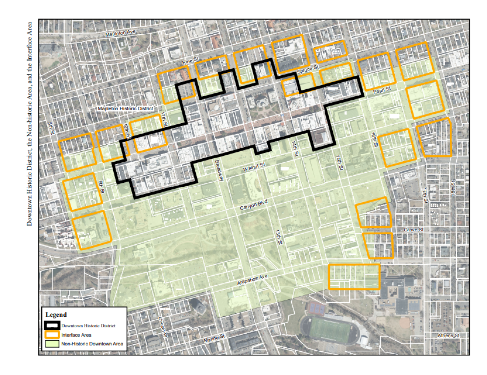
Map showing the Downtown Historic District and Interface areas in Boulder, with the Downtown Historic District boundaried by just past 10th Street to the west, just path Spruce Street to the north, 16th Street to the east, and Walnut Street to the south. The map also shows 20 interface areas indicated around this area and the entire non-historic downtown area indicated as spanning from 6th Street to the west, to just past Spruce Street to the north, to 18th Street to the east, and to just past Arapahoe Avenue to the south.
Text Description for Image
Accessibility Statement
The City of Boulder is committed to digital accessibility. Some content may not be fully accessible due to technical limitations or issues. For alternate formats or accommodations, please visit Accessibility | City of Boulder or contact accessibility@bouldercolorado.gov.