Principal and accessory buildings are limited in height as specified in the Form & Bulk Standards as outlined in Chapter 7 Table 7-1; B.R.C. 1981 as amended.
Whenever a building is shown to be within one foot of the maximum allowable height, verification will be required at the framing inspection. On occasion, height verification may be required when there are physical impacts such as topography or significant over lot grading has occurred.
Height may also be limited by Solar Access Regulations. In many instances the height of a building will be less than that allowed by the Bulk Charts due to solar access requirements. Whenever a required solar analysis indicates that an adjusted shadow terminates within one foot of the property line or when an actual shadow is shown to terminate within one foot of the shadow of the solar fence, height verification maybe required as well.
The method of measurement will vary as to whether the height is being calculated for solar access purposes or for determination of overall maximum height.
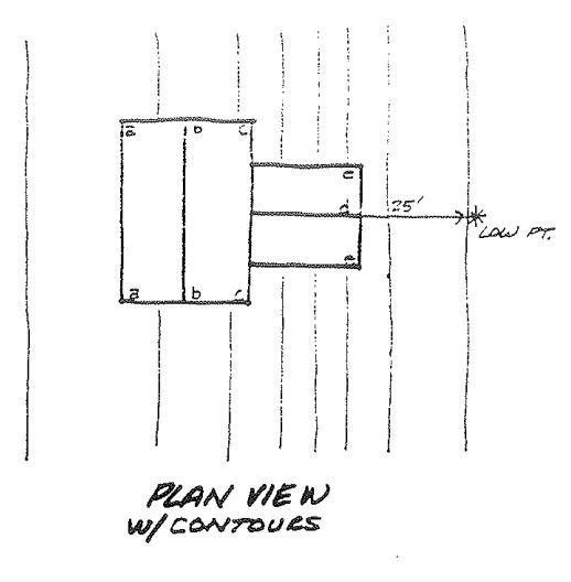
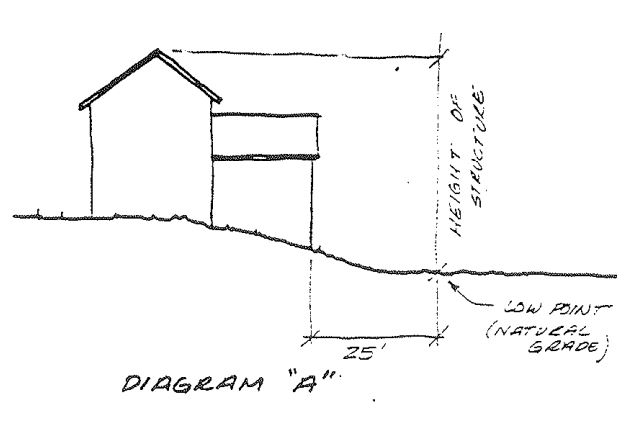
Overall maximum height is measured from the lowest point of natural grade within 25 feet of the structure (whether on site or off site) to the uppermost point of the structure excepting approved appurtenances per Section 9-7-7 B.R.C. 1981. The difference between these points shall not exceed the maximum heights found in the Bulk Charts.
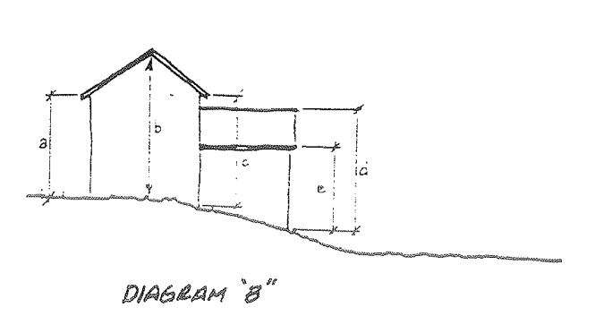
For solar access purposes only, height is measured from the top of the structural element (ridge, peak, eave, etc.) to the natural grade directly beneath the element.
When height verification has been noted as a condition of approval of a building permit, the applicant shall have the calculations performed by a licensed surveyor. At a minimum, the surveyor shall complete the “Height Verification Form” provided by the city. Please note that on most approved building permit plans the elevations of the high and low point locations have been shown. The surveyor is to verify the elevations shown or indicate the actual elevations should they differ.
Per B.R.C. 9-16 “Height” means the vertical distance from the lowest point within twenty-five feet of the tallest side of the structure to the uppermost point of the roof. The lowest point shall be calculated using the natural grade. The tallest side shall be that side whose lowest exposed exterior point is lower in elevation than the lowest exposed exterior point of any other side of the building.