Do you dig Boulder? Tour the ditches of downtown Boulder to learn how each spring, our more than 150-year-old ditch system brings water to our city’s plants and animals.
Jay Jones
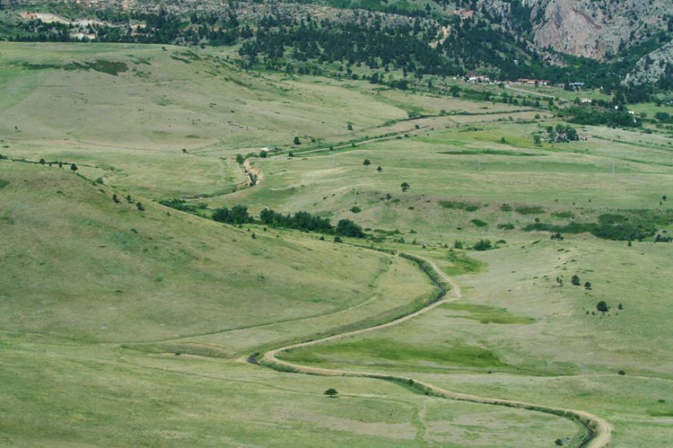
Community Ditch west of 93 by Jay Jones
Joy of Walking: Boulder Guided Walks Series
Joy of Walking is a series of themed guided walks in various neighborhoods around the city. Learn about little free libraries, architecture, history and more on these family-friendly walks guided by a Boulder Walks walk leader.
Walk Map
View the Caltopo map. View turn-by-turn text directions and self-guided tour information below.
Walk Details
- TIME: 9 a.m.-noon
- PACE: Conversational (1.5-2 miles per hour)
- TERRAIN: Sidewalks, paved multi-use paths, trail
- DISTANCE: 3.5 miles
- ELEVATION GAIN: 230’
- ACCESSIBILITY: Most of the route is stroller and wheelchair accessible; there are alternative paths when not. Viewpoint Trail along the base of Flagstaff Mountain is rocky and narrow with a 70-foot elevation gain, but not difficult.
Walk Overview
The Digging Boulder Walking Tour provides the opportunity to admire the great effort of carving strategic channels into this region’s rocky landscape to bring vital irrigation from Boulder Creek and Silver Lake, below Arapahoe Glacier, to the farmers of early Boulder. Today, these same ditches enable CSAs (Community Shared Agriculture), other farmers, ranchers, and localities to procure, store, and utilize water to produce harvests and sustain livestock. We will discuss the importance of ditch headgates, when and why they are opened, what those large horizontal wheels are and what they do, and the role of the dedicated ditch riders who operate them.
There are 70 ditches running 281 miles through the Boulder area covering more than 7,000 acres which are managed by OSMP. This tour guides participants to six of these ditches and along Boulder Creek, which feeds five of them.
The loop begins at the Boulder County Justice Center parking lot at Canyon Boulevard and 6th Street Parking is free on weekends. Heading west on Boulder Creek Path, the first stop will be Eben G. Fine Park at the beginning of Farmer’s Ditch, which runs northeast from Boulder Creek through Mapleton Hill, Old North Boulder, North Boulder, and through open space to Boulder Reservoir. Silver Lake Ditch, from the west, is just across the creek and runs parallel to Farmer’s Ditch before flowing up towards Red Rocks, along the north Boulder foothills, and on to the Mesa Reservoir. The Digging Boulder walk tour turns south to the Anderson Ditch alongside the foothills of Flagstaff Mountain. This ditch flows into University Hill through Columbia Cemetery and then to the southeast. The walk route tracks Anderson Ditch along Pennsylvania Avenue to 11th Street before turning north through The Hill to the Smith & Goss, Boulder & White Rock, and North Boulder Farmers ditch headgates below Broadway in the Central Park area.
Notes:
- Dress for the weather and bring a water bottle, sunscreen, and a camera. Sandals are not recommended on Viewpoint Trail.
- You can bike, walk, drive, or take the Hop or a Skip RTD bus route to reach the start of this walk.
- The route has accessible options along west Arapahoe Avenue and around Columbia Cemetery. Otherwise, it is stroller-friendly and appropriate for wheelchairs and ambulatory walkers. Overall elevation gain is 230 feet.
- Well-behaved dogs are welcome on 6' or shorter leashes.
- Restrooms are available in Eben G. Fine Park, near the ditch headgates by the Boulder Bandshell, and along Boulder Creek Path at 9th Street.
- In the summer, when arriving at the ditch headgates below Broadway, the Boulder Farmers Market will be ongoing between Arapahoe Avenue and Canyon Boulevard on 13th Street. You are welcome to leave the guided walk to participate. Alternatively, finish the loop and return to the Farmers Market from the Justice Center parking lot.
This walk, Digging Boulder: A Tour of the Ditches that Helped Develop the City, highlights only a few of the 70 ditches managed by City of Boulder. For more information, explore the following references:
Turn-by-Turn Directions & Self-Guided Tour Information
- Beginning at waymarker A on the south end of the Justice Center parking lot at 6th Street and Canyon Boulevard, follow the route west, up Boulder Creek Path, through Eben G. Fine Park to the headgates of Farmers Ditch and Anderson Ditch (waymarkers B and C).
- Silver Lake Ditch is visible across Canyon Boulevard as a mountain ridge. Return east along the path, staying to the right at the Arapahoe Avenue fork, and then on to the Viewpoint Trail access road, which is opposite the entrance to the Eben G. Fine parking lot.
- Take Viewpoint Trail along the foothill of Flagstaff Mountain, parallel to Anderson Ditch, to Marshall Street in University Hill.
- Go up to Pleasant Street and proceed parallel to Anderson Ditch into Columbia Cemetery (waymarker D). Enter the northwest gate from Pleasant Street. With the crusher fines path, wheelchairs may need to stay on the sidewalk. Walk south up the cemetery path just beyond Anderson Ditch and then walk across the grass beside the ditch (ground permitting).
- Exit the cemetery at the main northeast entrance, cross 9th Street, and proceed up to Pennsylvania Avenue Continue along Anderson Ditch and Pennsylvania Avenue and turn left on 11th Street. Go three blocks to Grandview Ave., turn left, cross the street at 11th Street, and continue two blocks north into the Boulder Public Library parking lot. Straight ahead, cross the pedestrian bridge and descend the steps onto Boulder Creek Path behind the Municipal Building. Continue east to the headgates in Central Park just beyond Broadway (waymarker E).
- Close the loop and return to the starting point by going up Boulder Creek Path to the Justice Center parking lot at 6th Street and Canyon Boulevard. (waymarker F).
A
Irrigation ditches
Boulder is a semi-arid region requiring irrigation. Smith-Goss (waymarker E) was the first ditch, dug in the city’s initial year of 1859, and development spread around this and follow-up ditches. Of the 70 ditches in Boulder, 23 are still active, carrying water for 30 miles through the city to gardens, orchards, pastures and fields. Users employ several methods to benefit from ditch water, including flood irrigation, siphon systems, and sprinkler systems. Compared to municipality water, ditch water is not treated with chemicals, is full of nutrients, is less expensive, comes directly from the mountains, and is a living ecosystem.
The flow of Boulder’s ditches is always a horizontal or downward grade. Originating from the Arapahoe Glacier west of Peak-to-Peak Highway and other sources, Boulder Creek feeds the ditches of central and north Boulder. As the area developed, many sections of ditches went underground. When seen above ground, the way they were dug, is called daylighting.
Water rights
Water rights, both direct flow and storage rights, are regulated and control when and how much water is released to each ditch and who can use the water. The priority of ditches, based on when the ditch began operating, determines seniority and what ditch receives its water first. Lower Boulder Ditch in east Boulder was the first ditch to register and therefore has highest priority. (Marinus) Smith Goss Ditch was second.
The rights of each user depend on shares, which were assigned to specific pieces of land and cannot be sold separately from the land. Shares receive a proportionate percentage of the total amount of water supplied by the ditch, which fluctuates from year to year. Generally, 7.7 gallons per minute flow when a ditch is at ‘full head.’ Main ditch users and lateral users of water are administered by separate entities. Ditch maintenance, which involves the entire length from the headgate to the final lateral, is also essential for users to receive water.
Headgates
A ditch headgate is a structure found at the entrance of an irrigation ditch that controls the flow of water and regulates the amount of water entering the irrigation system. The flow can be fully permitted, shut off, or reduced. Headgates are maintained by the water user and are located before any measuring devices, like weirs. Just beyond each headgate is a Parshall flume, a fixed, hourglass-shaped structure that is used to funnel and measure the water flow into the ditch. Ralph Parshall was a CSU professor in the 1930s. The flume has a converging inlet, a constricted throat, and a diverging outlet. The state water commissioner determines when each ditch has been given its fair allotment of water and then each user, depending on the ditch priority.
Some headgates became an impediment to allow fish passage up and down the ditch and stream and were rebuilt when controls were added.
B
Farmers Ditch headgate and Farmers Ditch
If able from Boulder Creek Path, walk down the dirt path to the creek. The headgate of Farmers Ditch is seen across the water on the north side, just below Canyon Boulevard. In 2025, this headgate was turned on during the fourth week of April.
Farmers Ditch goes under Canyon Boulevard and then runs parallel into Peoples Crossing, along the multiuse path, above west Pearl Street, and then enters Mapleton Hill through the luscious Campbell Robertson Park flowerbeds. The ditch meanders across the east-west streets until it was siphoned under at Dewey and 9th Street in 1953.
On the other side of North Boulder Park, Farmers Ditch daylights along Dewey near 10th Street. It crosses Broadway near Elder and runs behind the North Boulder Recreation Center and Longs Gardens along the path and Growing Gardens. Beyond Iris near 17th Street, the ditch is mostly exposed all the way to Wonderland Creek drainage near Norwood west of 28th Street.
Continuing northeast towards Jay Road and Boulder Valley Ranch, Farmers Ditch begins to run along Sage Trail. The ditch and its extensive laterals have delivered most of its water to working farms, almost as far east as 75th Street.
Silver Lake Ditch
Silver Lake Ditch has ‘junior’ water rights since it was dug in 1888, nearly three decades after the first Boulder ditches in 1859. Its water comes from the Boulder Creek direct flow through the spring runoff, when direct flow water rights move out of priority. Silver Lake Ditch also has storage rights from the Silver Lake and Island reservoirs, built in 1887 and 1890, respectively. These early storage rights filed in Boulder County are ‘senior.’
Like the ridge of a trail seen across a valley, Silver Lake Ditch can be seen carved into the side of the hill to the north of the Anderson Ditch and Farmers Ditch headgates. Reflection Point and Anemone Point can be seen from Boulder Creek Path above the meandering Silver Lake Ditch as it wraps itself around Red Rocks and flows north.
The headgate for Silver Lake Ditch is in Boulder Canyon near the mouth on the north bank of Boulder Creek, about one mile upstream. Here the ditch diverts water from Boulder Creek, beginning at a high elevation from where it gradually lowers while navigating the foothills, flowing to Mesa Reservoir north of Boulder. Silver Lake Ditch was used to develop Mapleton Hill, which Farmers Ditch also partially serves while skirting the south and east edges. The Silver Lake Ditch runs out to Mesa Reservoir west of Boulder Valley Ranch.
C
Anderson Ditch headgate and Anderson Ditch
The headgate for Anderson Ditch is located at the Boulder Canyon mouth, just to the west of the end of Arapahoe Ave. Approaching the headgate, note the Parshall Flume. In 1859, Anderson Ditch became the third highest priority in Boulder.
The Anderson Ditch Company operates and manages the ditch that runs through central and south Boulder. Its water is diverted from Boulder Creek at the canyon mouth, just to the south of Boulder Creek Path, carrying water through University Hill before terminating into Bear Canyon Creek at the northwest corner of Table Mesa Drive and Broadway. An Anderson extension ditch runs water out to Boulder Reservoir off South Boulder Road.
Anderson Ditch water mainly serves the University of Colorado campus. When Marinus Smith donated land for the CU campus, he also gave shares of water to CU. Varsity Pond is filled with Anderson Ditch water, which is reused on the campus using drip sprinkler controls and fertilizer injectors. The ditch is also used to support domestic and institutional landscaping and parks and is part of the municipal water supply for the City of Boulder. Anderson Ditch can help deliver storage water to Baseline Reservoir.
Some of the original ditch remains exposed on the CU Boulder campus to remind people of its historical importance. Until the 1950s when there was a push for safety, toddler and children deaths were common when any ditch was running. Over time, around thirty children drowned in Boulder’s ditch irrigation system during summer months, all between one-and-a-half and four years of age. Exposed laterals on the campus, extensions of ditches, were a ubiquitous hazard for students.
D
Columbia Cemetery
Enter the cemetery via the northwest gate on Pleasant Avenue, then follow the path west and south across Anderson Ditch. Then cross over the grass along the ditch.
E
Multiple headgates: Smith Goss Ditch, Boulder & White Rock Ditch, and North Boulder Farmers Ditch
Under Broadway on Boulder Creek Path are the multiple headgates of Smith Goss, the second highest priority ditch. Smith Goss Ditch runs mostly underground. The exposed section in front of Naropa on Arapahoe Ave is the oldest, surviving, white-man-made structure in Boulder.
Called ‘pioneer ditches,’ they were required and dug before building homes. From 1859 through 1861, five ditches were created on Boulder Creek and South Boulder Creek: Wellman, Smith, Goss, Howard, and Anderson. Smith and Goss later merged.
A system for using the water evolved, where headgates were used to open water flow and initially, first come, first served was the rule. Seniority of use through local government prevailed and became the means of water rights. Easement allowed building the ditch across another's property. Ditch companies dug above flood plains to create longer advanced ditches for gravity water flow.
In 1906, the City of Boulder bought water rights to Silver Lake Reservoir to run water to Betasso Water Treatment facility. 20% of Boulder's drinking water is from ditches. The city supervises 70 ditches covering 7,000 acres and 281 miles of ditches.
Acknowledgements
Much gratitude to the folks and resources that contributed to this Joy of Walking event, including Wendy Hall, former manager of the Boulder Public Library Carnegie Library for Local History; Len Aitken, producer of A Land Made from Water; Elizabeth Black, 2009 Ditch Project exhibit and web site; and officers of ditches and Boulder history buffs who joined an informative walkthrough, providing valuable insight into framing this curated walk. Thank you, Catherine Long Gates, Laila Parker, Elizabeth Black, and Wendy Hall.