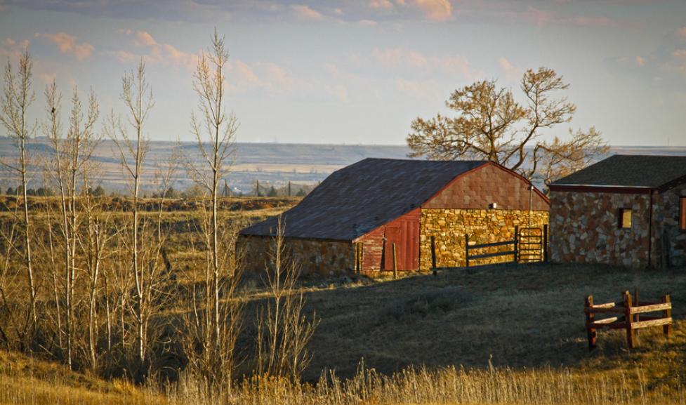
Open Space & Mountain Parks (OSMP) is implementing several changes to the western trails of the Boulder Valley Ranch (BVR) area which are outlined in the North Trail Study Area (TSA) Management Plan PDF. The North TSA Plan had significant community input, and was approved by the Open Space Board of Trustees and Boulder City Council in 2016.
The North TSA Plan provides direction for OSMP to implement the following in the western Boulder Valley Ranch area:
Improve visitor experience and trail connectivity by replacing high-density low-quality trails with fewer high-quality sustainable trails that minimize impacts to sensitive ecological resources.
Improve bike access through conversion of some trails to allow bicycle use.
Protect habitat by closing undesignated trails and some sections of designated trails.
Trail Closures
OSMP expects that construction-related trail closures will be minimal during upcoming work, although there may be short, intermittent closures to support construction work in the area. Upcoming closures will be posted below.
Project Updates
January 2026 update:Degge Trail is now open to hikers! Final construction will wrap up Spring of 2026. Hidden Valley re-route construction begins Summer of 2026 with the efforts of OSMP Trail Crews, volunteers and Boulder Mountainbike Alliance. It is expected to be completed by the end of 2026, when both Degge and Hidden Valley will officially open for multiuse access.
May 2025 update: Hidden Valley & Degge reroutes: Starting in June, OSMP Trail Crews, volunteers and Boulder Mountainbike Alliance will begin construction of major reroutes to the Degge and Hidden Valley Trails. This work is expected to last into 2026 and once complete these trails will allow for bike access.
April 2025 update:The Eagle Trail re-route is complete! Phase 2 of the project involved re-routing about 2,000 feet of the single-track section of Eagle Trail along the mesa-top. Coupled with the trail section dropping down to Sage Trail which was completed in December, the new trail alignment provides greatly improved drainage to prevent trail erosion, and winds gently along the landscape to help provide visitors with an engaging trail experience. Timberline Trailcraft (OSMP’s contractor) has now started construction of Shale Trail – a new trail connecting Boulder Valley Ranch Trailhead to Eagle Trail on the mesa-top. Shale Trail will be open to hikers and horseback riders to provide a non-bike trail experience in the BVR area. Construction timeframe is variable due to spring rains, but is expected to last until summer.
November 2024 update: OSMP and Timberline Trailcraft have completed and opened up a half-mile section of the Eagle Trail re-route! This new trail section replaces the steep, loose, and erosive section of Eagle Trail south of Boulder Valley Ranch Trailhead. The new trail is open to hikers, bicycles, and equestrians, and has been designed to accommodate adaptive mountain bikes – hand-pedaled cycles often used by people with disabilities. Please stay on the trail – do not shortcut, and do not utilize trails marked as closed – your efforts will help to protect vegetation and help closed trails to re-vegetate.
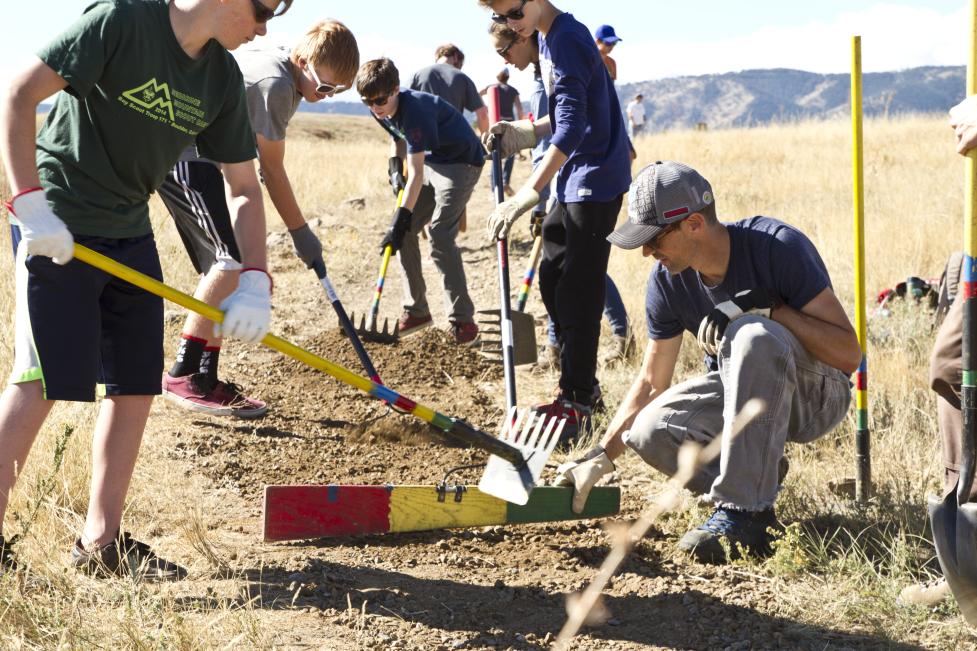
September 2024 update: Construction of the Eagle Trail re-route is under-way with OSMP’s contractor, Timberline Trailcraft! OSMP crews, volunteers and Boulder Mountainbike Alliance anticipate starting construction of the Cobalt Trail re-route on Sept 9 – when complete, this trail will allow for bike access.
Project Gallery
Eagle Trail reroute construction start - Sept. 5, 2024
1 of 5
Cobalt Trail reroute scheduled construction start: Sept. 9, 2024
2 of 5
Two people riding adaptive mountain bikes on the Eagle Trail.
3 of 5
A mountain biker rides down a section of the Eagle Trail re-route.
4 of 5
A large switchback being built on the Shale Trail
5 of 5
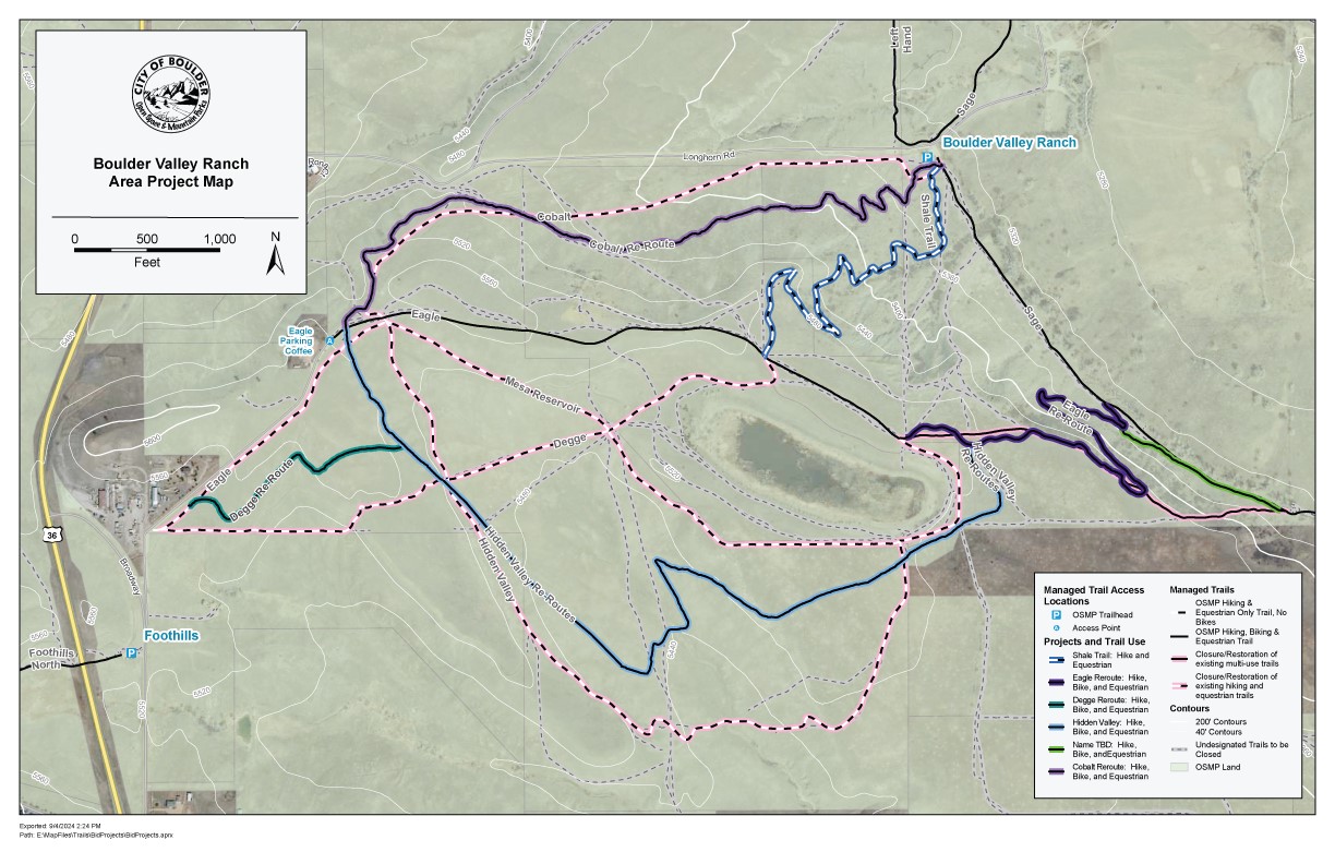
Trail Changes in the Project Area
The section of Eagle Trail between the Sage Trail junction west to the shade shelter will be re-routed with a new 2/3-mile route. This will replace the existing steep and erosive section of trail with a more sustainable and enjoyable trail grade. Trail use will remain open for hikers, mountain bikers, and equestrians. In conjunction with this project, a section of narrow single-track trail adjacent to Sage Trail will be constructed to connect the historic Eagle/Sage Trails junction with the new one.
Shale Trail will be constructed from the Boulder Valley Ranch Trailhead to the mesa-top to the southwest (connecting to Eagle Trail). This new 2/3-mile trail will replace two existing undesignated trails in order to reduce impacts to rare Bell’s twinpod plant habitat. This trail will be open to hikers and equestrians only in order to provide a non-bike route to the top of the mesa.
Cobalt, Hidden Valley, and Degge Trails will be re-routed to improve trail sustainability and visitor experience. All of these trails will be opened to bicycle use, while retaining historic hiking and equestrian uses.
Mesa Reservoir Trail and portions of Degge Trail will be closed to improve habitat conditions around Mesa Reservoir.
Project progress depends on weather conditions and trail system-wide priorities. OSMP estimates the following schedule for implementation of the western BVR area projects:
Eagle Trail re-route: Expected to start Wednesday, Sept. 4.
Re-routing trails to sustainable standards will make them less prone to erosion and other issues. Several trail sections will be surfaced with gravel to alleviate seasonal mud issues. OSMP expects that occasional closures will be necessary during muddy conditions in order to maintain good trail conditions.
Additional bicycle access
Some trails, when re-routed, will allow for mountain bike use, along with historically allowed hiking and equestrian use.
Improving accessibility
OSMP has placed high priority on providing trail experiences for visitors with disabilities. In the western BVR trails complex, trails that are open to mountain bikes will be constructed to also accommodate adaptive mountain bikes – hand-pedal driven bikes used by people with disabilities. Through use of modest trail design changes, these trails can be constructed such that they are available for a broader range of the community to enjoy.
Improved habitat
Undesignated trails (social trails) currently traverse through sensitive habitats, such as areas that are home to the rare Bell’s twinpod – a plant that only exists in a few locations in Boulder and Larimer Counties, and nowhere else in the world! OSMP will close these trails and others that the North TSA Plan has identified for closure to improve vegetation and wildlife habitat.


