If you prefer written directions or can't make the guided tour, here are the turn-by-turn directions.
The Noble King/Kings Ridge guided Boulder Walks tour explores the area north of Valmont Road, east of 47th Street to Airport Road, and south of the airport and Hayden Reservoir. Here we find multiple trails, pathways, irrigation ditches, wildland restoration areas, tree canopies, community playgrounds, and secluded neighborhood parks.
Waymarker A Starting Point
Beginning in the Valmont Bike Park parking lot, cross Airport Rd and proceed south on the sidewalk towards Valmont Rd.
Larger than 200 acres, Valmont City Park is one of Boulder’s largest and most diverse urban parks, comprising sports fields, playgrounds, dog parks, a bike park, and restored prairie habitats and wetlands. Valmont Bike Park is one of the largest in the country and attracts riders from around the region.
Waymarker B Boulder and Left Hand Ditch
Just before turning west onto Wonderland Creek Greenway path, cross over Boulder and Left Hand Ditch. Still on Airport Rd just ahead before Valmont Rd, is North Boulder Farmers Ditch (Waymarker C). See above for information on these Boulder ditches.
Waymarker D Wonderland Creek Path
Turn onto the Noble Park shaded corridor of the Wonderland Creek Greenway alongside Boulder and Left Hand Ditch and head west on the path.
Wonderland Creek Path is a paved major east-west connector. Stretching through several neighborhoods, the path is popular for commuting and recreation, linking parks and schools. Boulder’s greenway system, including Wonderland Creek Path and Cottonwood Trail, is designed to allow residents to traverse the city without using a car.
Waymarker E Christensen Park
When reaching Christensen Park, the path bends to the north. Looking over the park, enjoy the lovely view of the Flatirons and Boulder’s mountains. This is a choice location for a sundown respite.
Christensen Park Playground is a community gathering spot with modern play equipment, picnic tables, and open fields. In 1989, while the Noble Park/Kings Ridge subdivision was being developed, the City of Boulder was bequeathed a substantial donation and most of the Jean Louise Christensen estate for the creation of a three-acre park.
Waymarker F Paisley Park
Just before Wonderland Creek Greenway turns again to the west, take the path between houses toward Noble Court. Turn left (northwest) onto the Noble Ct sidewalk, go past two houses, and turn left onto Tesla Ct. The charming, landscaped island in the middle of the cul-de-sac is Paisley Park.
Named for its quirky paisley pattern, quiet Paisley Park provides open space, playgrounds, and shaded picnic areas. The small park is popular for local gatherings and relaxation.
Waymarkers G and H Cottonwood Path and Boulder and White Rock Ditch
Head west on the path between houses and cross Kings Ridge Boulevard. Turn south and, after a couple houses, west again onto Wonderland Creek Greenway. Stay on the path, taking note of the biodiverse pond, until reaching 47th St and Kings Ridge Blvd.
Staying on the east side of 47th St, carefully cross Kings Ridge Blvd. Turn to the east on Cottonwood Path and proceed alongside Boulder and White Rock Ditch.
At the first bridge, cross Boulder and White Rock Ditch and turn north to remain on Cottonwood Path. The immediate parking lot to the west, just over the ditch, belongs to the NCAR Foothills Lab on Mitchell Lane. The next property is Rocky Mountain Equality, with a bridge connecting to Cottonwood Path.
The Cottonwood Path/Trail is a popular multi-use path for walking, running, and cycling that meanders through northeast Boulder along the Boulder and White Rock Ditch. Cottonwood trees—one of Colorado’s native species—line parts of the shaded trail.
Waymarker I Hayden Lake
Continue a little way on Cottonwood Path until just before changing to the crusher fines Cottonwood Trail. Unseen through the trees, houses, and embankment is Haden Lake and the western edge of Hayden Dam.
Hayden Lake, named after Boulder water management history icon Alva Adams Hayden, is a reservoir under Boulder water management and supports agricultural irrigation and urban municipal water needs. The dam is at the southern end, between the water and the houses on Sentinel Drive and Vail Circle.
Connected to Boulder and White Rock Ditch, the reservoir and dam date back to the early 20th century. The lake, where waterfowl and amphibians thrive, is popular for birdwatching and contemplation.
Waymarker J NCAR and UCAR Labs
Before moving on, note the buildings across the ditch immediately to the northwest, additional NCAR labs as well as UCAR. At the junction of Cottonwood’s path and trail, take the paved path between houses onto Sentinel Drive and turn south.
Waymarker K Vista Village Entrance
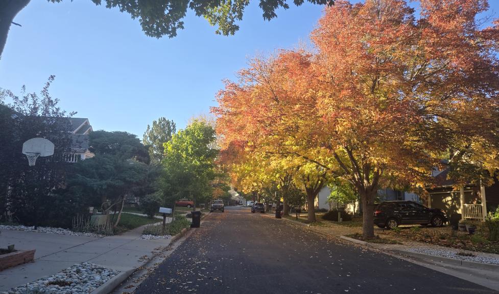
Stay on Sentinel Dr until it ends at Kings Ridge Blvd. Turn left, heading southeast to Franklin Dr. Loop around Franklin Dr, noting the native trees. In the fall, this neighborhood is a stunning display of autumn colors.
Upon reaching Noble Court, remain on the east sidewalk and turn south past seven houses to the first street. Turn onto Wright Ave, cross the street, and immediately pass between houses on the path into Vista Village.
Waymarker L Boulder Municipal Airport
Proceed north on Independence Dr and then east on Vail Circle. At the stop sign is Airport Rd. To the left is Boulder Municipal Airport.
Boulder Municipal Airport, alongside open space with distinctive views of the city and foothills, is a small-plane general aviation facility with flight training, aerial tours, local airshows, and community events. Since opening in 1928, it has played a significant role in local aviation history.
Waymarker M Finish
Cross Airport Road and turn right. Use the first path into the Valmont Bike Park parking lot area to finish.
Background Information
With development beginning in the late 1980s, Noble Park and Kings Ridge offered new home buyers in Boulder a planned community in an urban park setting with streets named in honor of Nobel Prize and other significant scientists, some listed below. The neighborhood has been an active and growing area in Boulder.
Conceptualized in the late 1970s as a specific subdivision called Noble Park/Kings Ridge, the Planned Unit Development (PUD) project was funded jointly by eight University of Colorado faculty member families who retained the same architect and builder. Wide, divided streets were lined with now-mature cottonwood and elm trees. Besides its parks and walkways, the neighborhood connects with larger park systems via path and trail access.
The focus of the development was on communal living and open space, a groundbreaking concept at the time. With the nod to scientists, it is sometimes mistakenly referred to as "Nobel Park." The community of 95 homes features common open space and an architectural style using consistent elements. White-painted masonry with colored shutters promotes the unique aesthetic of the neighborhood.
Noble Park is known for its open green spaces and playgrounds, exemplifying Boulder’s commitment to accessible outdoor recreation. The neighborhood features scenic views of the Front Range and walking paths lined with native trees, popular among families and dog walkers.
In 1989, Noble Park resident Jean Louise Christensen bequeathed a significant portion of her estate to the city for a park in the new subdivision. This legacy, completed in 1999 and since renovated, is known as Christensen Park at 3100 Kings Ridge Boulevard.
Bordered by wraparound Kings Ridge Boulevard, the Kings Ridge neighborhood is a quiet community in the southwest section of Noble Park. As a subset of Noble Park, the Kings Ridge development area is often referred to as Noble Park/Kings Ridge.
Additional Information
Science/Nobel-associated Street Names
Some Noble Park/Kings Ridge street names with nods to famous scientists and inventors include:
- Bell Dr
- Alexander Graham Bell did not win a Nobel Prize.
- The work of John Stewart Bell, known for Bell's theorem in physics, led to the Nobel Prize in Physics in 2022.
- Curie Ct
- Marie Curie won the Nobel Prize in Physics (1903) and Chemistry (1911). Pierre Curie also won the Nobel Prize in Physics (1903).
- Edison Ave
- Thomas Edison was a prolific inventor who predated the Nobel Prize.
- Franklin Dr
- Rosalind Franklin is associated with discovering the DNA structure, but she did not win a Nobel Prize. Prolific inventor Benjamin Franklin predated the Nobel Prize.
- Gibbs Ave
- Josiah Willard Gibbs was a famous statistical mechanics and chemical thermodynamics scientist who did not win a Nobel Prize.
- Hopkins Pl
- Frederick Gowland Hopkins won the Nobel Prize in Physiology or Medicine in 1929.
- Tesla Ave Nikola
- Tesla never won a Nobel Prize but did advance electricity and wireless technology.
- Wright Ave
- Flight pioneers Wilbur and Orville Wright did not win the Nobel Prize.
Boulder Ditches
Boulder and White Rock, Boulder and Left Hand, North Boulder Farmers
Three historic ditch systems were built from the late 1800s through early 1900s to channel water from Boulder Creek and other sources to farms and communities north of Boulder. The Boulder and White Rock Ditch, Boulder and Left Hand Ditch, and North Boulder Farmers Ditch are still used today for irrigation and serve as important wildlife and
trail/recreation corridors. The ditches of Boulder are among the oldest continually operating irrigation ditches in Colorado. For a related Boulder Walks route and more ditch information, see Digging Boulder: A Tour of the Ditches that Helped Develop the City.
The following three ditches daylight and flow through Noble Park, all with headgates in Central Park under Broadway at Boulder Creek.
- Boulder and White Rock Ditch (BWR) in northwest Noble Park runs alongside the Cottonwood path and eventually empties into Panama Reservoir near Mineral Rd, CO 52, and US 287.
- These ditches flow parallel to each other at the southern edge of Noble Park: Boulder and Left Hand Ditch (BLH) and North Boulder Farmers Ditch (NBF).
- North of Boulder Municipal Airport, BLH runs alongside BWR towards northeast Boulder County.
- NBF diverts from BLH under Foothills Parkway, east of Boulder Junction, and then joins BLH again north of Jay Road under 63rd Street.