Why Are Safe and Comfortable Connections So Important?
Iris Avenue, from 28th to 19th Streets, is on the 2023-2027 Vision Zero Action Plan High Risk Network – in part because of the mix of land uses along the street.
View the printable Fact Sheet PDF or explore this page for the web-accessible version.
The potential to enhance residential, neighborhood, and business access, low-stress walk and bike connections, and transit experiences.
Iris Avenue, from 28th to 19th Streets, is on the 2023-2027 Vision Zero Action Plan High Risk Network – in part because of the mix of land uses along the street.
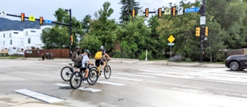
A typical day on Iris Avenue includes hundreds of people walking, biking, and taking transit along the corridor with over 1,000 people walking and biking across it, including about 400 at the Elmer’s Two Mile Park.
The CO 119 Safety, Mobility and Bikeway project will bring regional bus rapid transit and e-bike supportive multi-use paths to the eastern edge of Iris Avenue, making it a key multimodal corridor.
"The City of Boulder has a vision for a City where people of all ages and abilities can walk and bike comfortably to and from anywhere.”
- 2019 Low Stress Walk and Bike Network PlanDue to the number and speed of vehicles on Iris, the city’s Low Stress Walk and Bike Network Plan and national guidance (NACTO, AASHTO, and FHWA) call for more space between people walking and biking, and vehicles. I
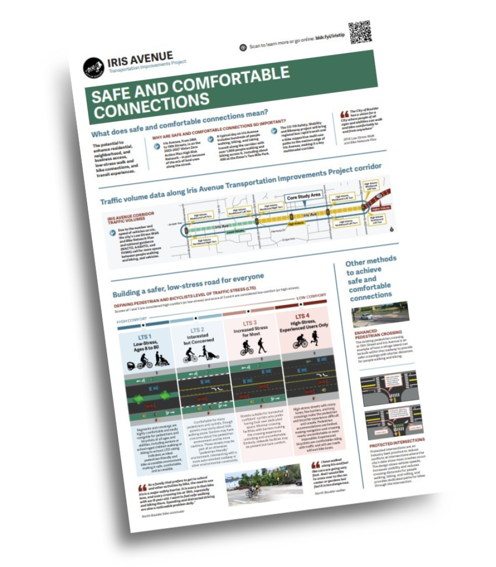
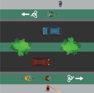
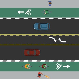
Scores of 1 and 2 are considered high comfort (or low-stress) and score of 3 and 4 are considered low comfort (or high-stress).
| CATEGORY | LTS 1 | LTS 2 | lts 3 | lts 4 |
|---|---|---|---|---|
| Example |
|
|
|
|
| Description | Segments and crossings are highly comfortable and easily navigable for pedestrians and bicyclists of all ages and abilities, including seniors or school-aged children walking or biking to school. LTS 1 rating indicates an ideal pedestrian-friendly and bike-accessible environment, making it safe, comfortable and accessible. | Comfortable for many pedestrians and cyclists, though parents may worry about kids walking alone. Seniors may have more concerns about the pedestrian environment and be more cautious. These streets may be part of an otherwise “pedestrian-friendly” environment, intersecting with a more auto-oriented roadway or other environmental constraints. | Streets suitable for “somewhat confident” cyclists who prefer having their own dedicated space. Minimal crossing facilities with barriers making the crossing experience uninviting and uncomfortable. Similarly, sidewalk facilities may be present but lack comfort. | High-stress streets with many lanes, few barriers, and long crossings make the pedestrian and bicyclist experience difficult and unsafe. Pedestrian accommodations are limited, making navigation and crossing nearly uncomfortable or even impossible. Experienced bicyclists are comfortable riding with traffic and will use roads without bike lanes. |
| Comfort level | High | Medium-high | Medium-low | Low |
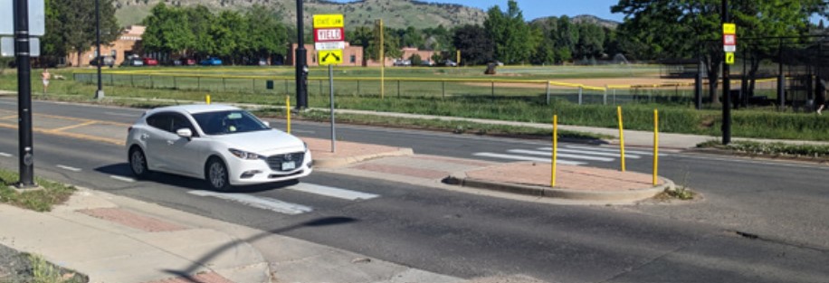
The existing pedestrian crossing at 15th Street and Iris Avenue is an example of how a refuge island can be built within the roadway to provide safer crossings with shorter distances for people walking and biking.
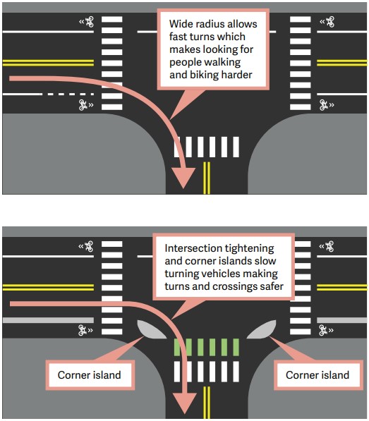
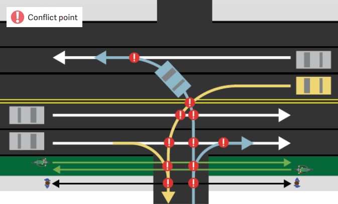
Protected intersections are an industry best practice to reduce conflicts at intersections where the city’s data show most crashes occur. The design slows vehicle speeds, increases visibility and reduces crossing distances for people walking, biking, and rolling, and provides dedicated paths for bikes through the intersection.
"As a family that prefers to get to school and other activities by bike, the need to use iris is a major safety barrier. It is scary in that bike lane, and scary crossing iris at 19th, especially with our 8-year-old. I want to feel safe walking and biking there. Speeding and distracted driving are also a noticeable problem daily.”
- North Boulder bike commuter"I have walked along Iris and feel like cars are going very fast. And I would like to cross over to the rec center or gardens but feel it is too dangerous."
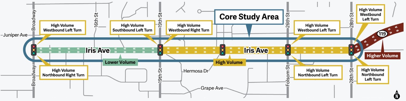
- North Boulder walkerTraffic modeling and analysis determined the “bookends” of Iris Avenue which are key to moving people reliably along the corridor. The “bookends” have thoughtful design considerations that balance the priorities of improving safety for all while keeping everyone moving.
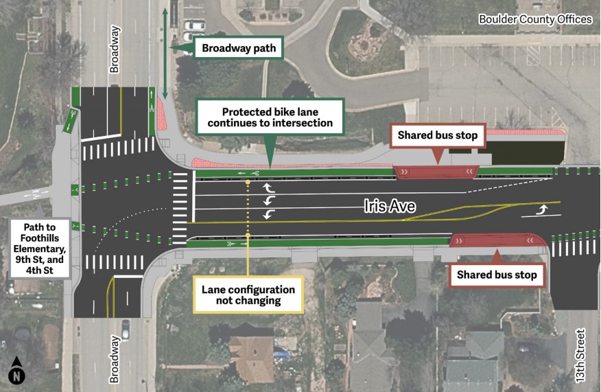
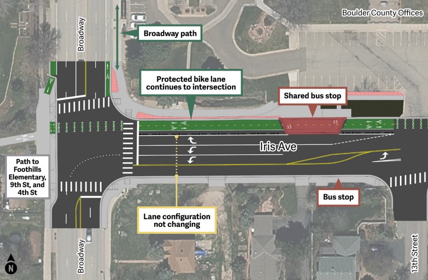
Improvements to the bookends will not change the number of vehicle lanes. Bike, pedestrian, and transit facilities and driveway access management will be improved to reduce conflicts and make connections safer for everyone. This focuses all Alternatives to the middle segment of Iris Avenue, which is on the High Risk Network.
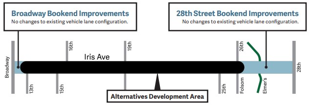
With the eastern 28th Street Bookend Improvements, people walking and biking will have separate spaces and improved connections to Elmer’s Two Mile, 28th St, local and regional multi-use paths, and transit.
The east end bookend receives more activity as people access commercial centers and enter and exit the corridor.
Conflicts arise when all of this activity crosses one another.
When crash data demonstrates these crossings are unsafe, limiting those conflicts is needed.
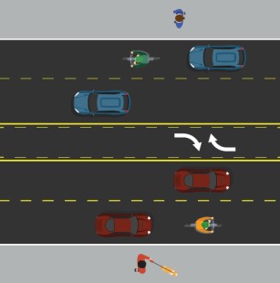
Access management, where turns are restricted, can reduce the potential for crashes.
"The free-for-all entrances and exits at the Safeway Shopping Center on both sides of Iris near 28th are an accident waiting to happen - and you don’t need to wait long for one to occur."
- Community memberThere were 12 left-turn crashes at the western Safeway Shopping Center driveway (2016-2023), three of which involved people biking.
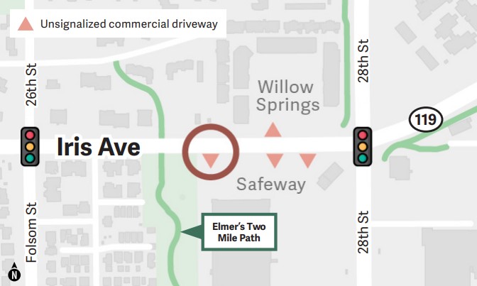
All alternatives will prohibit the westbound left turn from Iris Ave into the western Safeway Shopping Center driveway to address common crash patterns. The city will monitor for future access management needs at the Willow Springs and Safeway Shopping Center driveways.