Project Overview
The Andrus Road to Airport Road Multi-Use Path project will provide a walking and cycling connection between Gunbarrel (63rd Street path) and central Boulder.
The Andrus Road to Airport Road Multi-Use Path project will provide a walking and cycling connection between Gunbarrel (63rd Street path) and central Boulder.
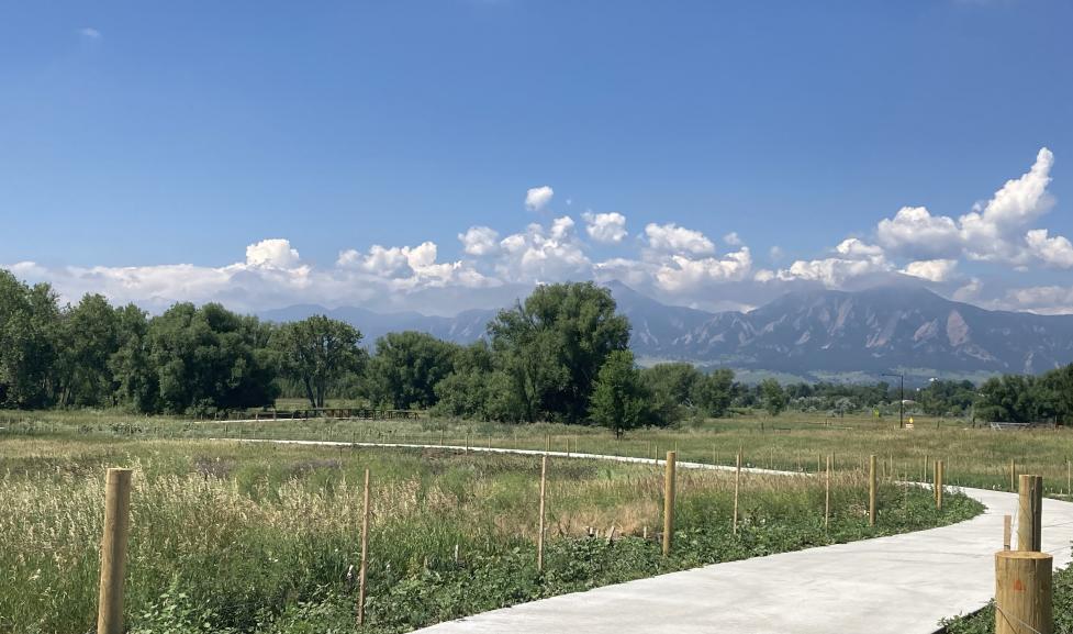
Phase 1 of project construction was completed in July 2021 and is now complete! See slideshow above. Construction included:
Phase 2 of the Andrus Road to Airport Road Multi-Use path project has been placed on indefinite hold. The FAA rejected the appeal by the City of Boulder to construct the path through the runway protection zone (please see below for additional information). At this time, an alternative pathway located outside of the runway protection zone and on OSMP property is not consistent with current OSMP policies. Consequently, Transportation and Mobility Department staff is currently working to advance the final design and construction of the Valmont Road Multi-Use Path (S. Boulder Creek to 61st St) in 2022 and 2023 (depending on funding). This change in focus allows the staff to continue the work of providing safe and reliable multi-modal transportation choices in pursuit of Transportation Master Plan goals as well as the area goal to provide off-street bicycle and pedestrian connections between Gunbarrel and the city center.
Because the proposed multi-use path is adjacent to the Boulder Municipal Airport, and further, due to a Federal Aviation Administration (FAA) rule change, FAA permission is now required in order to build a path in the vicinity of the airport – even if the path is on city open space. City staff have requested permission to build the path from the FAA twice – the second attempt was an appeal – and both requests were denied.
City of Boulder Open Space and Mountain Parks (OSMP) and Transportation and Mobility Department staff continue to work together to accomplish the city's goal of connecting multi-use paths between Gunbarrel and Boulder. To minimize environmental, agricultural and scenic resource impacts, Transportation and Mobility and OSMP will continue to explore other possibilities to connect the paths, including:
The city charter requires that the Boulder City Council and the Open Space Board of Trustees approve transfers/disposals of city open space – even to other city departments.
We understand the strong interest in accomplishing the goal of this project and want to inform you that no immediate decision for the board or City Council is pending. Additional background information about this multi-use path has been prepared for the Boulder City Council.
The Andrus Road to Airport Road Multi-Use Path project is one of three City of Boulder transportation connections identified in the area of the confluence of Boulder Creek and South Boulder Creek and Boulder Creek and Fourmile Canyon Creek (Confluence Area), which would provide a much-needed multimodal connection between Gunbarrel and the city.
Once fully constructed, the Andrus to Airport Multi-Use Path would consist of a 10-foot-wide, off-street, concrete multi-use path between Andrus Road and the Airport Road office park. The project would link to the existing path along the west side of 63rd Street in Gunbarrel to the existing path at Airport Road, improving the city’s system of multi-use paths, regional bicycling travel, and off-street and multi-use path connectivity between Gunbarrel and the Boulder urban center.
The proposed conceptual project design was created through the collaboration of the city‘s Public Works and Open Space and Mountain Parks departments and between the city and Boulder County. The edges of the proposed path are a solid pink line, the centerline of the path is a dashed yellow line, the proposed fence is in red and the existing fence is in orange.

1 of 3

2 of 3

3 of 3


