1. Community Engagement

  2. Plan

  3. Design

  4. Build

  5. Complete

Completion Date
2023-2024
Current Phase
Design

Project Overview

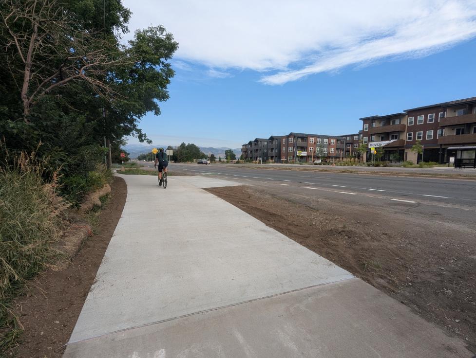
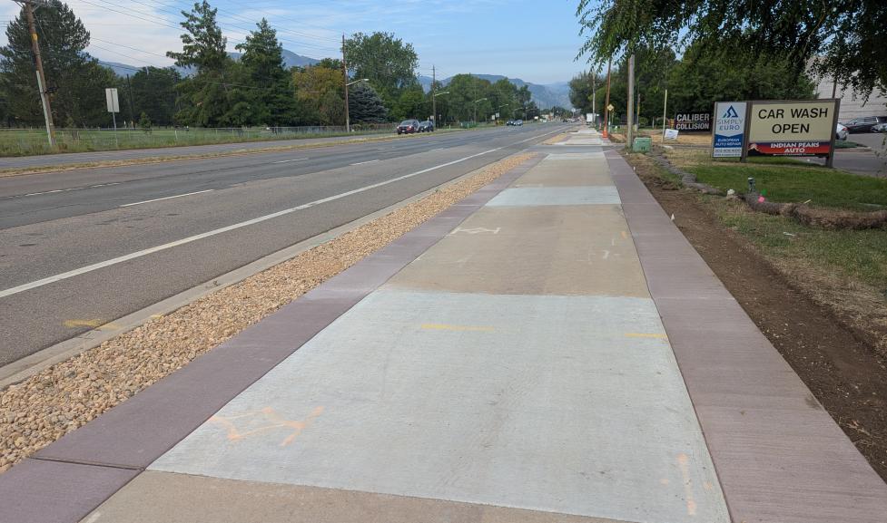
The East Arapahoe Multi-Use Path and Transit Stops Project will fill in missing links in the multi-use path system and enhance bus stops along Arapahoe Avenue between 38th /Marine streets and Cherryvale Road.

This project is part of the larger East Arapahoe Transportation Plan.

View the project map

Project Goals

Enhance multimodal safety, access and connectivity on East Arapahoe by:

  • Completing gaps in the pedestrian and multi-use path network
  • Creating off-street pedestrian and bicycle connections to local and regional transit service
  • Enhancing nine bus stops with shelters, trash receptacles and other amenities to provide a safe and comfortable environment for waiting transit passengers

Proposed Design

Based on community feedback gathered through public meetings and a questionnaire, staff have developed a proposed design for the East Arapahoe Multi-Use Paths and Transit Stops Project.

The proposed design features:

  • The addition of a 12-foot multi-use path and 8-foot landscape buffer where it can be accommodated within the existing public right-of-way (view mock-up).
  • In limited segments east of Eisenhower Drive, a 10-foot multi-use path and 2 to 8-foot landscaped buffer
  • Buffer landscaping throughout the corridor, with some hardscape buffers in appropriate locations
  • Enhancements to 10 transit stops along the corridor

Expand the slideshow below to see renderings and aerial overviews of the design.

You can also view the project's Community and Environmental Assessment Process (CEAP)

Background

This project is part of the East Arapahoe Transportation Plan, a long-range plan that will consider a number of potential transportation improvements within the East Arapahoe corridor, including biking and walking enhancements, Bus Rapid Transit (BRT) and local bus service and automobile travel.

Related Projects

CO 7 Multimodal Corridor: Brighton to Boulder

A Colorado Department of Transportation (CDOT) project, the CO 7 Multimodal Corridor will improve traveler safety, personal travel efficiency and operations, and access to multimodal travel along a nearly 25 mile stretch of Colorado State Highway 7 (CO 7, or Arapahoe Avenue) between Brighton and Boulder.