All City of Boulder administrative facilities and Age Well Centers will be closed Thursday, July 4, for the Independence Day holiday. Some facilities and services will remain open.
Healing Trail: Indigenous plantings, interpretive elements and program areas provide places for education, reflection, healing and gathering.
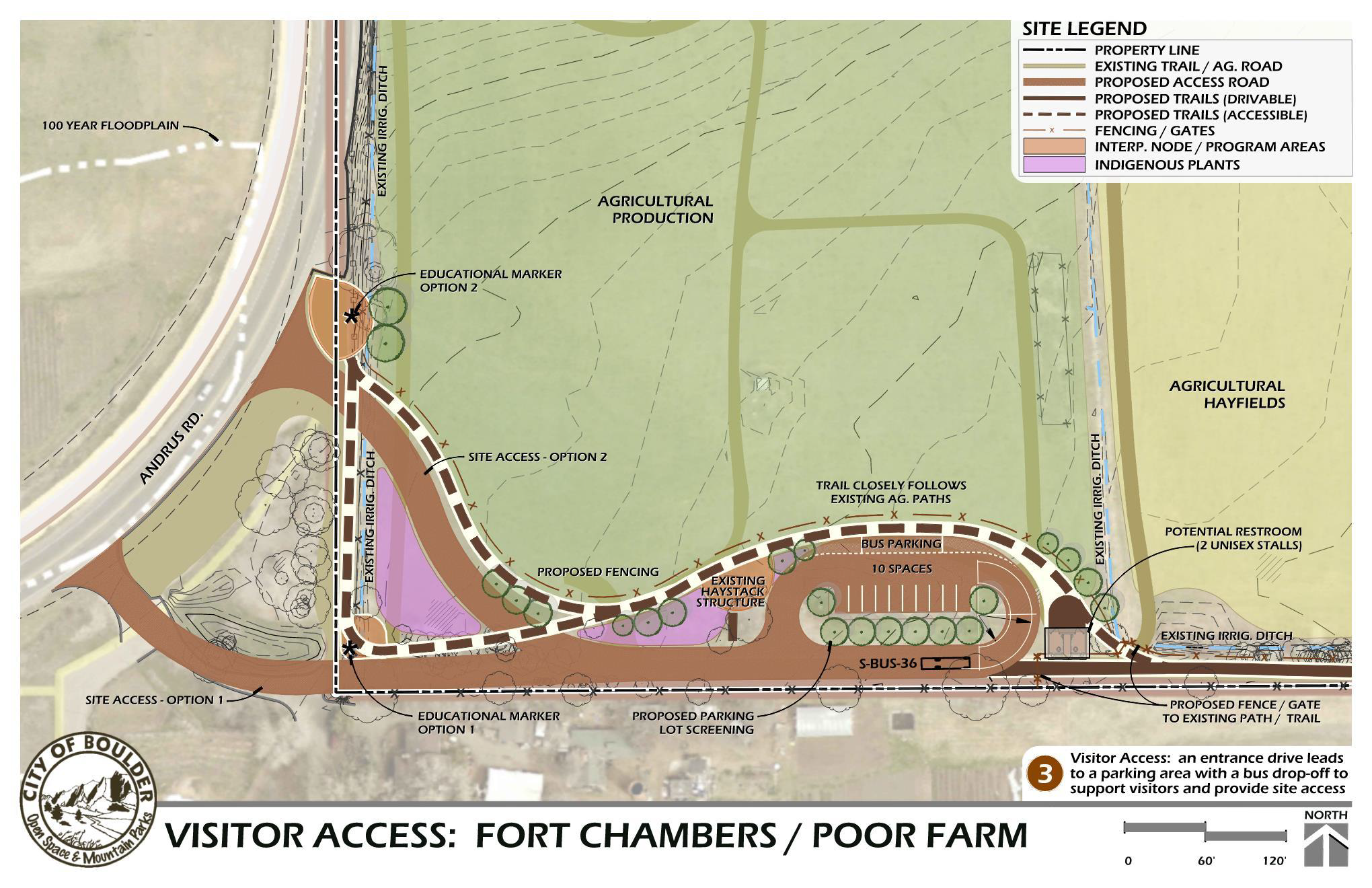
Visitor Access: An entrance drive leads to a parking area with a bus drop-off to support visitors and provide site access.
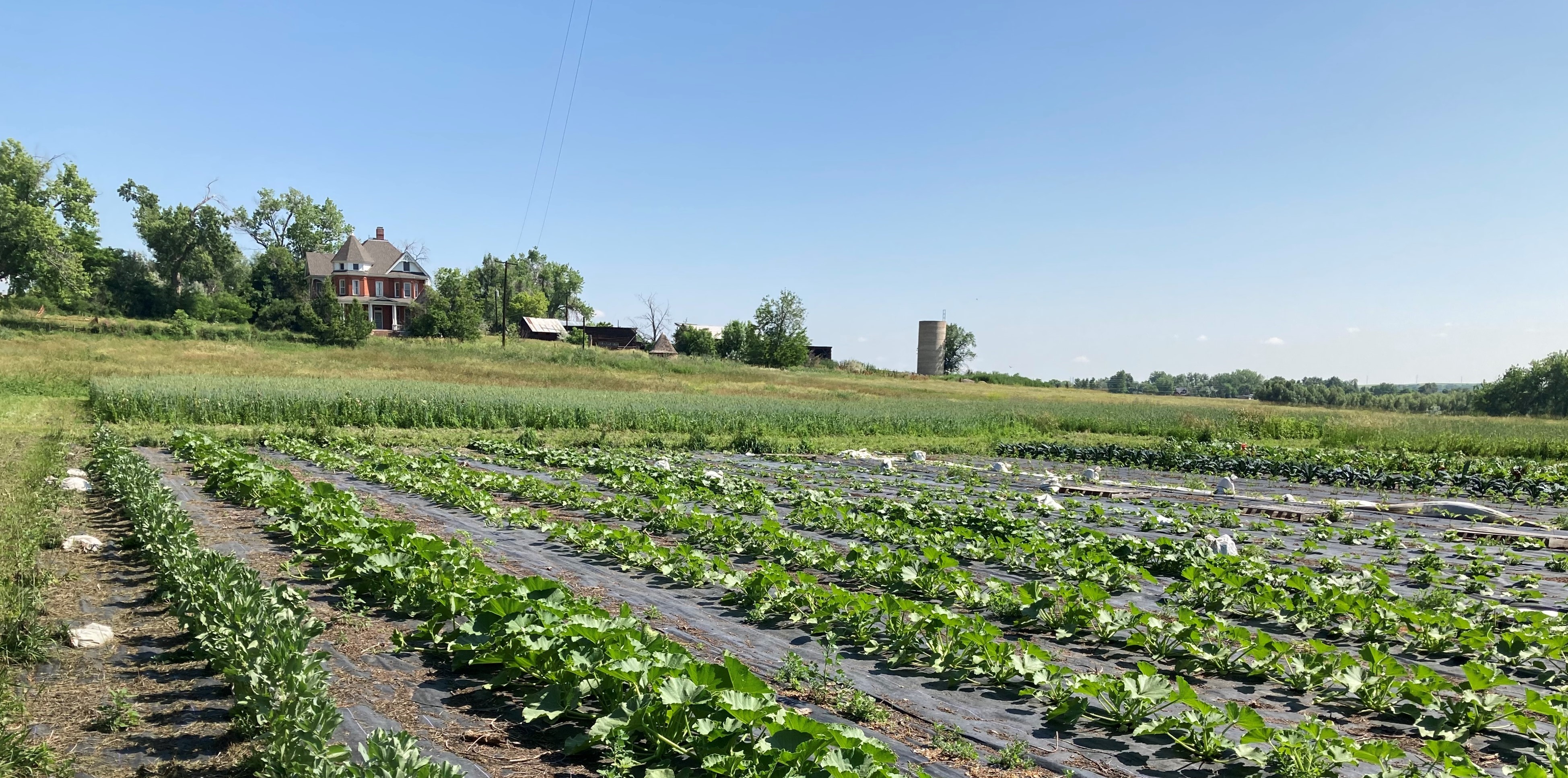
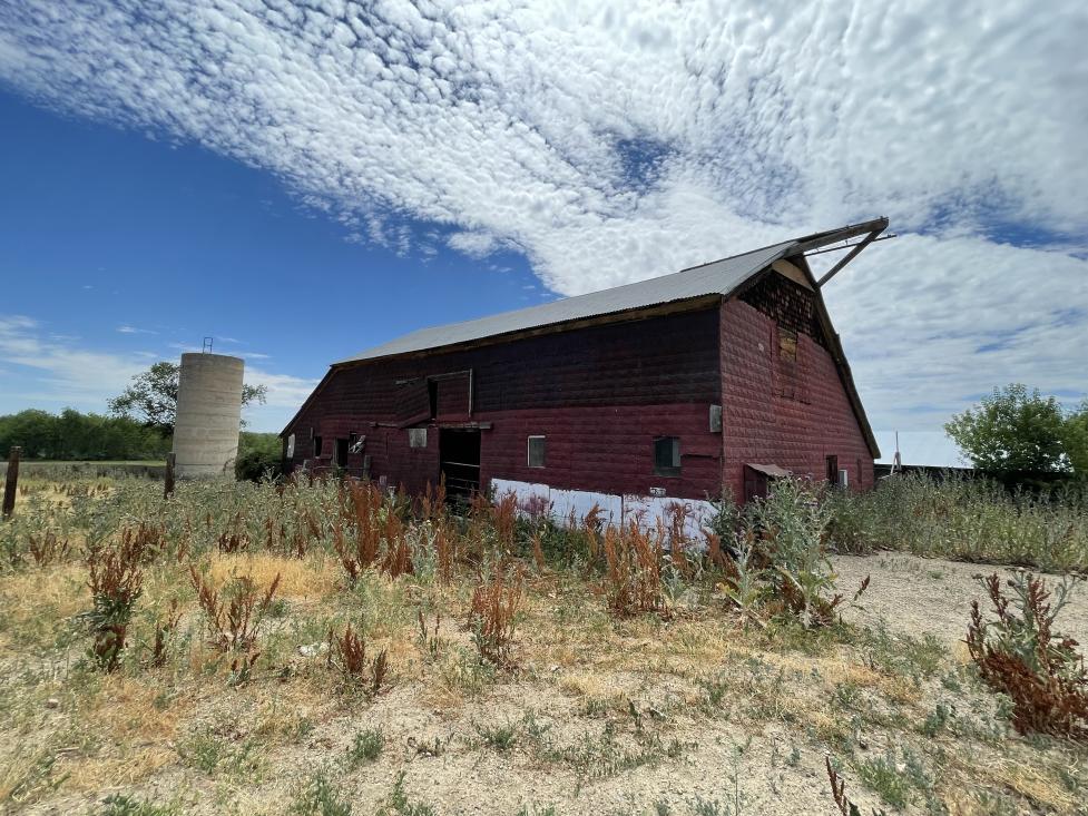
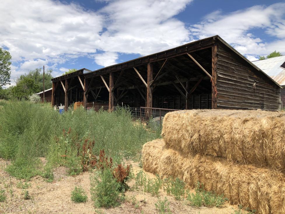
Farmstead improvements: To support ongoing agriculture including diversified vegetable farming and irrigated hay fields - recommendations include restoration of the historic Queen Anne style house and existing farm structures.
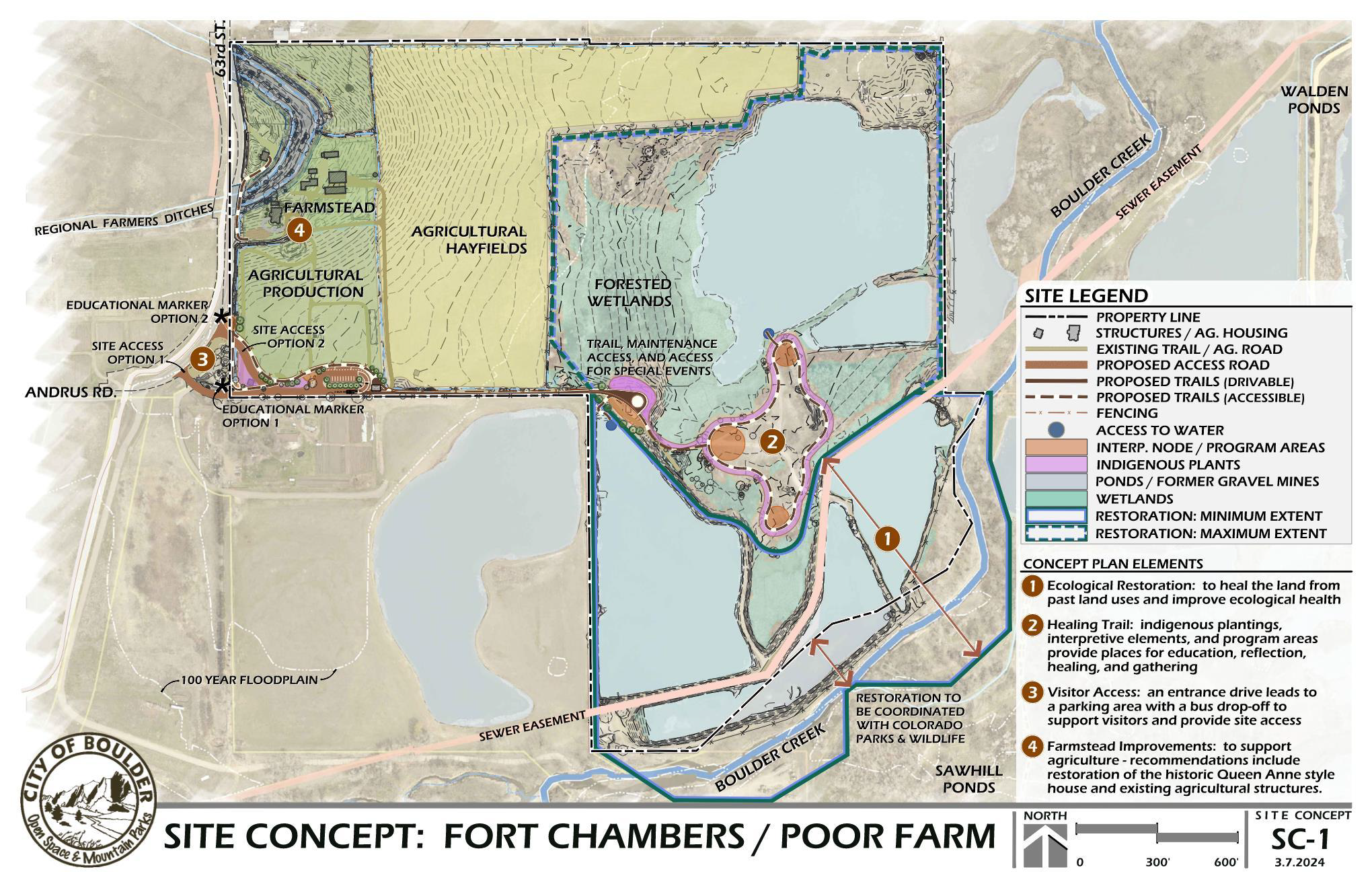
1. Ecological Restoration
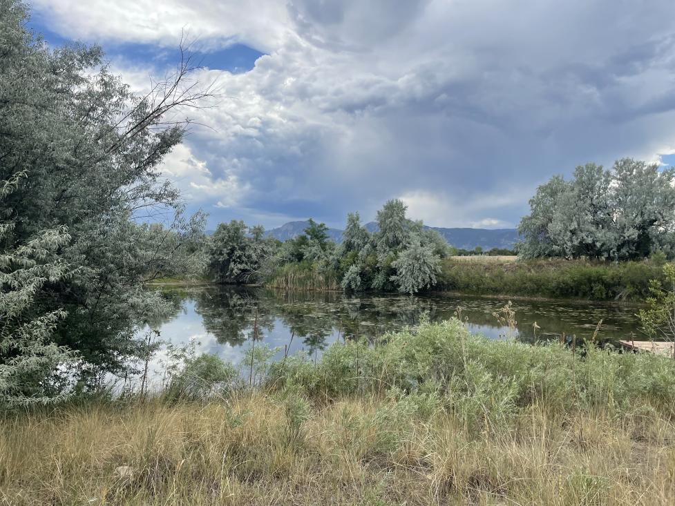
Heal the land from past land uses and improve ecological health. Existing wetland areas and site vegetation support a variety of wildlife. A large-scale restoration project along the Boulder Creek corridor is recommended to improve ecological health, restore ponds that were left from gravel mining, remove berms to reconnect the floodplain and create high quality wetlands that support native wildlife. Restoration efforts could potentially extend to neighboring properties. Trash, debris and noxious weed removal is also recommended.
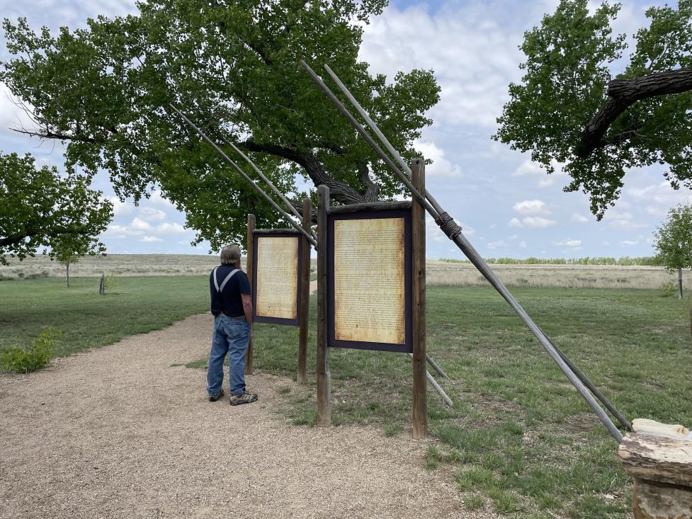
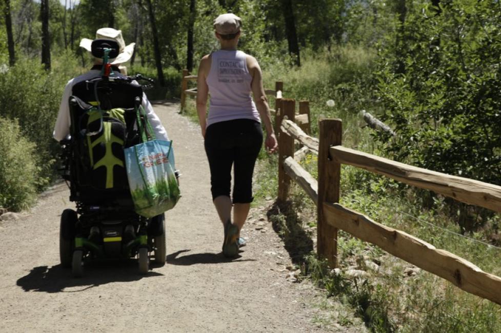
2. A Healing Trail
Create educational elements, indigenous plantings and spaces for reflection, healing and gathering. The pictures shown below are examples of the types of elements and features that could be included to support visitors and share the history of the site and its connection to the Sand Creek Massacre.
3. Visitor Access
An entrance driveleads to a parking area with a bus drop-offfor public access. Two access drive options are currently being evaluated. Bathroom facilities could also be installed to support visitor use.
An enlarged map of the visitor access and parking lot areas shows paths, driveways, a bus parking/drop-off space and a potential restroom with 2 uni-sex stalls. Fencing separates the agricultural production area from visitor use.
4. Farmstead Improvements
Support ongoing agricultural operations. This site has a long history of agriculture that dates back to 1862. The irrigated fields are uniquely suited to support diversified vegetable farming due to its fertile soils, irrigation water and farm structures. The Concept Plan includes recommendations to preserve and enhance existing agricultural uses and repairing existing farm structures.
Recommendations include repairing and restoring the historic Queen Anne style house that once served as the Boulder County Poor Farm. The house would support an agricultural tenant with educational opportunities explored as a secondary use.
Appreciation and Gratitude
The City of Boulder thanks Tribal Representatives from the Cheyenne and Arapaho Tribes, the Northern Arapaho Tribe and the Northern Cheyenne Tribe for providing guidance on their desired long-term relationship with the land and shaping this collaborative stewardship plan. Learn more about city work to develop the concept in collaboration with Arapaho and Cheyenne Tribal Representatives.
The city and Arapaho and Cheyenne Tribal Representatives thank community members for sharing their input on the draft concept plan.
Next Steps
The city will review public input on the draft concept plan and consider revisions with additional guidance from Tribal Representatives. Open Space and Mountain Parks staff anticipate presenting community feedback on the plan to the city’s Open Space Board of Trustees this summer. After the concept plan is finalized, specific plan elements will be further developed with guidance from Tribal Representatives.
The city recognizes the "Fort Chambers / Poor Farm” name is not consistent with the new vision of creating a healing and welcoming place for all. We look forward to future discussions of possible new names for future trailhead/trails with Tribal Representatives.