This grant-funded project on city-owned property west of town will reduce vegetation, or fuel, to protect critical infrastructure from potential wildfire impacts.

Paragraph jump menu

Jump To

Project Overview

The Colorado Department of Natural Resources’ Colorado Strategic Wildfire Action Program awarded the City of Boulder a $900,000 grant toward a fuel reduction project on Tram Hill, a city-owned property west of Boulder. The project will:

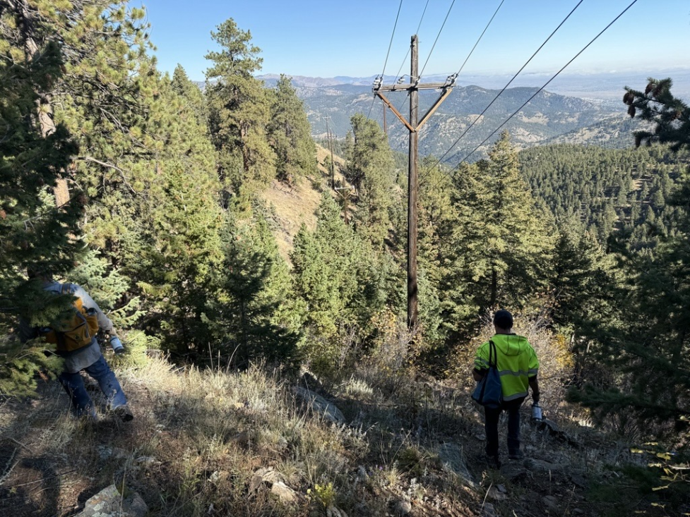
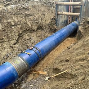
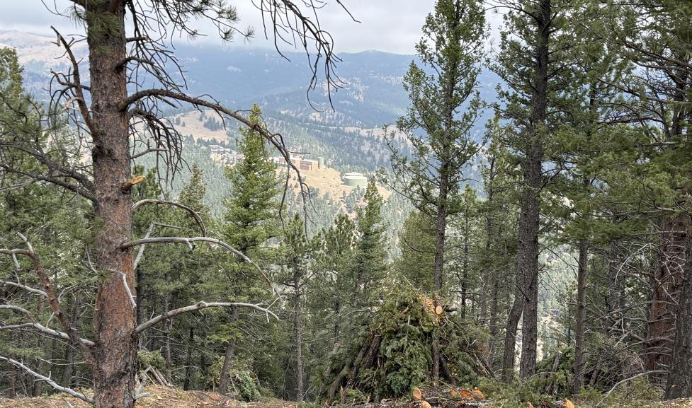
  • Protect critical drinking water, hydroelectric and electrical infrastructure.
  • Increase first responder access in the event of a wildfire.
  • Help to reduce wildfire spread and severity.

This work builds on previous and ongoing wildfire resilience efforts to improve emergency access and reduce wildfire risk in Boulder.

The Tram Hill project is located west of city limits running about two miles between Flagstaff Road and Boulder Canyon Blvd

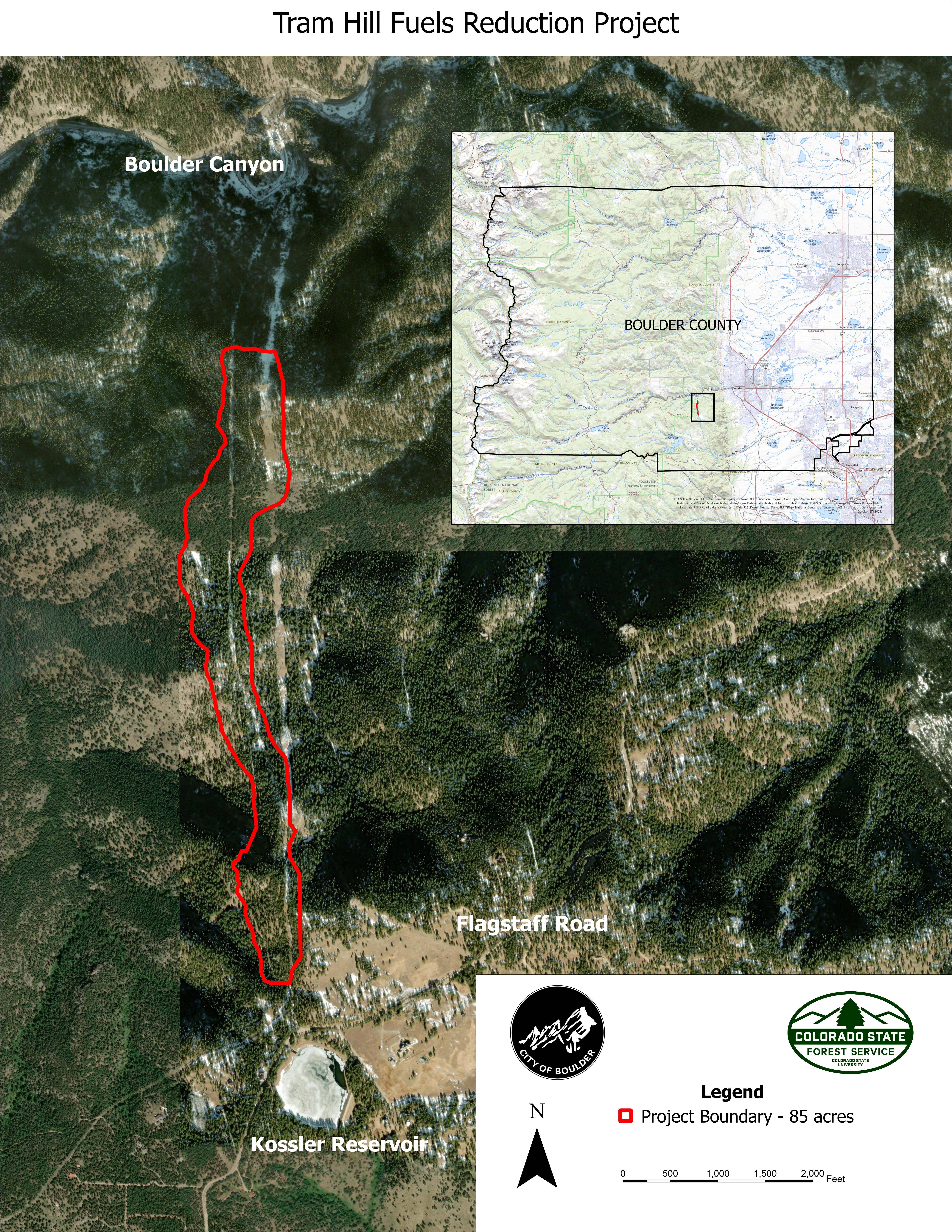
The Tram Hill project is located west of city limits and includes about two miles between Flagstaff Road and Boulder Canyon Boulevard.

Timeline

We are collaborating with multiple partners to plan and implement the Tram Hill project, including the Colorado State Forest Service, Boulder Watershed Collective, and Boulder County.

  • Phase 1: In early 2026, Xcel Energy will cut hazardous trees around their powerlines.
  • Phase 2: Following Xcel Energy’s work, city contractors will begin cutting trees along the same corridor. Trees will be stacked in piles in preparation for winter pile burning. This phase of the project is expected to be conducted between March and June 2026.
  • Phase 3: The Boulder Fire-Rescue Department will burn the piles for removal in the winter months of late 2026, 2027 and 2028 when snow is on the ground and as weather conditions allow.

Community Engagement

We will hold a community meeting on Wednesday, Feb. 25, to provide information for interested community members and answer questions. Meeting details will be posted along with other important updates on this project webpage and the city events webpage.

The City of Boulder is committed to transparent, inclusive and equitable community engagement. This project will inform the community per the city’s Engagement Strategic Framework.

decorative graphic

FAQ

This project covers about 90 acres west of the city limits but is located on City of Boulder property.

No road closures or traffic impacts are expected for this project.

No power outages are expected in relation to this project. Xcel Energy will communicate to their customers if there are any planned power outages.

  • The elimination of ladder fuels and increased crown spacing will help to reduce wildfire severity and reduce post-fire impacts to the trees, ground vegetation, and soils.
  • Increased crown spacing helps forest health and diversity, allowing for aspen and other species.
  • Project operations will consist primarily of hand crews cutting and processing trees on site; these operations minimally impact ground vegetation.

Trees and branches under 8 inches in diameter in areas that are not accessible with chipping equipment will be placed in piles for future burning during winter conditions. Burn piles will be managed by the Boulder Fire-Rescue Department. In some areas, material will be chipped on site to a target depth of two inches or less.

  • Trees growing on top of the drinking water supply pipeline will be cut down, in addition to trees that are less than 8 inches in diameter within the project corridor. Cutting trees less than 8 inches in diameter will increase the space between trees and help to reduce wildfire severity and spread.
  • Xcel Energy will also be cutting trees within their powerline corridor, as well as trees that pose a risk of falling on the powerline. Their powerline corridor is 10 feet on either side of the powerline

The only heavy equipment anticipated for the project is chippers. In some areas of the project, crews will process the cut trees by chipping material.

  • Prescribed fire is a type of wildfire mitigation method that is conducted on open space, agricultural areas, and water ditches to help reduce wildfire risk, support healthier ecosystems, control invasive plants, and maintain water and utility infrastructure.
  • Pile burning is a type of prescribed fire that we will use for the Tram Hill project during the winter months and as appropriate weather conditions allow.

The Wildland Division Chief will manage this prescribed fire. When the city implements a prescribed burn, firefighters trained in preparing, lighting, and supervising prescribed fires oversee the burn pile process. Pile burning is performed with the assistance of City of Boulder Open Space and Mountain Parks, local fire protection districts, and the Boulder County Sheriff’s Office.

  • We have a number of ways to provide information to community members about prescribed burns, including
    • Press releases the day before and day of the prescribed burn.
    • Our webpage for Public Safety Events.
    • City social media.
    • Email alerts sent the day before and day of a prescribed burn. Community members can sign up for email alerts related to prescribed burns from this project and others on our Prescribed Burn webpage.
    • If the prescribed burn is in a prominent area along the mountain backdrop, we work with the Colorado Department of Transportation (CDOT) to post notices on message boards along U.S. Highway 36 and Highway 93.

  • Community members may notice smoke in the area during planned burns and residual smoke after burns are completed. Firefighters monitor burned areas on an ongoing basis until all heat sources have been determined as completely out.
  • These burns are carefully planned, closely monitored, and are not emergencies. Residents are asked not to call 911 about visible smoke from this planned event.
  • Burn piles are planned to start in December 2026 and will continue through the winter months of 2027 and into 2028.

If a day has been approved for a prescribed burn, ignitions will generally begin after 10 a.m. and then stop before 3 p.m. Fire personnel will be on scene before 10 a.m. and after 3 p.m. to continue to watch the fire and keep the area safe.

The Wildland Fire Chief, Chief Oliver, will monitor pile burning, which will only occur under the correct conditions and weather (i.e. above 6400 feet, 6 inches of snow on the ground, and acceptable weather/wind).

Prescribed fire smoke may affect your health. Young children – especially those under 7 years, older adults, those who have pre-existing respiratory or circulatory conditions, and pregnant women may be affected by smoke. To avoid smoke, please close windows and stay indoors. For more information, please visit the Colorado Department of Public Health and Environment.

No major reseeding effort is expected to be necessary for this project. All reseeding will be done at an appropriate time of year if deemed necessary and in coordination with the Colorado State Forest Service, which has been helping to manage this project. The Colorado State Forest Service will also develop a post-management strategy to account for weeds and invasive species.

Staff on Tram Hill beneath powerlines surrounded by evergreen trees on steep mountainside

Xcel Energy

Xcel Energy’s 2025-2027 Wildfire Mitigation Plan involves a planned project to cut trees within 10 feet of powerlines. One of Xcel Energy’s powerlines falls within the treatment area for this Tram Hill project, all on city property. Xcel Energy plans to complete this work before March 2026.

If you have any questions about work being completed, you may reach out directly to Xcel Energy at 800-895-4999.

Stay Connected

Sign up for city news or check back on this webpage for project updates. To learn about the many wildfire resilience projects the city and our partners are working on in the area, visit Be Wildfire Ready.