Where does Gregory Canyon Creek join Boulder Creek? Gregory Canyon Creek joins Boulder Creek north of Arapahoe Avenue and west of 9th Street.
As Gregory Canyon Creek is rerouted, will the old creek bed be filled in/landscaped or remain a dry creek bed? Although not all portions of the creek will be realigned due to space constraints, where there is a change in alignment, the existing channel will be filled and landscaped.
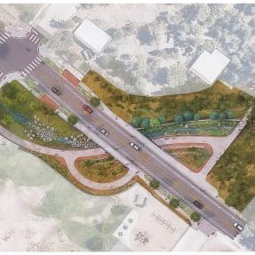
What aesthetic considerations will be part of the design of bridge abutments at new concrete culverts? We are still working through the details of the design of the new concrete culverts. Aesthetic considerations will be addressed as part of this process, and we will provide more information once those details are finalized.
Do property owners have a say in the final design for segments affecting them? At this stage of the design, this is part of the negotiations. We aim to create a consistent appearance, so working with property owners is an important focus. This is a key element of our one-on-one meetings.
How will flood water that exceeds the design capacity be handled? Floodwater exceeding the design capacity is addressed through emergency preparedness. The capacity of Boulder’s 16 drainages varies based on designs for specific events, but extreme events can still occur. That's where preparedness is key. We offer resources on flood and disaster readiness through our city’s website.
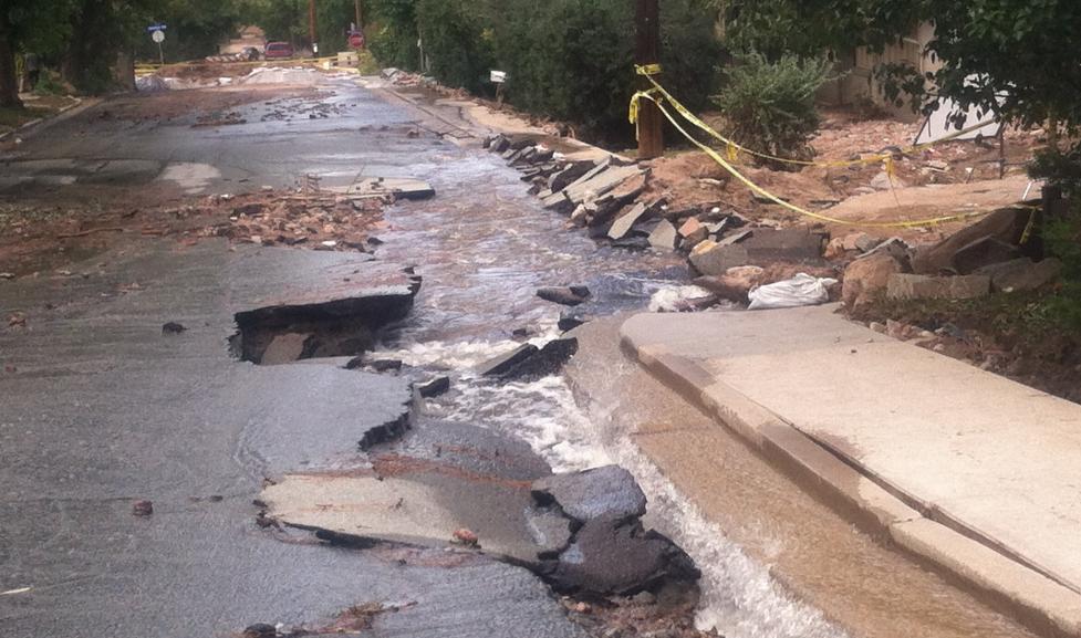
For Gregory Canyon Creek, the current limitation is the culverts, which can handle 150 cubic feet per second (CFS)—equivalent to 150 basketballs passing through per second. For comparison, Boulder Creek’s peak flows reach 500-700 CFS during spring runoff. After Phase I, Gregory Canyon Creek will handle just under 600 CFS, nearly four times its current capacity. While extreme flooding may still exceed the channel's capacity, these enhancements will significantly reduce flooding impacts compared to what would have occurred without the improvements.
What is the flow rate in CFS of a 25-year event? The design flow is around 570 or just under 600 CFS.
Are you planning to underground utilities? We’re not at that level of detail yet. We’re working through our utility relocations.
Are you planning to add a bike path along the creek? No, I don’t see that as a possibility.
What is happening at the viewpoint of the trail and Anderson Ditch?
We are currently working through the design for this area. There is a crossing between Gregory Canyon Creek and Anderson Ditch, and we will collaborate with the ditch company throughout the process. We will ensure that construction in this area does not impact the ditch's operation, particularly during its active season. Any construction will be timed appropriately to avoid interfering with the ditch’s function. This area is part of the ongoing design effort.
How many trees will the project remove? Will this be like other projects where a lot of trees are removed?
Tree impacts are unfortunately a reality on all of our flood mitigation projects. However, we are working diligently to minimize tree removal as much as possible while still accommodating the project’s design and flow requirements. We are very conscious of this and will continue to prioritize minimizing tree impacts throughout the project. While we don’t have an exact tree count yet, that information will be finalized in the final design. Tree removal will be discussed with property owners who may be directly affected.