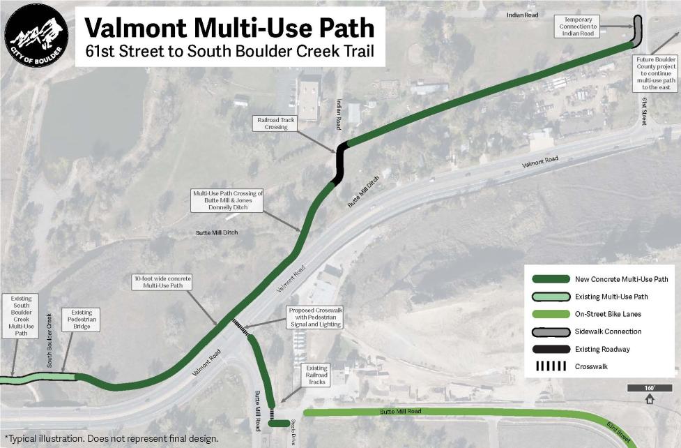
Current Phase
Build

Project Overview

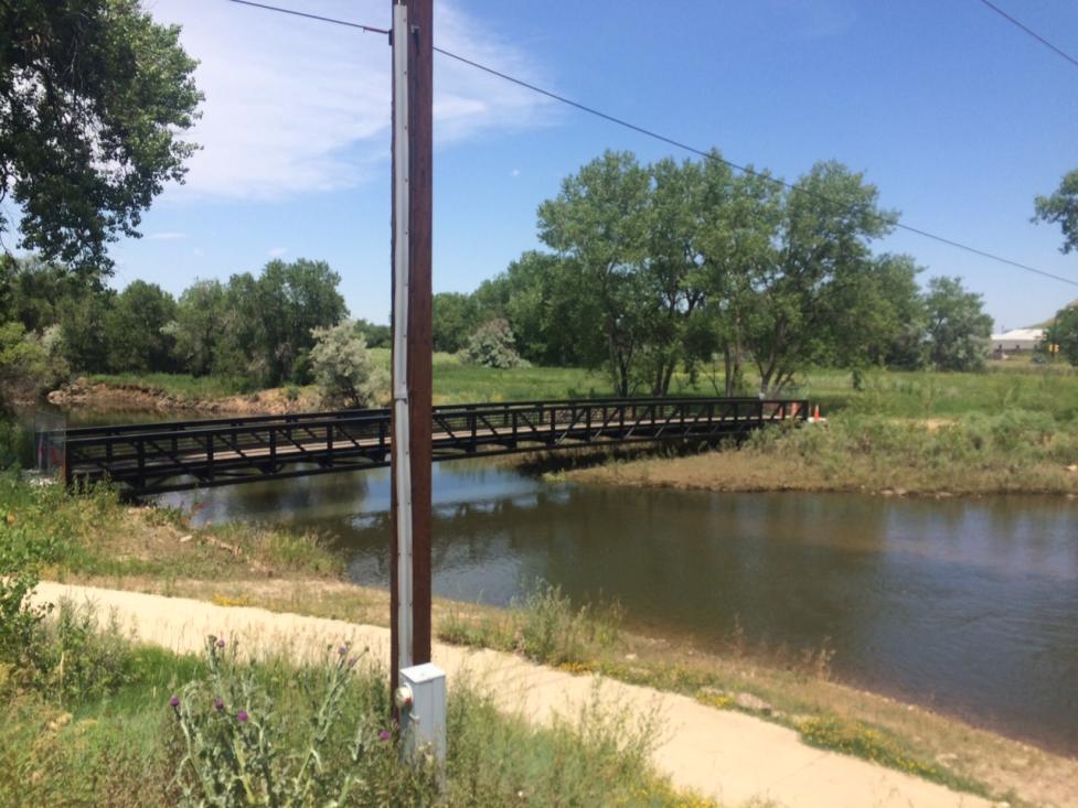
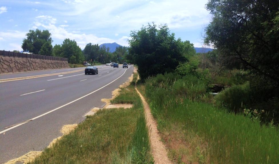
The city will build a new multi-use path near Valmont Road to provide an off-street connection from 61st Street to the existing pedestrian bridge and multi-use path at South Boulder Creek.

Project Map

An aerial image of Valmont Road between South Boulder Creek to the west and 61st Street to the east. The Valmont multi-use path connects the existing South Boulder Creek multi-use path and pedestrian bridge over South Boulder Creek to Indian Road along the north side of Valmont Road, crosses Indian Road, and follows the RTD railroad track alignment east to 61st Street. A temporary sidewalk connection will bring the multi-use path north to Indian Road. There is a future Boulder County project that will continue the multi-use path to the east across 61st Street. Another section of the path connects Stazio Drive to Valmont Road and the new multi-use path along Butte Mill Road.

The 10-foot-wide concrete path will include a crosswalk on the east side of the Valmont Road and Butte Mill intersection to connect the path to on-street bike lanes on 63rd Street. The multi-use path will be built on or near the property of Boulder County, city open space north of Valmont Road, and the Regional Transit District (RTD)’s existing rail tracks.

Project Timeline

We consulted stakeholders including RTD, Boulder County, and owners of adjacent properties between 2017-2020 and created a proposed conceptual project design through collaboration with our partners. Agreements with RTD about the project were finalized in early 2020.

Since then, we have refined and completed the final designs.

Construction is anticipated to begin in summer 2024, pending weather and contractor availability. View construction and traffic updates on Cone Zones.

Dirt path near South Boulder Creek bridge

A dirt path near South Boulder Creek bridge before constructing the Valmont Creek multi-use path.

Project Background

The Valmont Road multi-use path is one of three multimodal connections identified as key missing links between Gunbarrel and Boulder. Together, these Confluence Area Multi-Use Paths will complete missing links identified in the 1980s in the city’s Transportation Master Plan and will provide improved biking and walking connections for community members in Boulder.