*Featured image is a conceptual rendering, does not represent final design.
Projects will help mitigate potential future flooding and improve travel connections; expect lane closures beginning this March
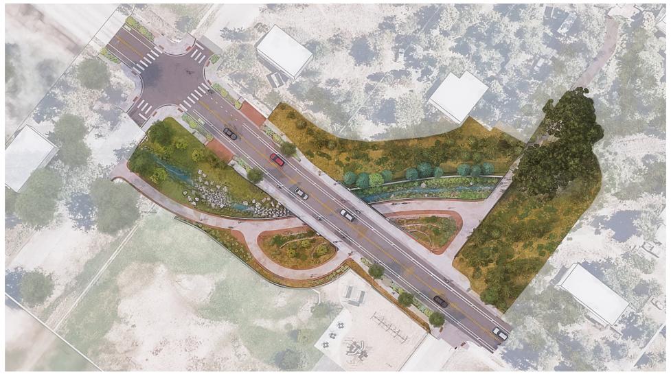
Conceptual rendering; does not represent final design.
Aisha Ozaslan, Media Relations, 303-501-3218
Angela Urrego, Media Relations, 720-325-4923
bouldercolorado.gov
The City of Boulder has begun construction on the 19th Street and Fourmile Canyon Creek Underpass Project, the first of two projects along 19th Street in north Boulder, to improve flood mitigation and multimodal transportation for all travelers.
Between Sumac and Upland avenues, travelers can currently expect periodic delays and flaggers guiding traffic in areas where the city has begun preparatory work for underpass construction. Later, travelers can expect long-term traffic impacts due to lane closures on 19th Street between Sumac and Upland avenues, anticipated to last for two years beginning on March 25, 2024:
View the project detour map for travel impacts to RTD transit, driving, biking and walking, and visit the city’s Cone Zones map for updates on traffic impacts.
Along with flood mitigation, this project will improve travel on 19th Street, an important multimodal connection in north Boulder. The city will construct a new bicycle and pedestrian underpass connecting Tamarack Avenue to Upland Avenue; replace and widen the 19th Street bridge over Fourmile Canyon Creek; improve transit stops; upgrade the on-street bikeable shoulder to a buffered bike lane; construct a new sidewalk; and install curb and gutter.
This project is the result of over a decade of work, including a Community and Environmental Assessment Process (CEAP) reviewed and recommended by boards and council. The CEAP provides the opportunity to assess a project design in consideration of community goals, city policies and plans, including the Boulder Valley Comprehensive Plan, and environmental, social and fiscal impacts. This project is funded by the city Utilities Department Stormwater Fund, Community, Culture, Resilience and Safety Tax, and Mile High Flood District.
This is the first of two projects along 19th Street. The second project will begin in summer 2024 to construct additional transportation improvements, with detours and impacts to be announced later this year. Learn more on the 19th Street Improvements webpage.