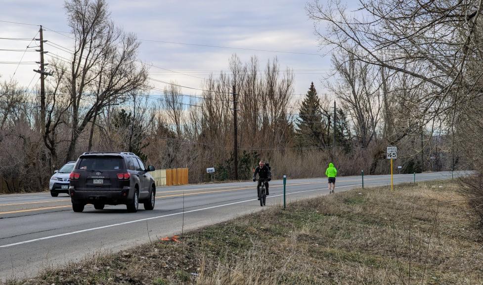
This project will extend the multi-use path on the west side of US 36/28th Street between Fourmile Canyon Creek and Jay Road. The new path will support safe, convenient travel options for people walking, biking and taking transit by filling an important missing connection to local parks, schools, neighborhoods and other popular destinations in north Boulder.

Project Overview

The project will:

  • Build a 10- to 12-foot-wide paved path as a safe and separated connection for people walking and biking.

  • Complete a major missing link and connection for local and regional travel between existing off-street walking and bicycling facilities, including the Fourmile Canyon Creek multi-use path and the southern sections of the US 36/28th Street multi-use path

  • Create direct access to local and regional transit routes, such as the Flatiron Flyer between Boulder and Denver and the RTD BOLT between Boulder and Longmont. The community has identified their interest and need for a continuous pedestrian and bicycle facility and improved connectivity from North Boulder to future CO 119 Bus Rapid Transit, the Flatiron Flyer, and Boulder Junction.

  • Install signage and wayfinding to help people navigate to popular destinations.
  • Improve the storm sewer system.

The path will be built on the west side of US-36 from the Fourmile Canyon Creek bridge to the existing sidewalk on Jay Road.
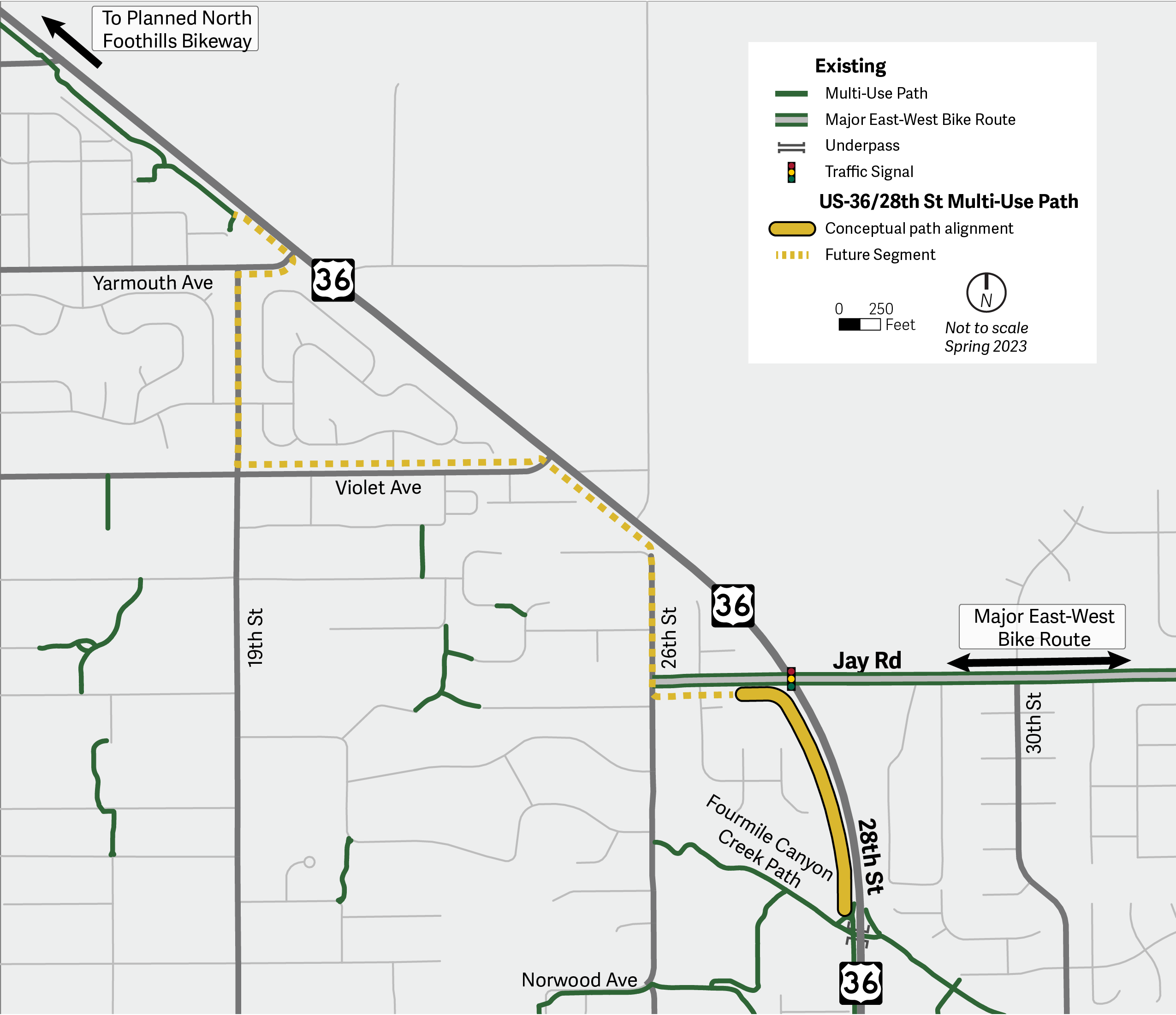
US 36 28th Street Context Map; street limits on project webpage

Why build a path?

Today, the roadway is not comfortable to walk or ride along, given that there is one 12-foot travel lane and an eight-foot shoulder in each direction, a high motor vehicle volume of approximately 18,000 vehicles per day and a posted speed of 45 mph. Combined, these factors limit accessibility for bicyclists or pedestrians and increase the potential for severe crashes to occur.

Community support for the project was affirmed by public input received when the project was being considered for the CDOT Transportation Alternatives Program grant application. Respondents to an online questionnaire expressed strong support for extending the 28th Street multi-use path north to provide neighborhoods a safe north-south bicycle and pedestrian connection.

Timeline

Anticipated timeline; dates may change.

  • 2022: Community engagement.
  • 2023: City awarded state funds to continue planning and design work.
  • 2024-2026: Design advances.
  • 2026-2027: Localized community outreach to gather feedback on draft concepts.
  • 2027 or later: Construction is anticipated to begin in 2027 at the earliest.

Community Involvement

Close collaboration with the nearby neighborhood and multi-use path travelers has been critical to understanding the community's needs and concerns. Community engagement through design and construction will build on earlier engagement during the state grant application process in 2022.

Feedback, along with transportation data analysis and professional best practices, will help advance the design from the high-level grant application design to a detailed design, with construction beginning as early as fall 2027.

The City of Boulder is committed to transparent, inclusive and equitable community engagement. This project will primarily inform the community per the city’s Engagement Strategic Framework.

decorative graphic

FAQ

The Colorado Department of Transportation (CDOT) awarded the City of Boulder $936,000 to extend the multi-use path on US 36/28th Street from Fourmile Canyon Creek to Jay Road Federal funds are allocated under the 2024-2026 funding period of the CDOT Transportation Alternatives Program (TAP), which awards grants to projects that expand travel choice, strengthen the local economy, improve quality of life and protect the environment. The city will contribute $234,000 toward the $1,170,000 total project, as part of the city's Capital Improvements Program.

While we’ve heard from the community that crossing Jay Road at the north end of the project area feels unsafe and uncomfortable, this intersection is in the jurisdiction of Boulder County and is not included in the project scope.

Background and Plans Guiding this Project

By building a more comfortable and connected network for people to travel, the city aims to achieve its transportation goals to be safe, be equitable, provide travel choices and support clean air. Learn more:

The Boulder Valley Comprehensive Plan seeks to protect the natural environment of the Boulder Valley while fostering a livable, vibrant and sustainable community. The plan provides an overview of the community’s desires for future development and preservation of the Boulder Valley. The city and county use it to guide long-range planning.

A connected walking and bicycling network provides a safe and comfortable transportation experience, enabling people of all ages and abilities to get where they want to go by foot or bike.

The Boulder Valley Comprehensive Plan describes the city’s core values, principles and policies to be implemented across Boulder. How these initiatives get applied to areas throughout Boulder is dependent on localized conditions of the built and natural environments as well as the motivations and desires of residents, land and business owners. Dividing the city into subcommunities creates more focused areas of study and provides a framework for managing change and implementing policy.

US 36/28th Street is identified by DRCOG as both a corridor on the DRCOG High Injury Network and an Active Transportation Corridor. DRCOG’s High-Injury Network identifies the roads where the majority of serious injury and fatal crashes occur — 9% of roads in the region.

This path will complete a segment of the Rocky Mountain Greenway regional trail system.

The Safe Streets Report provides an overview of the City of Boulder's efforts to continuously improve transportation safety by measuring traffic crash data and identifying trends in crashes. The 2023-2027 Vision Zero Action Plan (VZAP) is a companion to the Safe Streets Report, and identifies additional strategies the city can take to reduce fatal and severe crashes.

Boulder's transportation vision is to create a safe, accessible and sustainable multimodal transportation system that connects people with each other and where they want to go. Its goal is to be safe, be equitable, be reliable, provide travel choices and support clean air and our climate commitment.

decorative graphic

Accessibility Statement

The City of Boulder is committed to digital accessibility. Some content may not be fully accessible due to technical limitations or issues. For alternate formats or accommodations, please visit Accessibility | City of Boulder or contact accessibility@bouldercolorado.gov.