This is one of several City of Boulder projects to improve multimodal transportation — walking, biking, driving and taking the bus — on streets identified in the 30th and Colorado Corridors Study.
Community Engagement
Plan
Build
Complete
Paragraph jump menu
Jump To
Completion Date
2025
Current Phase
Build
Project Overview
This project will improve 30th Street between Colorado and Arapahoe avenues. The improvements include adding protected bike lanes, wider sidewalks and new landscaping for safer, more comfortable and more convenient travel experience.
Construction and travel impacts
More information
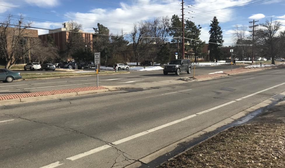
Travelers can expect periodic delays and flaggers guiding traffic; impacts to the vehicle lanes, with single lane closures as needed; RTD Bound stop impacts; and detours for people walking and biking. Community members can continue to access nearby neighborhoods, businesses and Scott Carpenter Park throughout construction. View the city’s Cone Zones map for updates on traffic impacts.
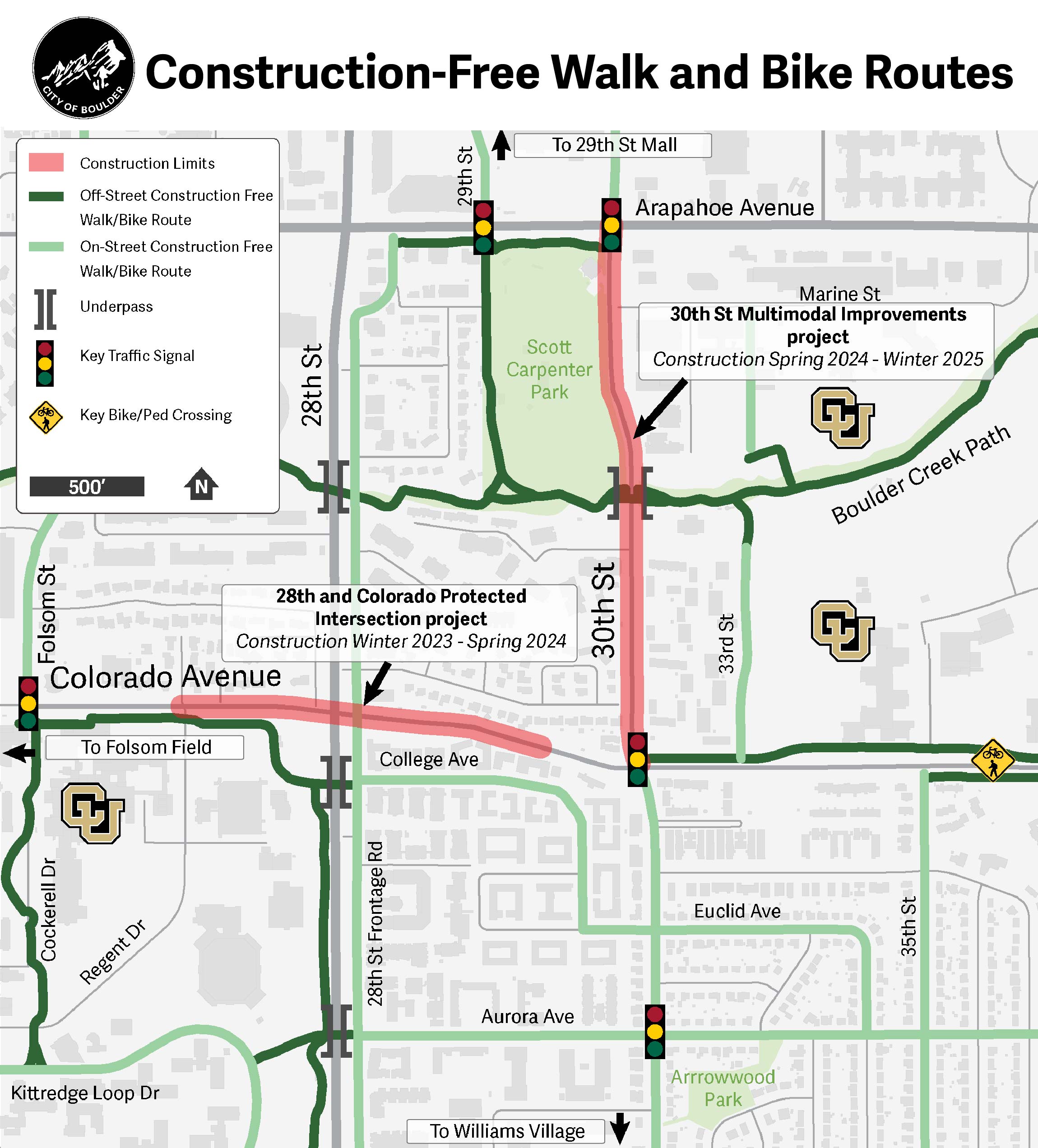
A map of construction-free routes. On-street and off-street walk/bike construction-free routes extend on existing on-street bike infrastructure, multi-use paths and sidewalks outside of the construction limits: 30th Street from Arapahoe Avenue to Colorado Avenue and Colorado Avenue from Regent Drive to just west of 30th Street.
Summer 2022 Info Session
A virtual information session was held on July 20th, 2022 to share more about the transportation projects being constructed as part of the 30th and Colorado Corridors Study. A recording of the information session can be found above. The information session covered the following projects:
The focus on the project is adding raised, separated bike lanes along 30th Street between Arapahoe Avenue and Colorado Avenue.
The project will also include wider sidewalks, and landscaping.
The project will also provide access at bus stops on 30th Street.
The facilities will connect to the new 30th Street and Colorado Avenue underpass and protected intersection, and the Boulder Creek Multi‐Use Path south of Scott Carpenter Park.
Project Background
We identified this corridor in partnership with CU Boulder for multimodal safety improvements after an extensive community engagement process for the 30th and Colorado Corridors Study. This study looked at existing and future travel conditions and the need to identify transportation projects to improve travel and safety for all transportation modes along the 30th Street and Colorado Avenue corridors. The study began in 2017 and following community engagement was approved by City Council in 2019.
This project location was among the areas with the highest number of crashes identified in the Safe Streets Report. All the projects recommended in the study will help Boulder build out its protected bike lane network for a safer and better-connected bike network around town. Improvements support the Vision Zero Action Plan to eliminate severe crashes.
Improvements to the area are also an important part of the city’s Core Arterial Network (CAN)— Boulder’s connected system of multimodal transportation improvements along the city’s main corridors that will help reduce the potential for severe crashes and make it more comfortable and convenient for people to get where they need to go.
This project is funded by the city and partners, including the Federal Highway Administration, the Colorado Department of Transportation, and CU Boulder.