Regulated Floodplains

A floodplain is an area that is at risk for flooding. Building or performing work on a structure in a floodplain has special requirements to help keep everyone safe.

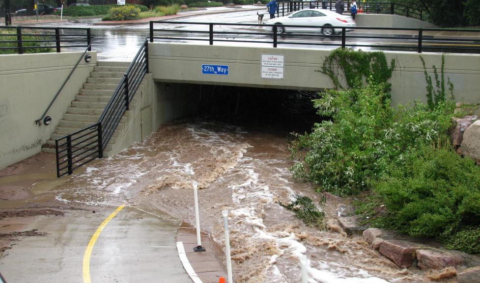
The City of Boulder's floodplain regulations are designed to reduce risk to life and property in areas along the 16 major drainageways within the city limits. The regulated floodplain currently covers about 15% of Boulder including over 2,500 individual structures.

The City of Boulder regulates development based upon FEMA Flood Insurance Rate Maps of the 1% Annual Chance Storm (aka the 100-year floodplain). Property owners of buildings with any portion of the structure (including roof overhang, gutters, footings, decks, balconies, etc.) encroaching into the 100-year floodplain are required to obtain a Floodplain Development Permit before expanding a building or constructing any improvements.

Outside of flood zones, please review information about Stream, Wetland, and Water Body Permits for more information about construction in those areas.

You can also review Boulder's municipal code regulations for floodplains.
Get Floodplain Information for a Property

Is your property in the floodplain?

Request documentation

  • To get formal documentation from city staff about the floodplain designation of your property (usually required by insurance providers) apply for a Floodplain Information Request through the Customer Self-Service Portal.

Search for an Elevation Certificate

Elevation Certificate search

  • Check to see if your property has an Elevation Certificate on file with the city's building department by going to the Elevation Certificate Dashboard.
  • If the map does not display an Elevation Certificate for your property, the City does not have one on file.

Look up your property

  • You can search by address using the search box on the map, or you can narrow your search by using the filters or zooming in or out of the map.

Get a new Elevation Certificate

  • If you need to acquire a new Elevation Certificate, please note that your Elevation Certificate must be prepared and certified by a Licensed Land Surveyor or Licensed Professional Engineer.
  • Typically, these certificates cost approximately $1,000 and take 1-2 weeks to complete.

Remove a Property from the Floodplain

Letter of Map Amendment & Elevation Certificate

  • Hire a licensed land surveyor to check if your property qualifies for a Letter of Map Amendment (LOMA) which will remove it from the floodplain.
  • Hire a licensed land surveyor to complete a FEMA Elevation Certificate. Typical cost is approximately $1,000 and it takes 1-2 weeks to complete.
  • Your property may have a Letter of Map Amendment (LOMA) through FEMA which, effectively, removes it from the floodplain and some flood requirements. Please use our LOMA Dashboard to search the map and find out if your property has an existing LOMA. If the map does not display a LOMA for your property, then FEMA does not have one on file.

Elevated and Incorrectly Mapped Properties

  • A request can be made to remove your property from the floodplain if your structure is elevated or if a property was incorrectly mapped.
  • It should be noted that, although Boulder’s floodplain mitigation and regulation is aligned with a 100-year flood, that doesn’t mean flooding can’t happen outside of the floodplain at any time.

Submit

  • Submit your elevation certificate and LOMA application directly to FEMA

Apply for a Floodplain Development Permit

Find an application form

Supporting materials

If you are applying for any building or development permits within a flood zone, providing an Elevation Certificate or LOMA can help expedite the process. If you find an Elevation Certificate or LOMA on the dashboards, please download and include it with your application materials.

Submit by email

  • Check the electronic submittal requirements outlined in Online Development Review Application Guide.
  • Email your properly formatted files to PDSskipatrip@bouldercolorado.gov.
  • The project specialist team reviews applications in the order in which they are received. Additional information may be requested from you after your application is received if the application form is incomplete and/or the project scope is not clearly defined.

What happens next

  • A project specialist will create an EnerGov case and contact you through the system with instructions for uploading digital files through the “Attachments” tab in the CSS portal. The email will come from a noreply email address, please check your spam/junk box if you do not receive an email within the processing time frame.
  • You will also see an invoice for the plan check or permit fee on the CSS portal (if applicable). A complete application package and payment of the plan check/ permit fee will be required prior to routing the application for review.