On Pearl Street between 30th and Folsom streets, travelers can also expect weekday nighttime work between 6 p.m. and 6 a.m.Community members living and working in the area may experience impacts from noise, lights, dust and vibrations from heavy machinery. The city apologizes for the disruption and will minimize impacts wherever possible. Nighttime work is required to reduce impacts on this high-traffic street and speed up construction completion.
2026 pavement maintenance
We're working on regularly scheduled pavement maintenance. These repaving efforts may be paired with small-scale mobility enhancements as a cost-effective way to improve safety for all travelers. Check Cone Zones for traffic impacts.
The Pavement Management Program (PMP) inspects and rates all 300 miles of the city's streets on a three-year interval to understand existing conditions and guide when and where to repair the pavement.
Pavement management typically begins with curb and gutter repair work, and curb access ramp upgrades compliant with the Americans with Disabilities Act (ADA). Depending on the street, the city may also complete new road striping or other bicycle, pedestrian and transit upgrades.
The program is funded by the city's Transportation Fund, which is mainly supported by Sales & Use Taxes.
Paragraph jump menu
Jump To
Pavement work may be paired with small-scale mobility enhancements as a cost-effective way to improve safety for all travelers.
For current information about traffic and parking impacts during pavement work, view the Cone Zones map.
You will receive a notice about a week in advance of work on your street.
If you will be out of town during scheduled work, do not park your car on the street.
During repaving activities, travel with caution to keep yourself, neighbors and work crews safe.
Schedules are subject to change due to weather impacts and contractor availability.
Please watch for No Parking signs on-site for the most up-to-date information.
Work in the public right of way requires a permit. If any scheduled home improvements may impact the street, please contact us at 303-441-3200 to coordinate the work.
Program Map
View proposed streets on the program map. Proposed streets and treatments may change.
Curb and gutter repairs and curb ramp upgrades to comply with the Americans with Disabilities Act (ADA) occurred in fall 2025 through spring 2026. Repaving and other enhancements will occur May through August 2026, as consistent warm temperatures support construction.
Types of Pavement Treatments
From spring through fall, the program repairs prioritized streets with different types of pavement treatments, or preservation and rehabilitation maintenance, depending on the current condition of the street. Click the treatment types below for more information.
Cracks in the pavement are sealed to prevent moisture from entering the base and sub-base of a roadway, reducing the likelihood of pavement failures and potholes and extending the pavement life.
This is the most cost-effective treatment for preserving and extending pavement lifespan.
Asphalt rejuvenation is used on streets to restore the original pavement properties that degrade over time from oxidation and weathering. The rejuvenation process happens in three steps:
An oil-based emulsion is sprayed onto the street.
A layer of washed sand is applied on top of the emulsion to minimize tracking of the emulsion onto nearby surfaces during the 24-hour curing process.
The street is then swept the next day to remove the sand.
In response to questions from the community regarding the asphalt rejuvenation program, staff will be providing more advanced notice and additional signage before future treatments begin. View the Asphalt Rejuvenation FAQs for more information.
Chip sealing is a surface application used to prolong the life of an existing street by applying a liquid asphalt membrane binder (“seal”) and a layer of small crushed stone (“chip”) over the existing street surface. Chip sealing typically extends the useful life of the existing pavement by 8 to 12 years and is typically used on residential or lower-volume streets.
Streets that receive a chip seal typically require asphalt and curb and gutter repair in preparation for the actual chip seal application. The chip seal process does not significantly impact traffic but does require that parking be removed from the street while the work is being completed. The chip seal process typically takes two to three days. Typically, one to two days later, a thin layer of liquid asphalt “fog coat” is applied on top of the stone chips to provide further sealing of the pavement. The final step is sweeping the streets to remove any remaining chips that have come loose during the process.
Slurry sealing is a cost-effective pavement preservation treatment that consists of a mixture of finely crushed aggregate, asphalt emulsion, water and additives. It is applied as a thin, uniform layer over existing pavement to restore surface texture, seal minor cracks, and protect against oxidation and moisture infiltration. Slurry seal provides a smoother, more aesthetically pleasing finish and is well-suited for residential streets, low-traffic roads and urban areas.
Asphalt resurfacing, or overlays, are used on higher-volume roads or lower-volume streets that have deteriorated to a point that a chip seal or other pavement preservation treatments are no longer effective. An overlay typically requires some level of removing the existing surface by grinding, either along the edge or the full width of the street, depending on the condition of the street.
The overlay process generally occurs in several phases:
Removal and replacement of deteriorated curbs and gutters, as well as reconstruction of selected sidewalk ramps to comply with Americans with Disabilities Act (ADA) criteria.
Two or more inches of the existing pavement section is removed through the roadway milling process.
After the removal is completed and the roughened surface is thoroughly cleaned, a fresh layer of asphalt is laid down through the paving process.
The overlay process at times may include a phase to remove and patch some areas of the street that have extensive wear or damage beyond the surface of the pavement. The existing asphalt pavement and subgrade are removed from the roadway and then reconstructed with six to eight inches of new asphalt pavement.
At times, streets deteriorate to a point that requires total reconstruction of the pavement structure. Streets requiring reconstruction will typically require similar steps as an overlay, beginning with pedestrian ramp and curb and gutter repair. Then, the existing pavement and sub-grade are removed, and the roadway is reconstructed with six to eight inches of new asphalt.
Mobility Enhancements Initiative
Slideshow
1 of 8
2 of 8
3 of 8
4 of 8
5 of 8
6 of 8
7 of 8
8 of 8
1 of 8
2 of 8
3 of 8
4 of 8
5 of 8
6 of 8
7 of 8
8 of 8
The Mobility Enhancements Initiative is part of the Pavement Management Program. This initiative takes advantage of cost-saving opportunities by incorporating bicycle, pedestrian and transit facility improvements into annual pavement resurfacing work to help make our streets safer for everyone. Improvements are typically small in scale and vary by street.
Learn more about the improvements considered in the Mobility Enhancements Toolkit below.
Improved Crosswalks
New or improved crosswalks can increase the safety of people walking or rolling across the street. Informed by the city’s pedestrian crossing guidelines, examples considered for mobility enhancements include:
New crosswalk striping in locations without a crosswalk.
Adjusting existing crosswalk locations to better provide access to community destinations and serve nearby community members.
Bike Lane Striping and Pavement Markings
Bike lane striping and pavement markings can increase the safety of bicyclists and other street users by providing a designated space for bicyclists and increasing the visibility of bicyclists. Examples considered for mobility enhancements include:
Adding bike lane striping in places where it does not currently exist.
Changing existing bike lane striping to widen the bike lane, adding vertical separation between bike and vehicle lanes, and/or adding a bike lane buffer, which is space between bike and vehicle lanes.
Updating areas where people driving and bicycling interact near intersections, called mixing zones, to meet current city standards.
Adding pavement markings such as green bike markings, bike boxes and/or two-stage turn queue boxes.
Two-stage turn boxes provide a way for people biking to wait outside of the vehicle lane and crosswalk when making a left turn from the right lane. Learn about Boulder's first two-stage turn box or watch the video to see it in action.
Traffic Calming
Traffic calming tools reduce vehicle speeds and increase safety for all street users, particularly on streets where people driving tend to travel above the posted speed limit. Examples of traffic calming tools considered for mobility enhancements include:
Speed humps or cushions.
Median islands.
Curb extensions.
Removing centerline striping.
Narrowed or repurposed vehicle lanes. Vehicle lane repurposing can reduce prevailing speeds by up to 5 mph, and the friction from vertical bike lane separation can reduce speeds by an additional 2 mph. This lessens the severity of crashes if they do occur for all road users by moderating vehicle speeds. Repurposing lanes also reduces the number of lanes people walking and biking have to cross, which lowers the potential for a common type of crash identified in the Vision Zero Action Plan – collisions between vehicles and pedestrians/bicyclists crossing the street.
Signage
Signage improves safety and provides clear wayfinding and navigation for everyone traveling on the street.
Intersection Improvements
Intersection improvements increase safety for travelers of all modes by making it easier for people walking, biking, and rolling to see and be seen by drivers, separating travel modes in both time and space, and providing predictable spaces for people using different travel modes. Examples of intersection improvements considered for mobility enhancements include:
Protected intersection elements, including corner islands that extend separated or protected bike lanes to the intersection, increase space between the vehicle lane and bike lane, and create more visibility for people walking, biking, and rolling. Corner islands can be constructed with concrete or temporary materials.
Minor traffic signal upgrades that separate travel modes in time.
Dedicated paths for bicyclists and pedestrians through intersections.
Transit Improvements
Transit improvements increase the speed and reliability of transit, reduce conflicts between buses and users of other travel modes, and improve comfort for people using transit. Examples of transit improvements considered for mobility enhancements include:
Bus lanes, which are dedicated to transit vehicles to help increase reliability and safety, but can also be used by right-turning vehicles. Bus lanes are marked in red, making it easier for all travelers to see where to go.
Bus stop upgrades, including ADA-accessibility improvements and floating bus stops. Floating bus stops include a boarding island, which is a dedicated space to wait for, get on, and get off the bus, and allow buses to stop in-lane, improving transit speed and reliability. These bus stops also reduce conflicts between buses and people riding bikes and between transit users and bicyclists by placing the bike lane behind the boarding island, enhancing safety for bicyclists and improving transit reliability.
2026 Mobility Enhancement Initiative Streets
Mobility enhancements on 20th Street include:
Restriping vehicle and bike lanes. Vehicle lanes will be slightly narrowed, and the centerline will not be restriped after paving – two safety designs that reduce vehicle speeds. Bike lanes will be upgraded to buffered bike lanes where space allows, implementing the recommendation from the Low-Stress Walk and Bike Network Plan.
Improving the 20th Street/Walnut Street intersection. We modified the existing curb extensions to maintain the width of the bike lanes on Walnut Street through the intersection. Curb ramps were also upgraded to ADA compliance.
Adjusting the approaches of the 20th Street/Bluff Street traffic circle to clarify bicycle and vehicle movements and improve safety for all users.
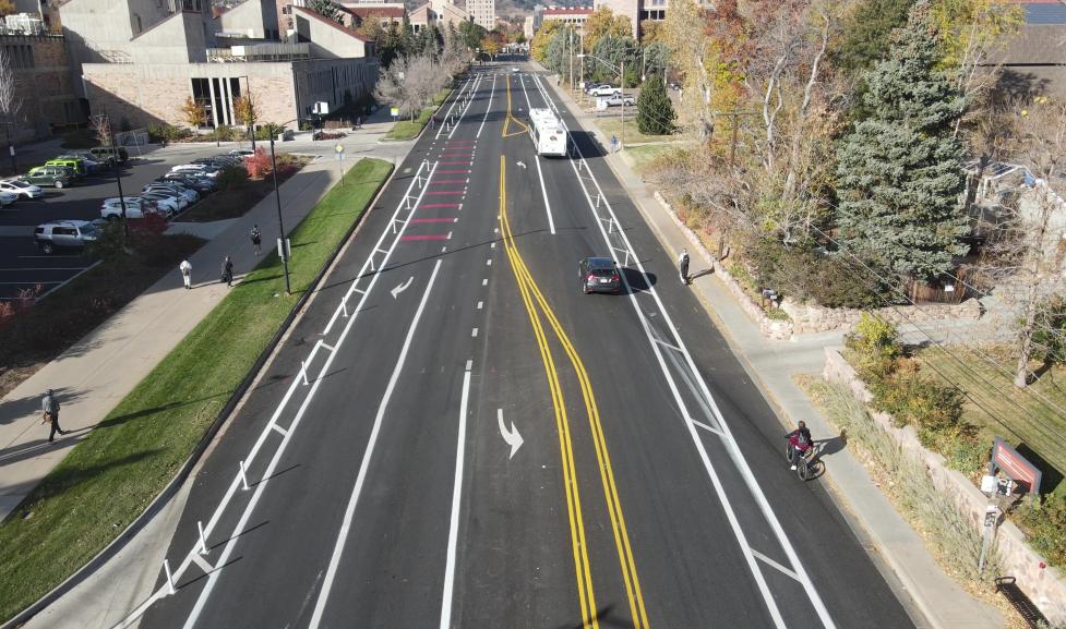
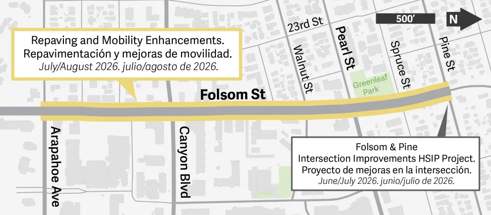
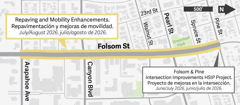
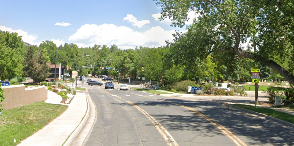
The pavement quality on Folsom Street between Arapahoe Avenue and Pine Street has significantly deteriorated. The street must be repaved in 2026 to avoid costly and time-intensive street reconstruction in the future. Repaving will begin mid-July 2026 and take approximately 2 weeks to complete. As part of this routine maintenance work, the Pavement Management Program Mobility Enhancements Initiative is installing near-term safety enhancements. Coordinating these efforts is a cost-effective and efficient way to deliver immediate, smaller-scale safety upgrades during routine maintenance efforts.
This work is being coordinated with the Highway Safety Improvement Program (HSIP) project at Folsom and Pine streets, which is constructing intersection improvements in July/August. While near-term safety enhancements are informed by community engagement from the Folsom Street Safety Improvements Project, this work is a separate effort. Once additional funding is secured for the corridor project, the recommended improvements will proceed to final design and construction in the coming years.
Mobility enhancements on Folsom Street include:
Restriping vehicle and bike lanes. Vehicle lanes will be slightly narrowed, a safety design that reduces vehicle speeds. Bike lanes will be widened to a standard 5-foot width minimum.
Installing and refreshing bike boxes on Folsom Street, which includes refreshing the existing southbound bike box and adding a northbound bike box at the Arapahoe Avenue intersection and installing new bike boxes at the Canyon Boulevard and Pearl Street intersections. Bike boxes are designated areas at the front of vehicle lanes at intersections that provide people on bikes with a safe and visible space to wait ahead of queuing traffic.
Implementing No Right Turn on Red at the Arapahoe Avenue, Canyon Boulevard, and Pearl Street intersections in coordination with the installation of bike boxes at these intersections and in alignment with national best practices. This change helps reduce right-turn-on-red crashes and right-turn crashes, two of the most common crash types in our Vision Zero Action Plan.
Lowering the speed limit from 30 to 25 mph between Valmont Road and Colorado Avenue — the recommendation from the city’s separate, but related, Speed Limit Setting and Signing Project.
Installing protected corner islands at all four corners of the Folsom Street and Pine Street intersection and at the northeast and southeast corners of the Folsom Street and Pearl Street intersection. Protected corner islands give bicyclists and pedestrians a safe waiting area at intersections, reduce vehicle turning speeds, and make it easier for bicyclists and pedestrians to see and be seen by drivers.
Converting the outside northbound lane to a right-turn-only lane at Pearl Street. This change eliminates the short northbound vehicle merge that currently occurs north of Spruce Street, directly addressing safety concerns heard duringlast year’s Folsom Street Safety Improvements Project community engagement. It also reduces driver conflicts by separating right-turning vehicles from through-traffic, lowers the number of vehicle lanes pedestrians must cross at Spruce Street, and allows the northbound bike lane between Pearl and Pine streets to be upgraded to a post-separated bike lane, similar to the existing southbound bike lane between Pine and Spruce streets.
Adding curb extensions through pavement striping and flexible delineator posts at the South Street, Goss Street, and Grove Street intersections. Curb extensions slow turning vehicle speeds, increase the visibility of pedestrians, and reduce pedestrian crossing distances.
We will repave Pearl Street between Folsom and 30th streets beginning early July 2026. Work will take approximately 2 weeks to complete.
As part of this routine maintenance work, the Pavement Management Program Mobility Enhancements Initiative is installing near-term safety enhancements. Coordinating these efforts during routine maintenance is a cost-effective and efficient way to deliver immediate, smaller-scale safety upgrades.
Restriping vehicle and bike lanes. Vehicle lanes will be slightly narrowed, a safety design that reduces vehicle speeds. Between 28th and 30th streets, lane striping will be adjusted to improve shopping center access and eastbound travel. Where space allows, bike lanes will be widened, buffered, or post-separated to increase safety and comfort for people bicycling on Pearl Street.
Adding two-stage bike turn boxes on the east and west sides of the Pearl Street and 30th Street intersection. Two-stage bike turn boxes provide a place for northbound and southbound bicyclists to wait to make a left turn onto Pearl Street without having to exit the bike lane and enter the vehicle lane.
Minor improvements to the pedestrian refuge island between 28th and 30th streets were made in spring 2026 to upgrade it to ADA compliance. More significant improvements will be made in the next 5 years as part of a separate project.
When we repaved Colorado Avenue from Folsom Street to 30th Street in 2025, we installed mobility enhancements between Folsom Street and Regent Drive to close a key gap in the low-stress bike network connecting CU Main and East campuses and improve the speed and reliability of Buff Bus transit service. In summer 2026, we will come back to Colorado Avenue to make additional enhancements at the Folsom Street intersection.
Mobility Enhancements are separate from the Folsom Street Safety Improvements Project. Funding and further design are needed before we can construct the improvements recommended in the Folsom Street Safety Improvements Project. Once funding is secured for that project, it will proceed to final design and construction.
Mobility enhancements at the Colorado Avenue and Folsom Street intersection include:
Installing an eastbound floating bus stop on Colorado Avenue just east of the Folsom Street intersection. Floating bus stops improve transit speed and reliability by allowing the bus to stop in the bus lane, instead of pulling to the curb to pick up or drop off passengers. They also improve bicyclist safety by removing conflicts between buses and bicyclists, such as when a bus crosses into the bike lane to stop for passengers at a traditional bus stop. In coordination with the eastbound floating bus stop, CU Boulder will construct a westbound floating bus stop just west of the Colorado Avenue and Folsom Street intersection.
Installing a protected corner island at the northeast corner of the Colorado Avenue and Folsom Street intersection. Corner islands give bicyclists and pedestrians a safe waiting area at intersections, reduce vehicle turning speeds, and make it easier for bicyclists and pedestrians to see and be seen by drivers.
Constructing a bicycle ramp on the south side of the Colorado Avenue and Folsom Street intersection. Currently, bicyclists and pedestrians share the existing pedestrian ramps to cross Colorado Avenue. Adding a dedicated bicycle ramp will reduce conflicts between bicyclists and pedestrians by giving each mode of travel a dedicated ramp.
Past Mobility Enhancement Projects
Most of the 2025 mobility enhancements corridors were proposed Neighborhood GreenStreets — low-traffic streets prioritized for making walking and biking comfortable for people of all ages and abilities. The city uses safety signage, crossings, paint markings and other installations on these streets to reach these goals. In addition to the enhancements described below, proposed Neighborhood GreenStreets may receive additional signage and pavement markings after repaving to help people walking and biking navigate the corridors and increase driver awareness of their presence.
Work took place along:
6th Street (Pearl Street to Baseline Road)
11th Street (Arapahoe Avenue to Grandview Avenue)
Martin Drive (Moorhead Avenue to Table Mesa Drive)
Ash Avenue (Lashley Lane to Moorhead Avenue)
Colorado Avenue (Folsom Street to Regent Drive)
6th Street (Pearl Street to Baseline Road)
Mobility enhancements on 6th Street, a proposed Neighborhood GreenStreet, are located in 4 primary locations. Concrete work was completed in winter 2024-2025/spring 2025, and repaving will follow this summer.
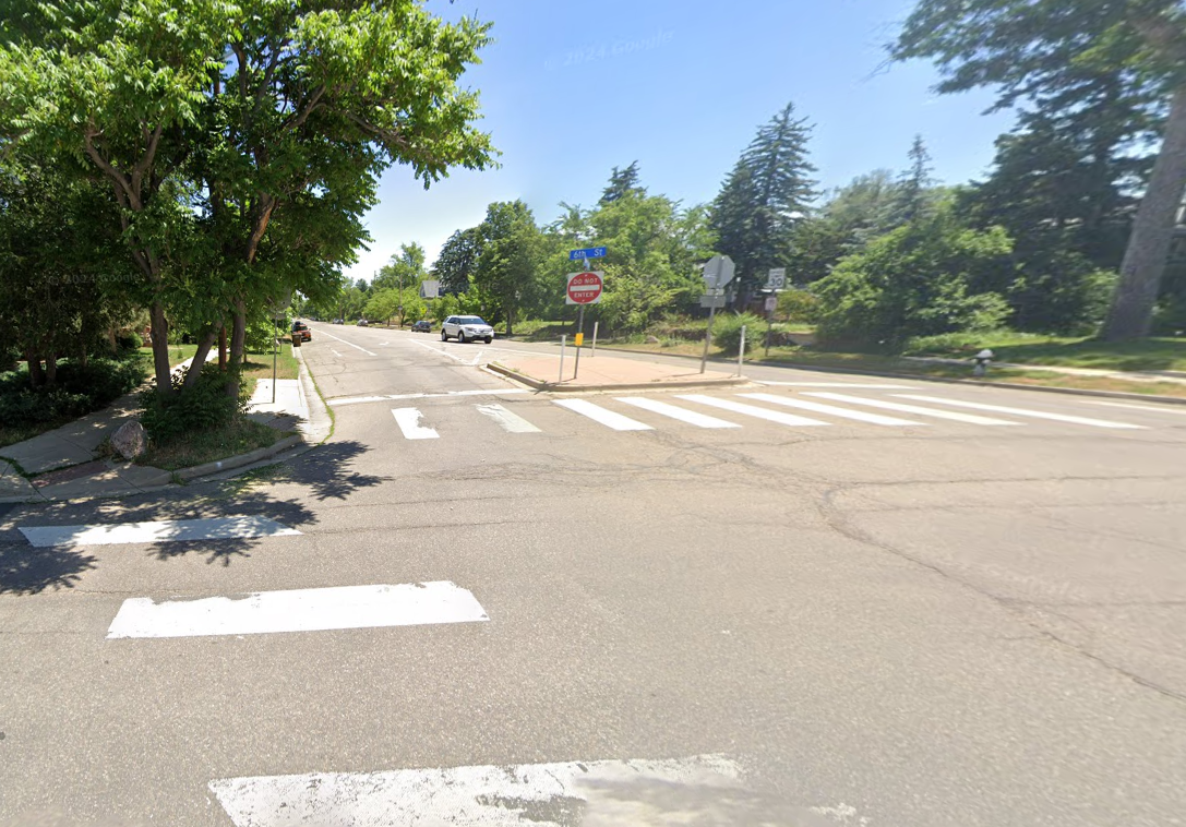
South of Boulder Canyon Drive: We relocated the pedestrian crossing between the Boulder County Justice Center and its parking lot to just south of the parking lot driveway to align with the existing ADA ramp to the Justice Center. We also added a pedestrian refuge island at this crossing to enhance the safety of pedestrians crossing.
Before photo.
After photo.
University Avenue: We added curb extensions and the east-west crosswalk was relocated to shorten pedestrian crossing distances and increase pedestrian visibility.
Before photo.
After photo.
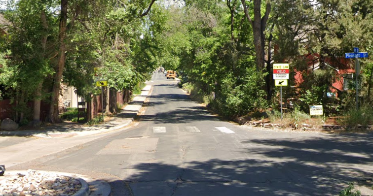
Pleasant Street: We relocated the east-west crosswalk to the south side of the intersection and added a short section of new ADA-compliant sidewalk was constructed on the southeast corner of the intersection. These improvements increase pedestrian visibility and safety, and provide an enhanced route to Flatirons Elementary School.
Before photo.
After photo.
Euclid Street: We decreased the turning radii to slow vehicle speeds and improve visibility through this turn.
Before photo.
After photo.
11th Street (Arapahoe Avenue to Grandview Avenue)
New sidewalks were constructed on 11th Street, a proposed Neighborhood GreenStreet, to close gaps in the important pedestrian corridor between University Hill and Downtown Boulder.
The new sidewalks improve the walking experience along 11th Street, creating a safer and more pleasant alternative to walking along Broadway.
These sidewalks follow the path of new pedestrian-scale lighting we installed on University Hill a few years ago — shorter, visually appealing lights that better illuminate the sidewalk for people walking.
The sidewalks were added just north of Marine Street on the east side and just north of Grandview Avenue on the east side.
To maintain room for vehicle travel lanes with the added sidewalks, we added short No Parking Any Time zones on part of the street, on one side.
Sidewalks were constructed in March 2025 and repaving on 11th Street and other streets in the neighborhood followed in summer 2025.
11th Street north of Grandview Avenue
Before photo of 11th Street north of Grandview Avenue without a sidewalk.
After photo of 11th Street north of Grandview Avenue with a new sidewalk.
11th Street north of Marine Street
Before photo of 11th Street north of Marine Street without a sidewalk.
After photo of 11th Street north of Marine Street with the new sidewalk.
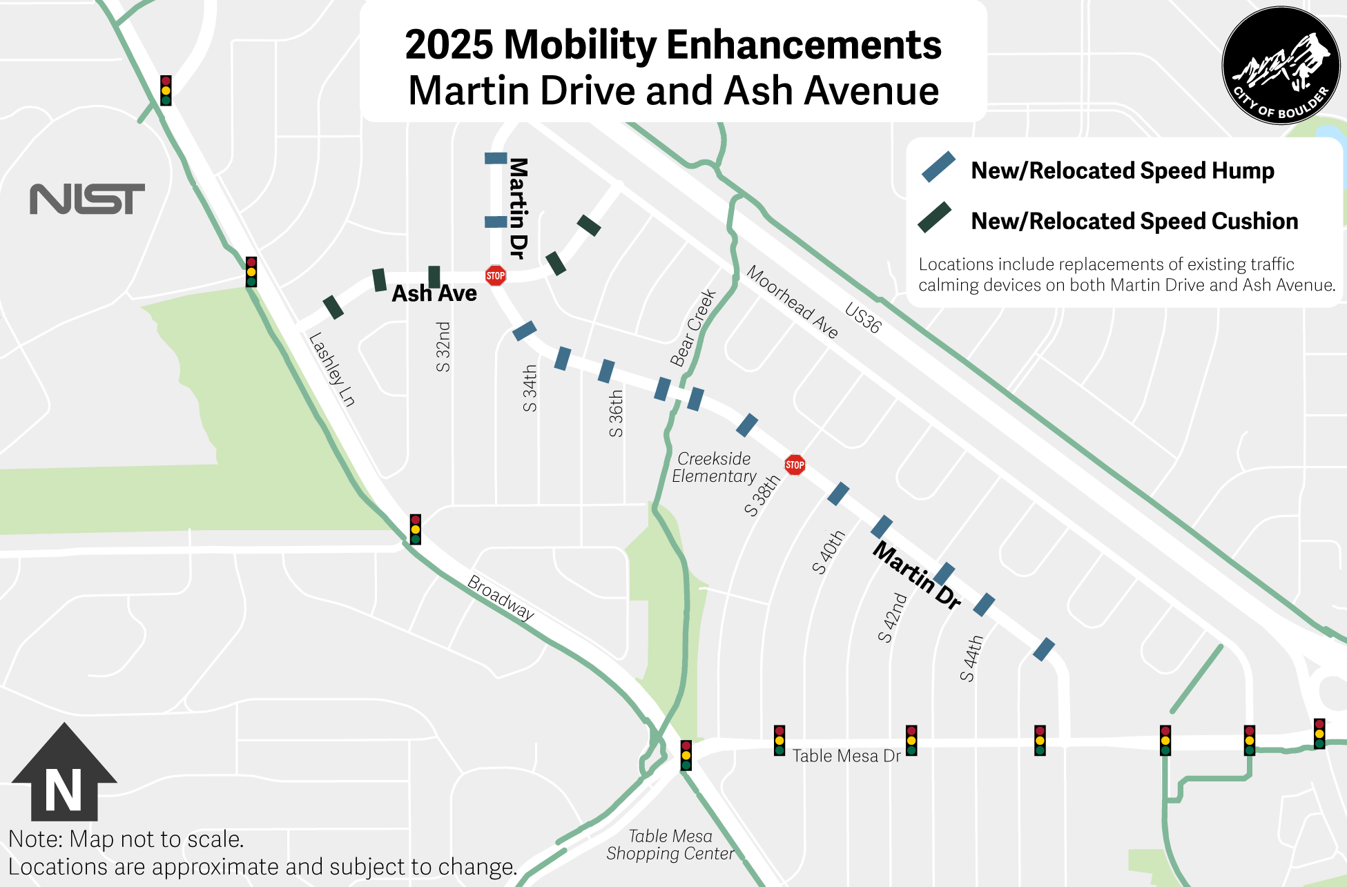
Martin Drive (Moorhead Avenue to Table Mesa Drive)
Concrete work was completed in winter 2024-2025/spring 2025, and repaving was completed in June 2025. Mobility enhancements on Martin Drive, a proposed Neighborhood GreenStreet, were informed by what we heard from the Creekside Elementary School community in fall 2024 and include:
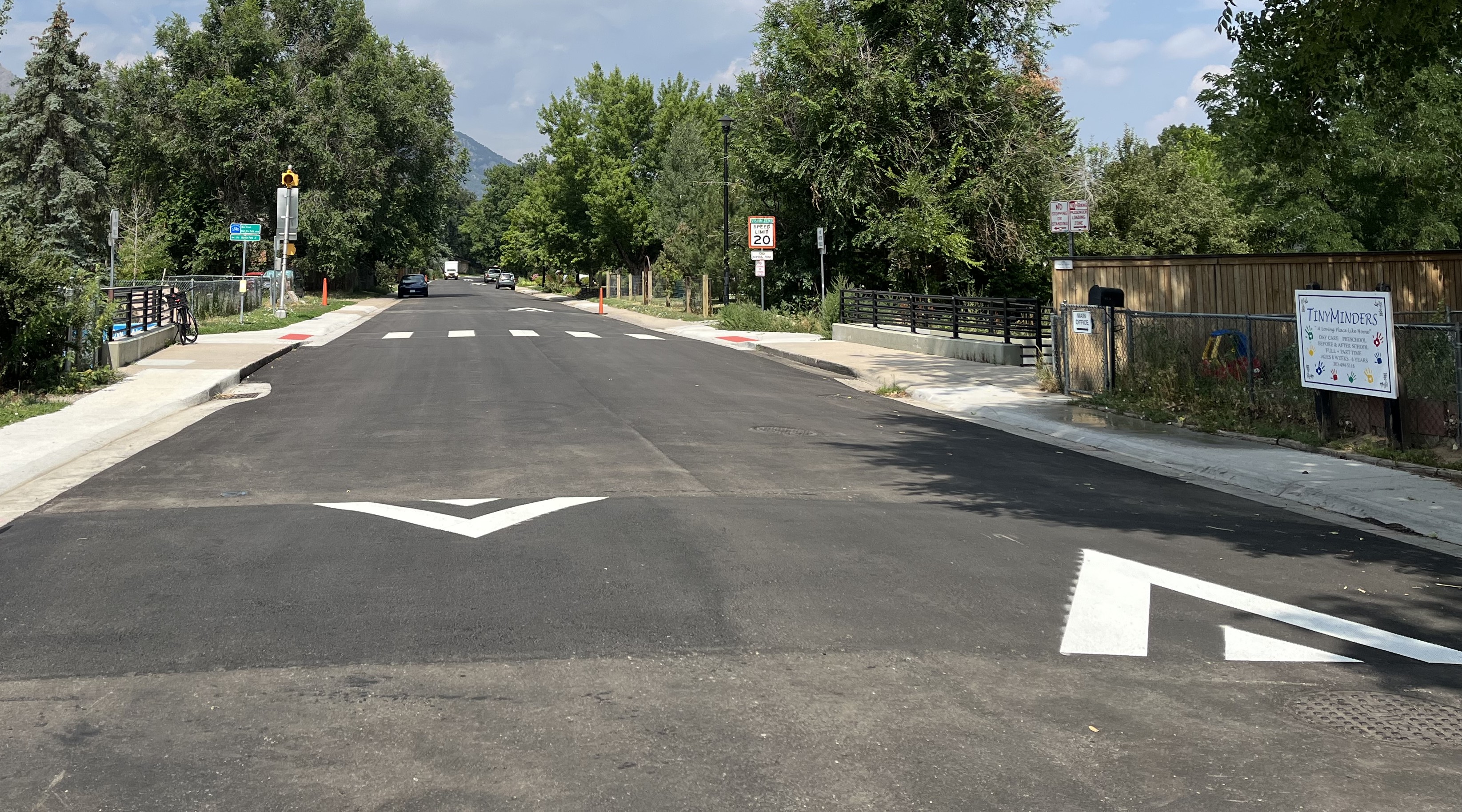
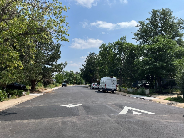
Traffic calming: Martin Drive provides access to Creekside Elementary and is designated as a Neighborhood GreenStreet in citywide plans, with the goal of creating a street comfortable for walking and biking for people of all ages and abilities. To address vehicle speeds, speed humps, which are a traffic calming device, were installed on Martin Drive in July 2025. This installation is a direct response to speed data indicating that the majority of drivers on the corridor routinely travel significantly faster than the 20 mph speed limit. The 85th percentile speed collected was 33-34 mph, meaning 85% of drivers were traveling at or below this speed. The speed humps were placed approximately every 350 feet. View the map of speed hump locations below for more details.
The existing raised crossing at the Bear Creek Multi-Use Path could not be reconstructed to comply with ADA within this program’s resources. To mitigate this, a speed hump was added on both sides of the current crossing.
Before photoAfter photo.
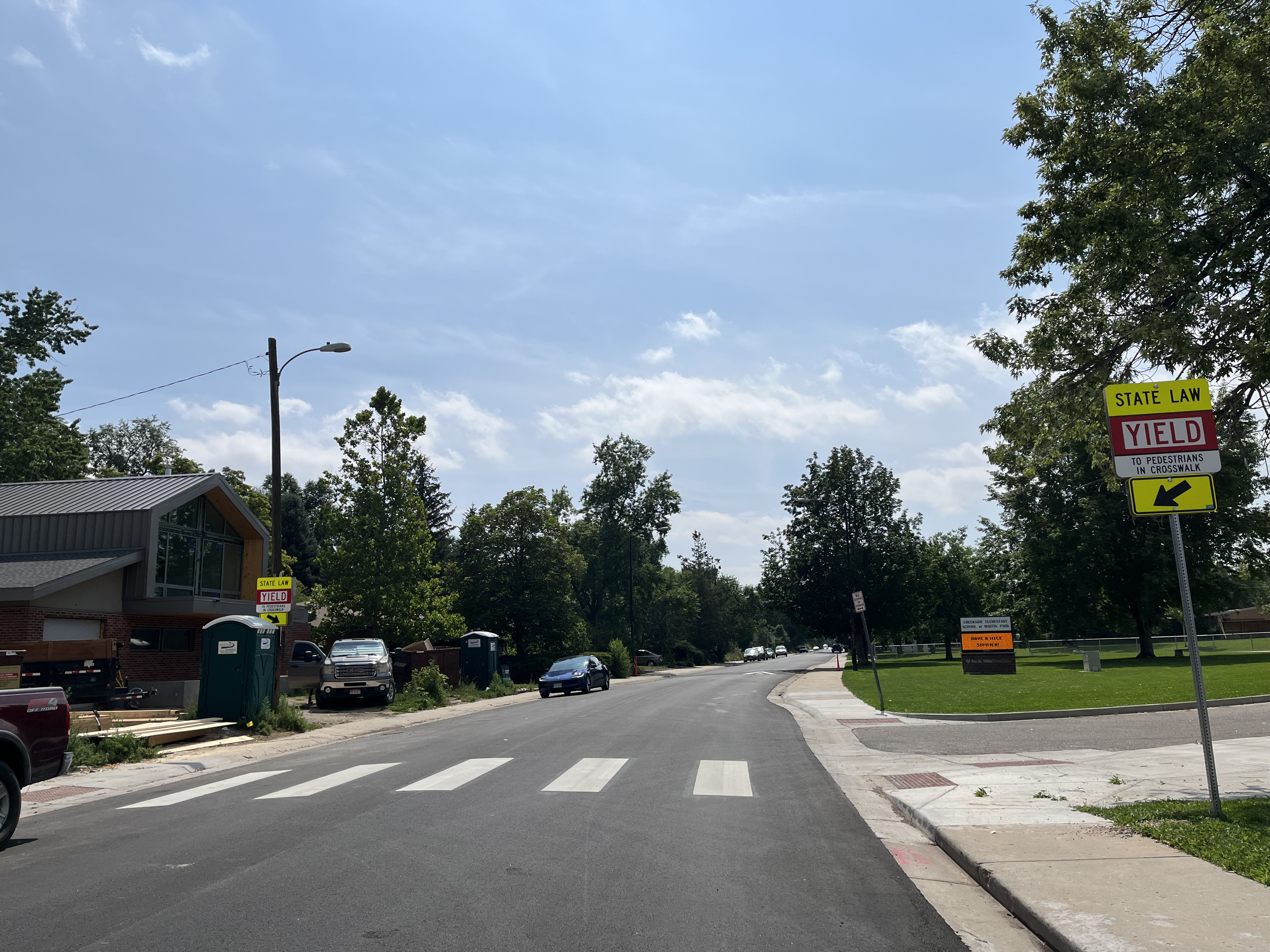
The existing crosswalk in front of Creekside Elementary was relocated to provide a safer and more direct crossing to the school.
Before photo. After photo.
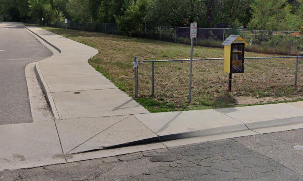
The sidewalk adjacent to the Creekside Elementary parking lot driveway was slightly widened to improve pedestrian access between the school and the Bear Creek Path.
Before photo.
After photo.
As curb ramps at intersections were reconstructed to comply with ADA, curb radii were reduced to slow vehicle speeds and improve pedestrian crossings.
Ash Avenue (Lashley Lane to Moorhead Avenue)
Concrete work on Ash Avenue, a proposed Neighborhood GreenStreet, was completed in winter 2024-2025/spring 2025, repaving was completed in June 2025, and mobility enhancements followed in July 2025 and include:
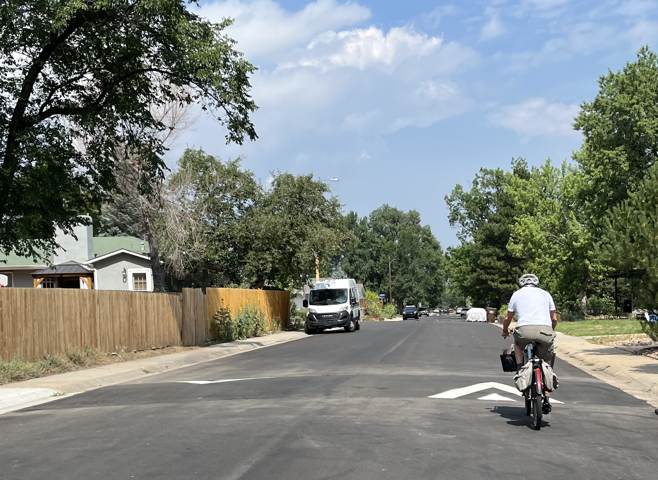
Traffic calming: Ash Avenue is designated as a Neighborhood GreenStreet in citywide plans, with the goals of creating a street comfortable for walking and biking for people of all ages and abilities. To address vehicle speeds, speed cushions, a traffic calming device similar to a speed hump, were installed on Ash Avenue in July 2025. The existing speed humps were changed to speed cushions based on input from our emergency response partners. Additionally, new speed cushions were added approximately every 350 feet to respond to speed data indicating that the majority of drivers on the corridor routinely travel significantly faster than the 20 mph speed limit. The 85th percentile speed collected was 28 mph, meaning 85% of drivers were traveling at or below this speed. View the map of speed cushion locations below for more details.
After photo.
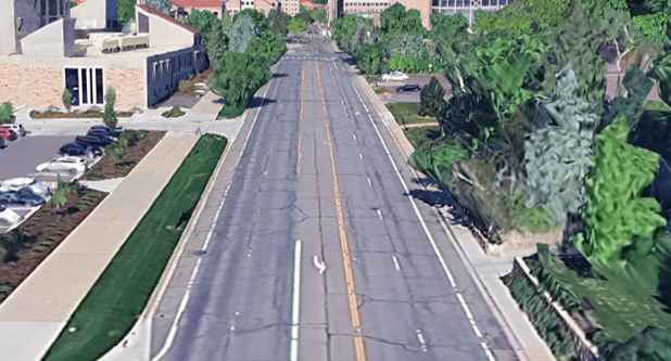
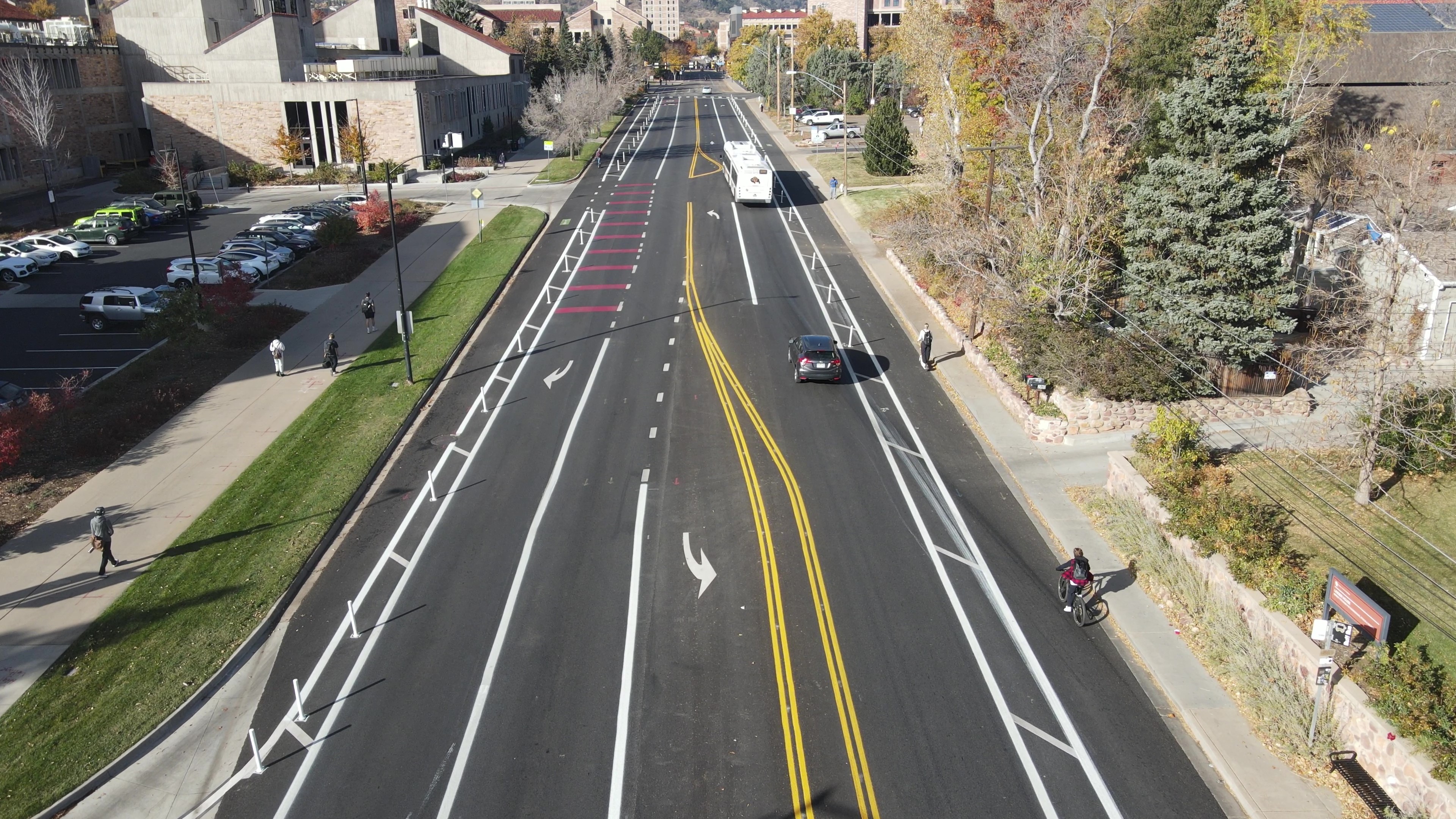
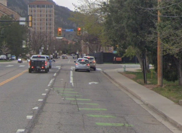
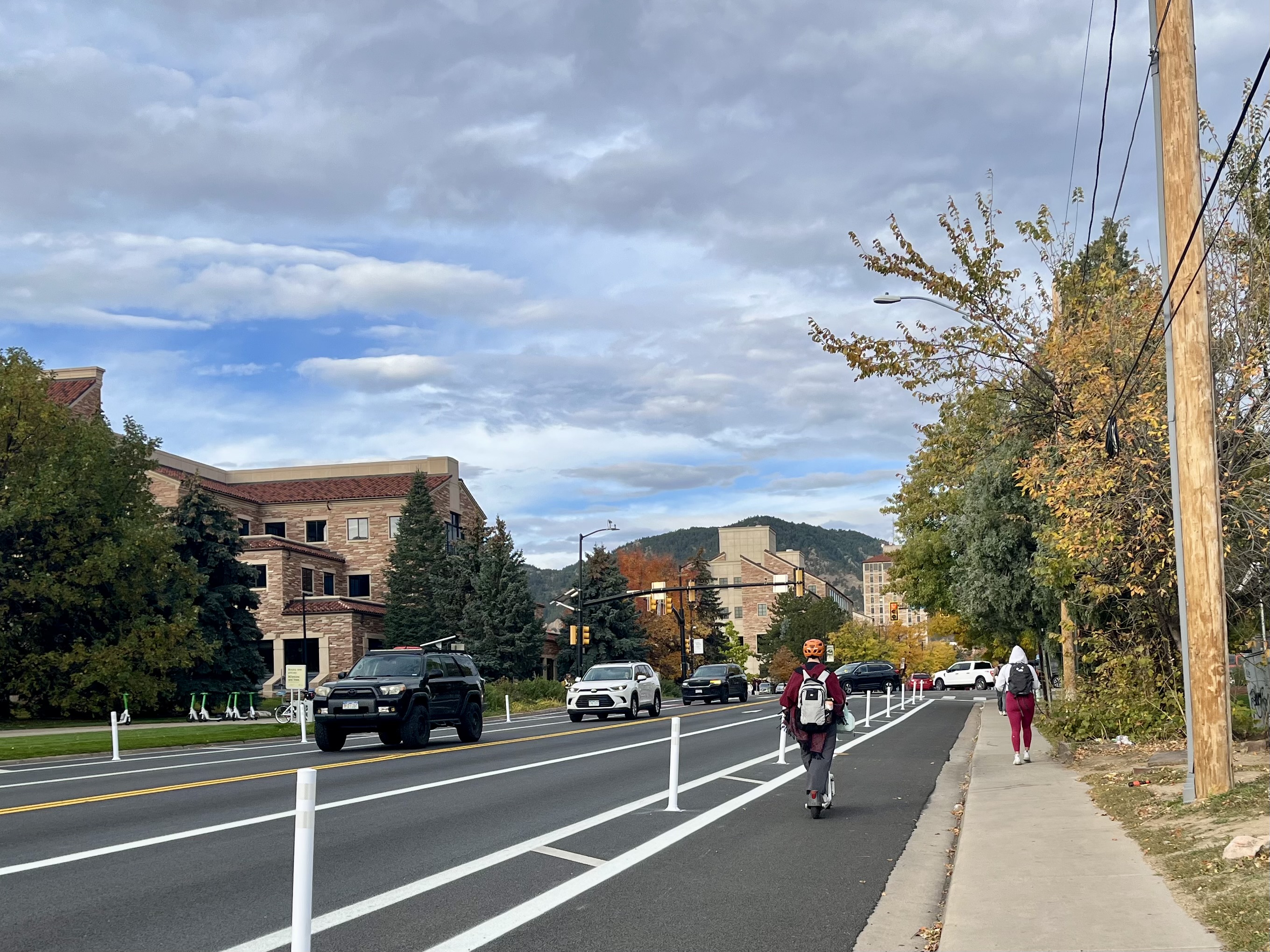
Colorado Avenue (Folsom Street to Regent Drive)
Cost-efficient mobility improvements on Colorado Avenue between Folsom Street and Regent Drive were coordinated with scheduled repaving in summer/fall 2025.
These mobility enhancements achieved two key objectives supported by the 30th Street and Colorado Avenue Corridors Study: closing a key gap in the low-stress bike network connecting CU Main and East campuses, and improving the speed and reliability of Buff Bus transit service.
Before photo of Colorado Avenue.After photo of Colorado Avenue.
2025 enhancements include:
Improved bike lanes with vertical separation provided by flexible delineator posts.
Before photo of Colorado Avenue, facing west.After photo of separated bike lanes on Colorado Avenue.
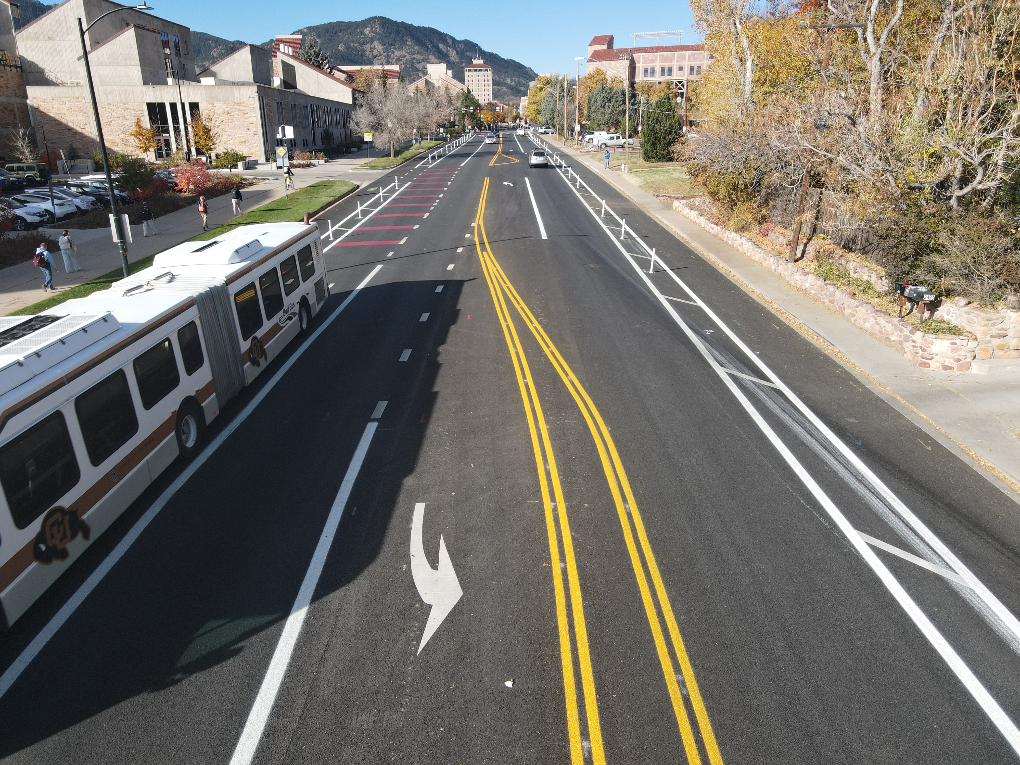
The two-way center turn lane between Folsom Street and Regent Drive, turn lanes at Regent Drive, right-turn lane at Folsom Street, and access to adjacent properties and driveways were all maintained. Approximately 400’ of one of the westbound vehicle lanes was repurposed to create space for improved bike lanes and future bus stop improvements. Vehicle lane repurposing can reduce vehicle speeds by up to 5 mph, and the vertical friction from bike lane separation can reduce speeds by an additional 2 mph. This lessens the severity of crashes if they do occur for all road users by moderating vehicle speeds.
The area where people driving and bicycling westbound interact before the Folsom Street intersection, called a mixing zone, was updated so that people driving and bicycling have separated spaces up to the intersection, improving safety for all travelers.
Before photo of Colorado Avenue east of Folsom Street.After photo of Colorado Avenue east of Folsom Street.
Existing bus lanes were modified to be clearer and more intuitive for drivers and transit operators, and to be consistent with other planned bus lanes in the city. Bus lanes are dedicated to transit vehicles to help increase reliability and safety, but can also be used by right-turning vehicles. The bus lanes are marked in red, making it easier for all travelers to see where to go. Just like green bike markings, these colors are part of federal guidance to help people travel safely.
After photo of bus lane markings on Colorado Avenue.
The speed limit on Colorado Avenue between Folsom Street and 30th Street was lowered from 35 mph to 25 mph, implementing the recommendation from the city’s separate but related Speed Limit Setting Project.
Additional enhancements are planned for 2026 in coordination with CU Boulder.
An eastbound floating bus stop just east of the Folsom Street intersection. Floating bus stops include a boarding island, which is a dedicated space for people to wait, and allow buses to stop in-lane, improving transit speed and reliability. These bus stops also remove conflicts between buses and bicyclists by placing the bike lane behind the bus stop, enhancing safety for bicyclists and improving transit reliability.
Dedicated bike ramps will be installed at the south end of the Folsom Street intersection to better connect the Folsom Street bike lanes to CU Main Campus.
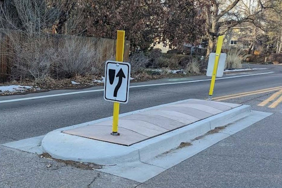
Moorhead Avenue between 27th Way and Table Mesa Drive
We repaved Moorhead Avenue between 27th Way and Table Mesa Drive in summer 2024.
While the posted speed limit is 25 mph, speed data collected on the corridor suggested most drivers are traveling up to 10 mph over the posted speed limit (the 85th percentile speed collected is 35 mph).
Based on data collection, citywide design and construction standards, and what we heard from the community about a desire for traffic calming and more comfortable bike facilities on Moorhead Avenue and concerns of limited visibility at pedestrian crossings and transit stops due to on-street parking, the enhancements included several features to make the street safer for everyone:
A combination of speed cushions and splitter islands was installed to bring vehicle speeds closer to the posted 25 mph speed limit.
An example splitter island on 26th Street.
An example speed cushion on 26th Street.
To further help lower speeds, the vehicle travel lanes and the parking lane were narrowed by 1 foot each. After repaving, the centerline was not striped.
The southbound bike lane was upgraded to a buffered bike lane.
The northbound bike lane was widened to 6 feet.
“No Parking Anytime” signage was added to locations where parking is currently prohibited per citywide code to reduce conflicts with driveway access and increase safety for and visibility of people walking and rolling, crossing the street, and accessing transit. Per Boulder Revised Code 7-6-13, parking is prohibited within intersections, within 20 feet of all crosswalks or intersections, and within 5 feet of all driveways and in bus stops.
Baseline Road between Foothills Parkway and just west of Gapter Road
We repaved Baseline Road between Foothills Parkway and just west of Gapter Road in late July to early August 2024. Work followed a data-driven approach informed by analysis of speeds, crash history, operational impacts, industry best practices, our Transportation Master Plan, Low-Stress Walk and Bike Network Plan, Vision Zero Action Plan, and what we heard during Safe Routes to School community engagement at Manhattan Middle School.
The mobility enhancements are located within the two-block stretch of Baseline Road between Foothills Parkway and 55th Street. Improvements create space for dedicated right-turn lanes at all side streets and bike lane buffers with vertical separation provided by flexible delineator posts.
This work connects to recently installed tall curb-separated bike lane improvements on Baseline Road west of Foothills Parkway. It also improves the intersections at Manhattan Drive/Crescent Drive and 55th Street by shortening the distance people crossing Baseline Road are exposed to vehicle traffic.
Areas where people driving and bicycling interact near intersections, called mixing zones, were updated to meet current city standards.
Manhattan Drive intersection: A new dedicated right-turn lane to Manhattan Drive to improve intersection operations and access to Manhattan Middle School and neighborhoods to the south.
The median between Manhattan Drive and 55th Street: A short median segment was narrowed to extend the eastbound left-turn lane and provide space for bike lane buffers.
Whitter Neighborhood
This work implemented the city’s Low Stress Walk and Bike Network plan recommendations for Balsam Avenue and Edgewood Drive. The plan identifies buffered bike lanes to build a network of low-stress facilities to help people of all ages and abilities walk and bike safely and comfortably throughout the area.
The project impacted Balsam Avenue from 9th to 19th streets and Edgewood Avenue from 19th Street to Folsom Avenue
This area was repaved and restriped. The on-street bike lanes were also be enhanced.
The westbound bike lane, from east of Broadway to 24th Street has a two-foot buffer, to provide greater separation between people biking and vehicles, while retaining the on-street parking lane on the south side of the road
The eastbound and westbound bike lanes, between 9th Street and Folsom Avenue, has bike markings added to provide greater visibility
Vehicle travel lanes are 10 ft wide to help slow vehicle speeds
Lehigh Street
Pedestrian crossing and intersection safety improvements near Mesa Elementary
Installation of a paved multi-use path through Bear Creek Park connecting Lehigh and Bear Creek Elementary
Resurfacing of Lehigh/Greenbriar between Table Mesa and east of Galena/Redstone
Removal of the center turn lane between Table Mesa Drive and Cragmoor Road to add a buffer and provide more separation between bike lanes and vehicle travel lanes
17th Street
Resurfacing of 17th Street from Pearl Street to Macky Drive
Two-stage left-turn queue boxes for making left turns onto Walnut Street from 17th Street, including “no right turn on red” signs for drivers
Green pavement markings to increase the visibility of bike paths on Canyon Boulevard and Arapahoe Avenue
A new bike lane segment southbound from Pearl Street to Walnut Street
Newly restriped bike lanes and crosswalks between Pearl Street and Macky Drive
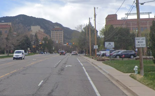
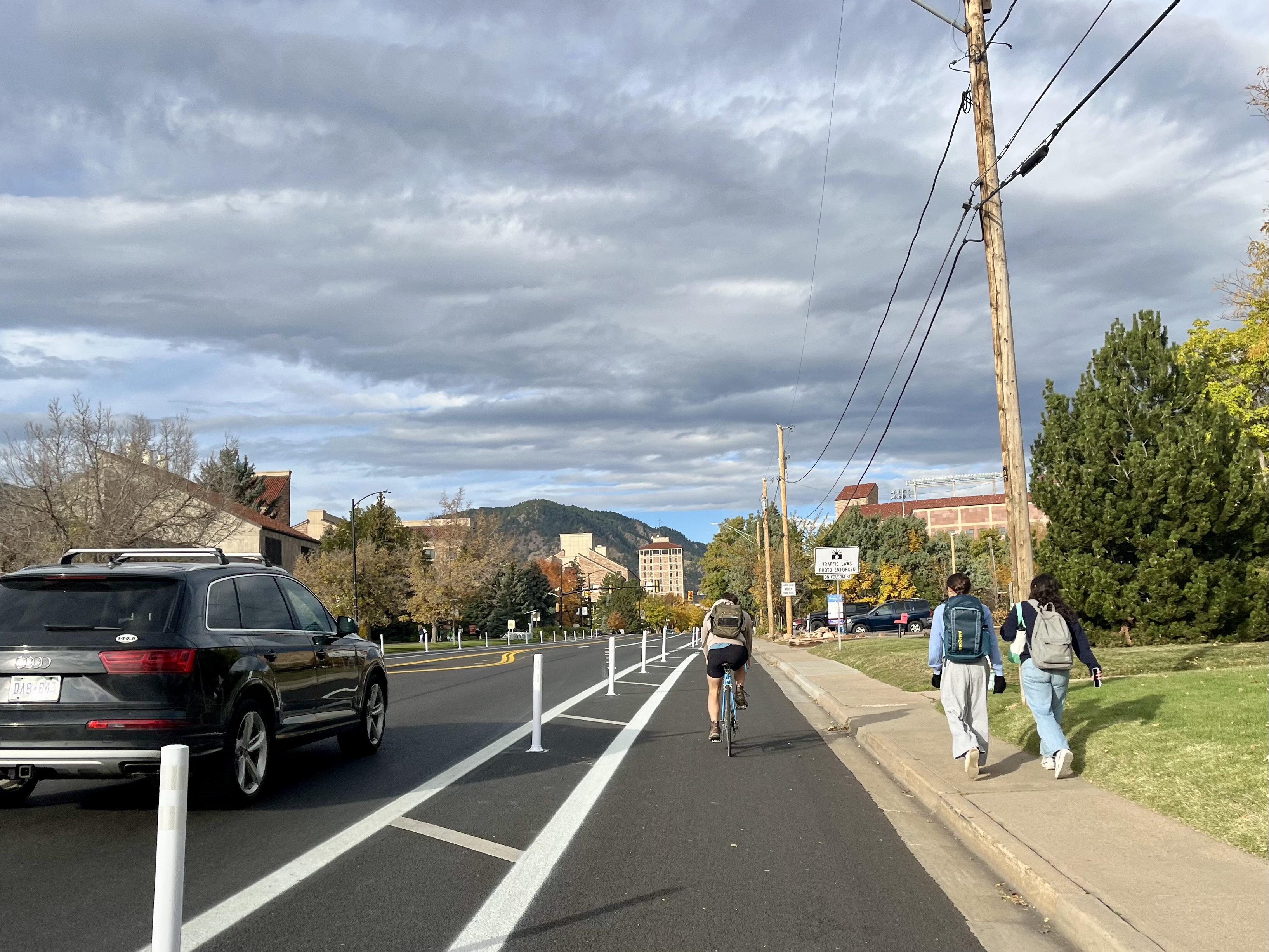
Folsom Street (Valmont Avenue to Pine Street)
A cast-in-place curb-separated bike lane treatment with plastic delineators for enhanced visibility of the curb separation for bicyclists and motorists.
Additional green conflict markings
Enhanced signing
Resurfacing and striping upgrades (completed over the summer)
This location was identified for a vertically separated bike facility due to its 30 mph speed limit and higher average daily traffic.
Baseline Road (Gregory Canyon to Broadway)
Installed a buffered bike lane at the eastbound approach of the intersection at Baseline and Broadway
Resurfacing on Baseline was completed in early October.
The buffered bike lane provides a dedicated area at the front of the intersection, increasing visibility and safety for travelers.
All three streets were identified for multimodal safety improvements in Boulder’s Low-Stress Walk and Bike Network Plan, which charts a course for enhancing existing facilities and filling in missing links in Boulder’s bicycle and pedestrian transportation network.
Pine Street (Folsom Street to 28th Street)
A new buffered bike lane was installed between Folsom and 28th streets. Along with the new bike lane, the speed limit on this stretch of Pine Street was lowered from 30 mph to 25 mph.
Table Mesa Drive (Vassar Drive to Broadway)
A number of bicycle safety improvements were made across the Table Mesa corridor, in addition to the pavement resurfacing work. These included adding and widening bike lanes and installing a painted "bike box" at Broadway to assist with safe turning movements.
Folsom Street (Iris Avenue to Valmont Road)
The city installed green bike lane striping at intersections to improve visibility added a buffer between the existing drive lanes and bike lanes and reduced the speed limit from 30 mph to 25 mph.
Before and After Photos
Comanche Drive Before Pavement Work
1 of 10
Comanche Dr After Pavement Work
2 of 10
Elder Ave Before Pavement Work
3 of 10
Elder Ave After Pavement Work
4 of 10
Kohler Dr Before Pavement Work
5 of 10
Kohler Dr After Pavement Work
6 of 10
Mohawk Dr Before Pavement Work
7 of 10
Mohawk Dr After Pavement Work
8 of 10
West Moorhead Circle Before Pavement Work
9 of 10
West Moorhead Circle After Pavement Work
10 of 10
Web Accessibility
This is a text alternative to the map of Folsom Street. A map of Folsom Street with the segment between Arapahoe Avenue and Pine Street highlighted to indicate repaving and mobility enhancements in July/August 2026. An arrow points to the Folsom Street/Pine Street intersection to highlight the Folsom and Pine Intersection Improvements HSIP Project in June/July 2026.