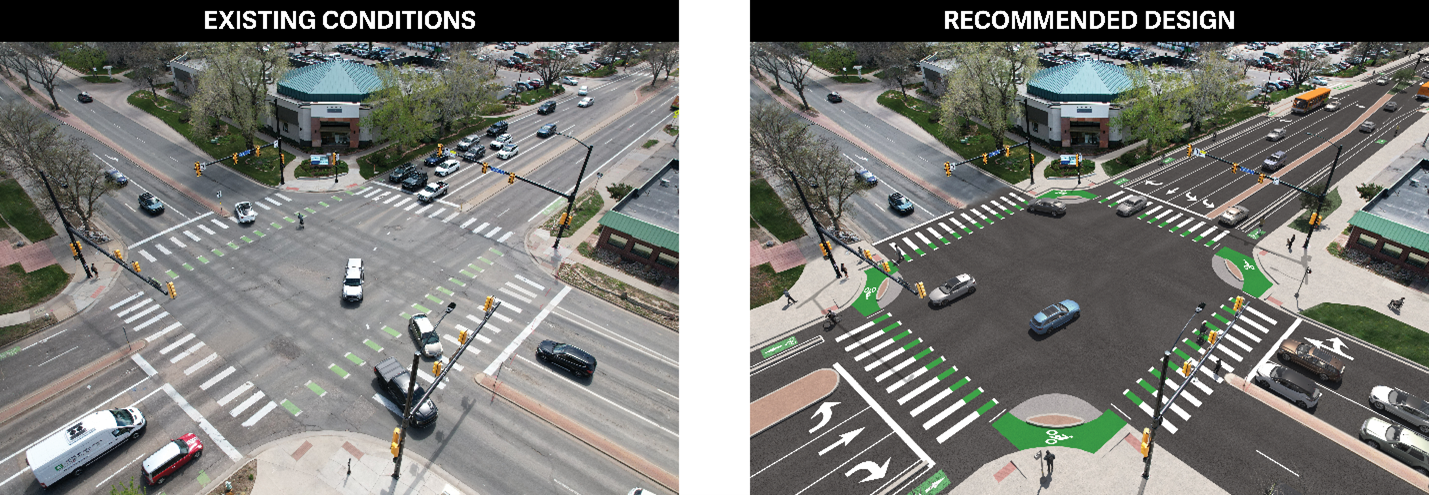
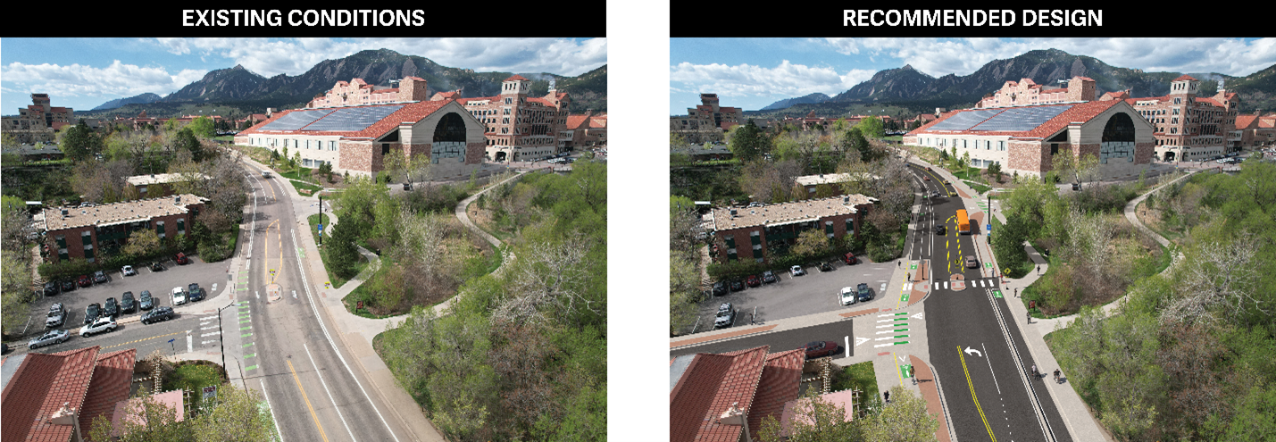
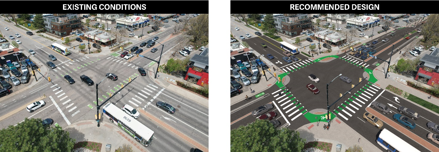
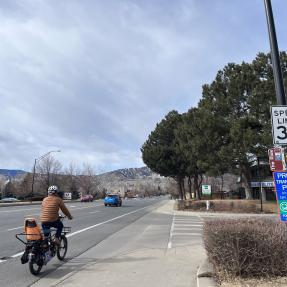
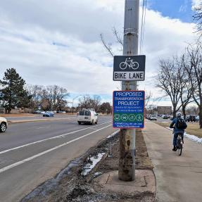
This project will make north-south travel on Folsom Street between Pine Street and Colorado Avenue safer, more connected and more comfortable.

Current Phase
Community Engagement

Project Overview

This project includes community engagement, along with transportation data analysis and professional best practices, to help inform conceptual designs that improve north-south travel on Folsom Street between Pine Street and Colorado Avenue, providing safer, more connected and more comfortable travel choices no matter how people choose to move along or across this corridor.

Folsom Street from Pine Street to Colorado Avenue is an important corridor in central Boulder. As a key city street, Folsom Street connects homes, office spaces, restaurants, shops, grocery stores, parks, and CU Boulder’s Main Campus, to each other and to the city’s transportation network for walking, bicycling, driving, and taking local and regional transit.

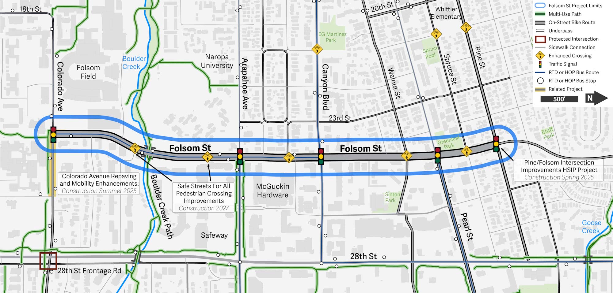
A map of the project area for the Folsom Street Safety Improvements project between Pine Street and Colorado Avenue.

View full project map

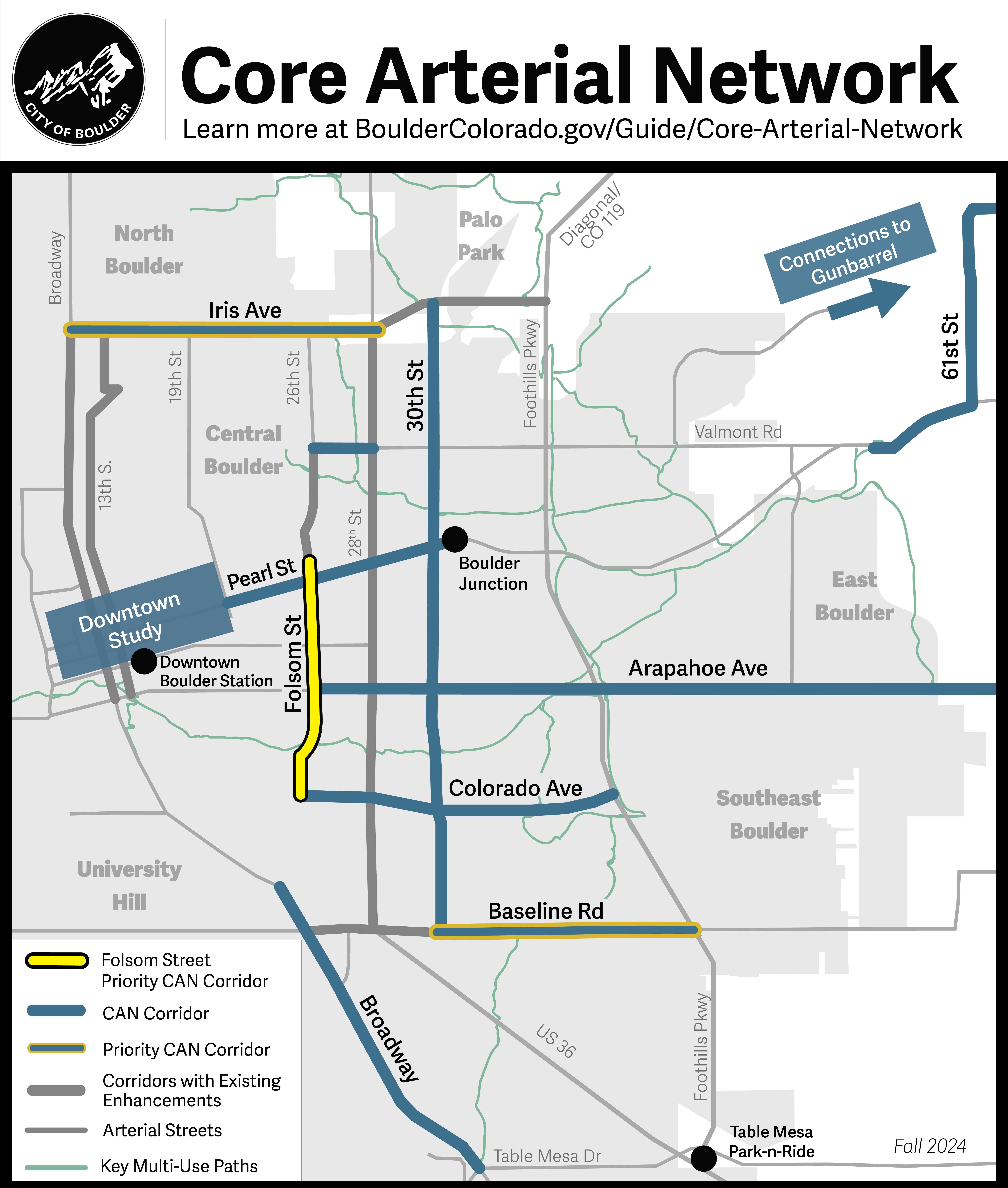
Following findings that show that 67% of traffic crashes resulting in serious injury or fatality occur on arterial streets, City Council prioritized design improvements to 13 key streets as part of Boulder's Core Arterial Network (CAN) initiative. This project is one of three priority corridor projects on the CAN.

A map of streets on the city's Core Arterial Network. Folsom Street from Pine Street to Colorado Avenue is highlighted.

View full CAN map

Community Engagement

Community engagement has begun! We hope to learn about your travel experiences today and collect your ideas for better travel in the future on Folsom Street from Pine Street to Colorado Avenue.

The online questionnaire has closed. Stay tuned for future opportunities to engage and learn more about we heard through the project email.

The City of Boulder is committed to transparent, inclusive and equitable community engagement. The Folsom Street Safety Improvements Project will provide multiple opportunities to inform and consult the community per the city’s Engagement Strategic Framework.

Timeline

Community engagement, transportation data analysis and professional best practices will inform the development and evaluation of conceptual design options into early 2025. The recommended conceptual design will then follow a Community Environmental Assessment Process (CEAP) to ensure consistency with the community’s long-term vision in the Boulder Valley Comprehensive Plan. Results will be shared with the Transportation Advisory Board and City Council in mid-2025. If approved, the city will move to final design and implementation.

Frequently Asked Questions

City plans, federal guidance and community input call for proactive improvements to make Folsom Street safer, more comfortable and connected for everyone, no matter how you travel.

This stretch of Folsom is the third of three priority corridors on the CAN.

  • The CAN is Boulder’s connected system of multimodal transportation — taking the bus, driving, biking and walking — improvements along Boulder’s main corridors that will help reduce the potential for severe crashes and make it more comfortable and convenient for people to get where they need to go.

Folsom Street is on the city’s High Risk Network.

  • The2023-2027 Vision Zero Action Plan identifies Folsom Street from Fremont Street to Taft Drive as part of the High Risk Network (HRN). The HRN is where nearly half of all fatal and serious injury crashes occur, or are likely to occur in the future, despite comprising only a small part – just 7% – of city streets. The HRN identifies this section of Folsom Street as having five of the six risk factors that account for the most frequent and severe crashes.

Existing infrastructure for walking and biking on Folsom Street do not meet city or community standards.

  • Sidewalks are narrow or missing in some places and bike lanes do not meet current city standards for width.

Folsom Street is on the Denver Regional Council of Governments’ High Injury Network.

  • The High-Injury Network identifies the roads where the majority of serious injury and fatal crashes occur - 9% of roads in the region. Folsom Street from Valmont Road to Canyon Boulevard is on the High Injury Network.
  • Between January 2015 and July 2024, a total of 566 crashes occurred on the corridor, with drivers experiencing the most crashes (82%). Approximately 18% of crashes involve vulnerable road users – people walking, biking, and rolling. There have been 20 severe or fatal crashes on the corridor and 95% of these have involved vulnerable road users.

Folsom Street is part of the city’s Low Stress Walk and Bike Network.

  • The city's 2019 Low Stress Walk and Bike Network Plan recommends protected bike lanes with vertical physical separation for Folsom Street and creating more space between vehicle lanes and people walking.

The Folsom Street Safety Improvements Project will design safety improvements for all travelers. The project focus is on safety and providing comfortable multimodal options that connect to the city’s broader transportation network for taking the bus, driving, biking and walking.

The project intent is to reduce the likelihood of crashes across all modes of travel, with an emphasis on vulnerable roadway users; and when crashes do occur, they will be less likely to result in severe injuries.

Improvements will help safely connect people to:

  • Pine, Spruce and Walnut streets, which all directly connect to downtown.
  • Two major east-west multi-use paths (Goose Creek and Boulder Creek).
  • First- and last-mile connections to transit. This includes existing and anticipated local and regional bus services on Folsom Street, Canyon Boulevard, Arapahoe Avenue, and 28th Street.
  • Major destinations, including homes, office spaces, restaurants, shops, grocery stores, parks and CU Boulder Main Campus.

This project will improve safety and provide comfortable and connected multimodal options for the wide variety of people who use Folsom Street on a typical day, including:

People who drive on Folsom Street

  • From January 2015 to July 2024, 566 crashes occurred on this part of Folsom Street. People driving experience the most crashes, or 82% of total crashes.

Vulnerable roadway users

  • Of the total crashes, there were 20 serious or fatal crashes, with 95% disproportionately involving vulnerable road users — people walking, biking and rolling.

Boulder residents

  • 30,000+ Boulder residents live on or within walking distance, or 1/2 a mile, of Folsom Street.

Cost-burdened households

  • 55% of these nearby households are cost-burdened, meaning they spend more than 30% of their monthly income on housing costs, and 13% don’t have access to a car, versus 5% across our region.

Boulder commuters

  • 27,000+ people work along or within one-half mile of Folsom Street today.
  • 34,000+ employees are anticipated to work along the corridor by 2050.

We will use community feedback, data analysis, technical expertise and best practices to develop conceptual design options.

A design will be selected through the Community and Environmental Process (CEAP). The CEAP is a formal review process. It assesses the potential impacts of capital improvement projects to help select a recommended alternative. The evaluation will consider potential social and environmental impacts, project-specific criteria, and community feedback.

The city uses the CEAP process to identify a recommended alternative by evaluating conceptual alternatives against the criteria of the three cornerstone components of this process: the CEAP Checklist, Project-Specific Evaluation Criteria and Community Input. The CEAP is presented to the Transportation Advisory Board (TAB), who then makes a recommendation to City Council. City Council is then asked to approve TAB’s recommendation.

Potential impacts to nearby streets is an important consideration for this project.

We will analyze data on nearby neighborhood streets and review the recommendations from the now-closed Neighborhood Speed Management Program (NSMP) to identify speed management needs. If issues at specific locations are identified, speed mitigation installations and traffic management will be considered as a concurrent project. Those locations will be installed with construction for the Folsom Street Safety Improvements Project.

We will also monitor additional street segments for increases in traffic and speeds after construction is complete.

Safety is a city and community priority. We will work closely with our public safety partners throughout the design process.

Design development will be informed by the city’s Boulder-Fire Rescue and Police departments, and the Office of Disaster Management (ODM) for the City of Boulder and Boulder County.

Vehicle travel time impacts will be analyzed for all designs considered. This will inform conceptual designs that are evaluated as part of the CEAP.

Providing safer and more comfortable and connected travel options allow people, including children and older adults, to travel more independently by any mode they choose. Supporting all modes of travel also makes it easier, safer and more convenient to travel in sustainable ways, like walking, biking and taking the bus. When more people feel comfortable enough to choose these travel options, vehicle pollution decreases and air quality increases, improving quality of life and moving us toward our community climate goals.

In May 2023, the Denver Regional Council of Governments approved a Transportation Improvement Program grant funding award for community engagement and conceptual design for the Folsom Street Safety Improvements Project. The project budget is $1.5 million, with $1 million funded by the TIP and $500,000 funded by the city. As the project moves forward from conceptual design to final design and construction, we will pursue additional grant funding.

There have been several projects along Folsom Street to improve travel. These projects have a different purpose and process.

Project Folsom Street
Safety Improvements
(Ongoing)
Folsom Street
Living Lab
(2015)
Purpose

A comprehensive safety and connectivity project to improve travel for all modes, not just bicycling.

An experimental, iterative pilot project. The project focus was primarily to improve bicycling safety, with some crossing improvements.
Process

It will have an extensive planning, design, and formal review and approval process long before any construction begins.

This includes community input, data collection of the project street and nearby side streets, crash analysis, and national best practices.

It was a unique project that tested results in the field by installing changes first and later collecting data and community engagement.

Installations were then adjusted based on pilot learnings.

Since 2015, the transportation industry has also made significant advancements in street designs that improve safety for everyone. The Folsom Street Safety Improvements Project will lean on these updated best practices to improve the whole street — for all travelers.

In Detail: What did the Living Lab project accomplish?

The pilot project repurposed a vehicle lane in each direction from Valmont Road to Canyon Boulevard to install post-separated bike lanes, aiming to improve bicycle safety and comfort. The city then adjusted installations based on data and community learnings after a two-month pilot period. This includes:

  • Folsom Street from Spruce Street to Canyon Boulevard was restored to its original configuration of four vehicle lanes and painted bike lanes.
  • Folsom Street from Spruce Street to Valmont Road retained the new configuration of two vehicle lanes, a center turn lane and post-separated bike lanes.
  • Folsom Street from Pine Street to Iris Avenue was later upgraded in 2021, including concrete curb separation for bike lanes from Pine Street to Valmont Road, as part of the Pavement Management Program.

Overall, safety and connectivity improvements on parts of Folsom Street have been iterative, under multiple implementation efforts, leading to the street that people use today.

decorative graphic

Additional Resources

HSIP Signal and Crossing Improvements

The Folsom Street Safety Improvements Project is located south of planned traffic signal and pedestrian crossing improvements at the intersection of Folsom and Pine streets. This nearby work will begin in 2025 as part of the federal Highway Safety Improvement Program (HSIP).

28th Street Improvements Project

Improvements on 28th Street from Iris Avenue to Canyon Boulevard will transform the street into a multimodal corridor with a consistent design that delivers transportation, safety, aesthetic and economic enhancements. Improvements include bus lanes, bus stop enhancements, connecting gaps in the existing multi-use paths, traffic signal replacements, and more.

This section will provide text alternatives to webpage graphics. The city is in the process of making all of its websites and applications more accessible. If you would like assistance, contact the city's ADA Coordinator using the Accessibility Complaint or Request Form or by calling 720-576-2506. Please know that the city is happy to assist you and do not hesitate to reach out.