

Jump to Parks
Systems Class
The Boulder Valley systems make up the framework of critical habitat, recreation areas, agricultural activities and natural infrastructure that the community relies on for healthy, safe and sustainable living. These systems work together to support our community’s ecosystem services, climate resilience, cultural identity and unique built form and provide the network where the urban and rural environments interconnect.
Land Use Goals
- Maintain the urban and rural characteristics that define the Boulder Valley
- Enhance opportunities for connection with nature
- Support spaces for social activity, recreation and play
- Maintain a healthy agricultural community
Environmental Goals
- Maintain and enhance natural areas that increase biodiversity, protect water resources, sequester carbon and perform other ecosystem services
- Improve climate adaptation and resilience by thinking of systems holistically across the Boulder Valley
- Recognize the critical link between urban and natural systems
Mobility Goals
- Provide safe, multimodal connections for all ages and abilities that prioritize transit, pedestrian, bicycle and micromobility access
- Maintain safe, low-intensity road networks that support rural travel needs, focusing significant commuter travel onto primary multimodal corridors and minimizing impacts on the surrounding landscape
Economic Goals
- Reduce economic losses related to climate change and environmental hazards through resilient system design
- Support the local economy by maintaining and enhancing systems, parks, greenways, open space, agriculture and rural landscapes
- Enhance the attractiveness of Boulder’s neighborhoods and employment centers by investing in natural and recreational systems
- Sustain local agricultural enterprises by preserving working landscapes and supporting local and regional food systems
Equity Goals
- Ensure community spaces and services are dispersed throughout the Boulder Valley
- Focus resources on underserved areas
- Ensure access to nature, places to cool off and recreation are dispersed throughout the Boulder Valley
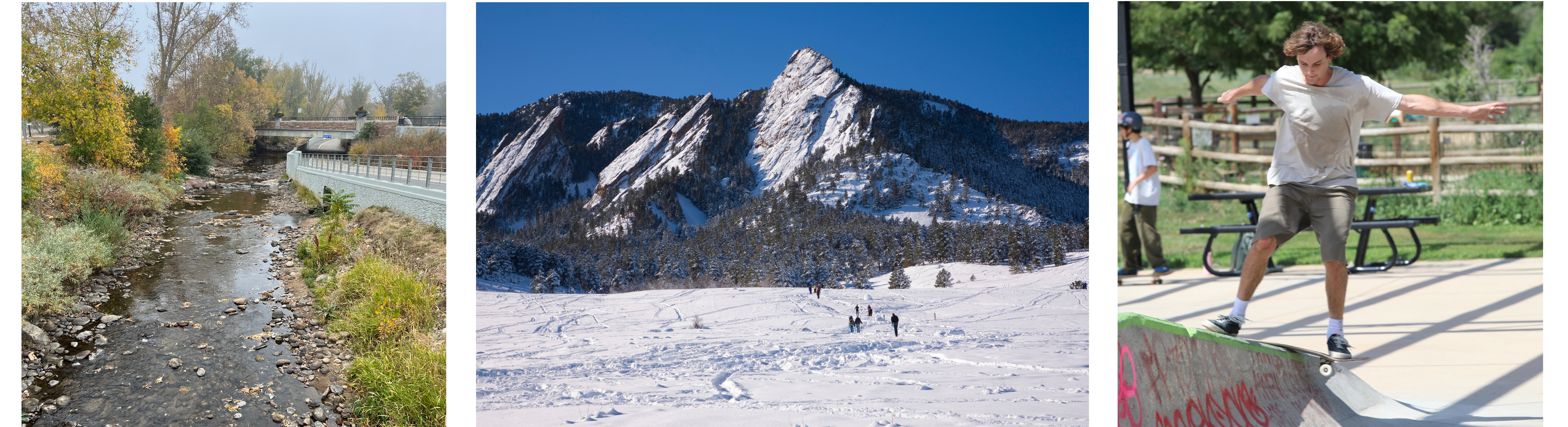
Examples of Parks, Greenways and Open Space included under Systems Class
Parks
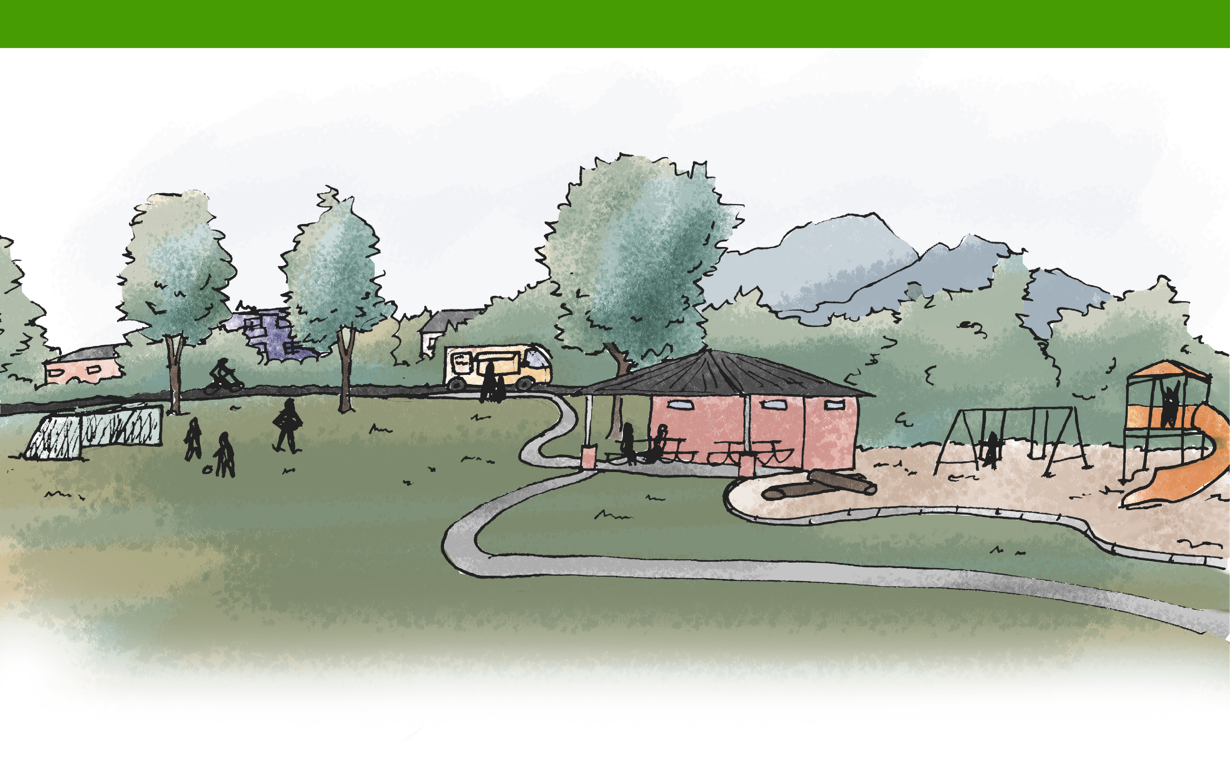
What it is
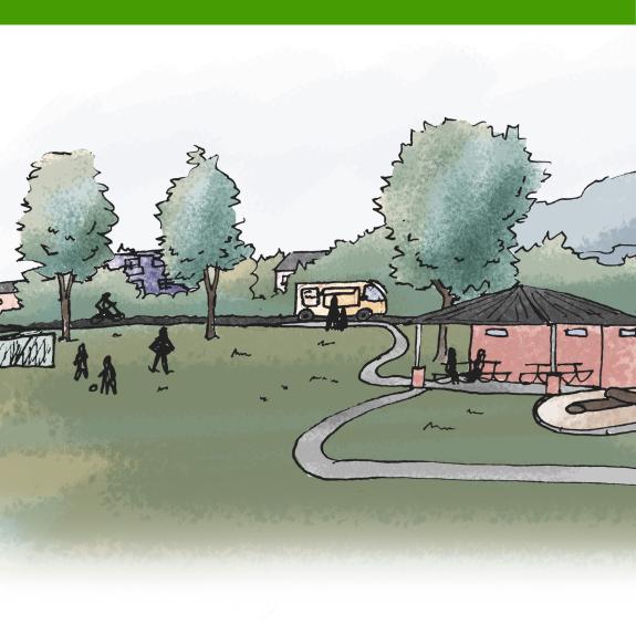
Parks are publicly accessible, active and passive recreational spaces such as multi-use lawns, gardens, playgrounds, nature play areas, water play areas, sport courts and fields, dog parks, historic and cultural sites and recreation centers. These areas are designed for community members to gather, exercise, rest, build social relationships and enjoy the outdoors. Some park areas may prioritize low-impact, ecologically sensitive design with the goal of habitat preservation.
Why it matters
Parks directly contributed to the mental and physical health and well-being of the entire Boulder community. These public spaces support a healthy and socially thriving community, economic vitality, sustainability and resilience. Together with the urban tree canopy, greenways and other open natural areas, Parks are critical to the livability of the urban environment and serve as important places to connect to and play in nature.
What you can expect
Uses
Primary:
| Category | Uses |
|---|---|
| Other | Active Recreation; Passive Recreation |
Supporting:
| Category | Uses |
|---|---|
| Commercial | Retail; Food and Beverage; Arts, Culture and Entertainment |
| Civic | Government |
| Other | Agriculture; Open Lands |
For definitions of the use terms, visit our land use glossary.
Urban Design
- Park design supports places to socially gather, have fun, play and contribute to economic vitality. Design balances the restoration and enhancement of local ecosystems and biodiversity, climate resilient practices and the need for welcoming, safe, inclusive and accessible spaces for all ages and abilities.
- Parks are well connected to surrounding uses and local mobility networks. Clear wayfinding, visible entrances and thoughtfully integrated amenities encourage everyday use.
- Design responds to Boulder’s unique natural setting, cultural history and surrounding context and reinforces Boulder’s identity as a community closely connected to its natural environment.
Mobility
- Mobility in and around Parks prioritizes inclusive access and active transportation, including transit service.
- Pathways and trails connect efficiently and seamlessly to surrounding neighborhoods and regional networks, inviting walking, rolling and bicycling for recreation and daily trips.
- Parking and transit stops are near entrances and amenities, providing accessibility and opportunities for visitors to move through green spaces.
Greenways
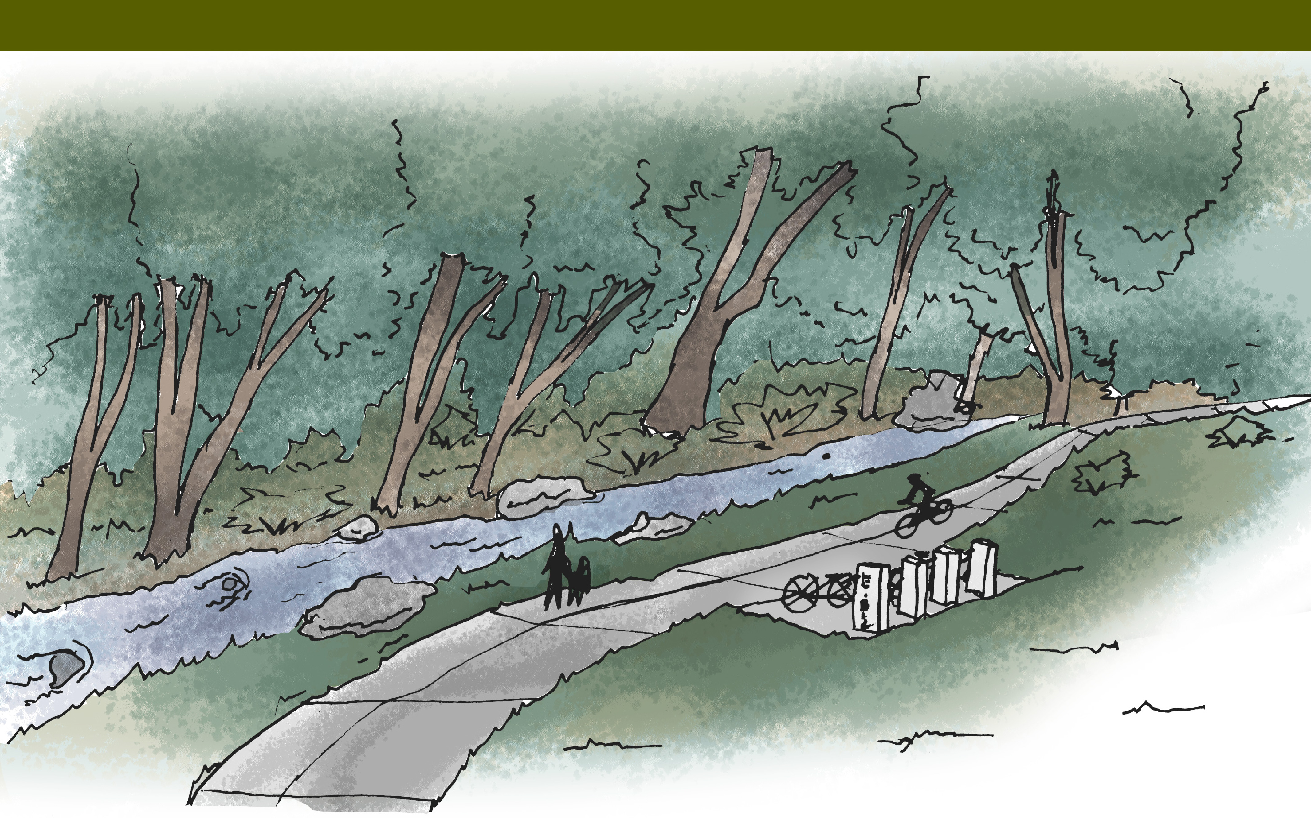
What it is
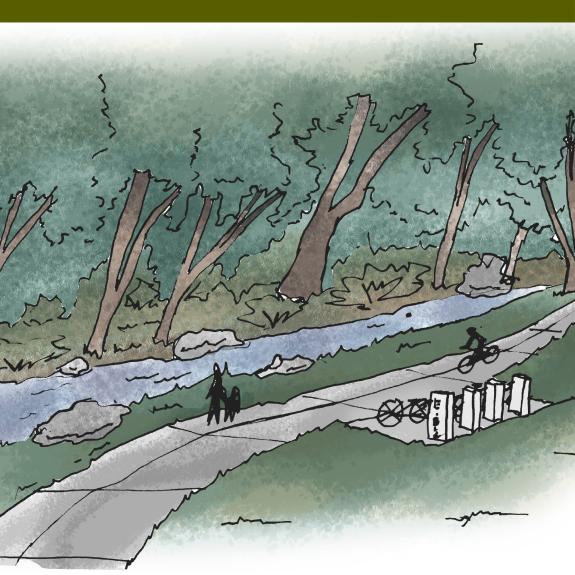
Greenways are areas adjacent to natural urban waterways within city limits, including Boulder Creek and tributary streams, that help manage and mitigate flooding, support multifunctional landscapes and ecosystem services and protect cultural resources. Greenways may also offer recreation and active transportation amenities. These areas form an interconnected system across public and private lands.
Why it matters
Greenways are a key feature of the community’s flood mitigation strategy and provide connected environmental corridors in the urban area that support habitat, wildlife movement and climate resilience. Additionally, they offer opportunities for passive recreation and off-street mobility networks that enhance the community’s ability to connect with nature and each other.
What you can expect
Uses
Primary:
| Category | Uses |
|---|---|
| Civic | Utility Operations; Open Lands |
Supporting:
| Category | Uses |
|---|---|
| Other | Passive Recreation |
For definitions of the use terms, visit our land use glossary.
Urban Design and Management
- Greenways are associated with Boulder Creek and other major drainageways. These linear spaces serve to manage creek and flood waters while weaving natural systems into the urban fabric that also support mobility networks and limited recreation activities.
- Greenways management emphasizes flood control, continuity and ecological integrity to support ecosystem services, including the movement of urban wildlife into and across the system. Built elements, such as paths, trails, bridges, lighting, seating, wayfinding and interpretive signage, are integrated sensitively into the landscape to support recreation and movement that works with the needs of the ecosystem and offers minimal disturbance.
- Some Greenway segments are publicly accessible, whereas others occur on private property or within utility, drainage, or conservation easements that support flood management, ecological function and landscape connectivity without full public access.
Mobility
- Some Greenways may provide scenic, continuous routes for walking, bicycling and rolling, offering a low-stress alternative to on-street movement.
- Multi-use paths along some Greenways link neighborhoods, parks, Open Space and major destinations, creating a backbone for regional connectivity.
- Access points may include curbside parking, bikeshare stations and micromobility facilities that support recreational, daily and commuter travel.
Open Space
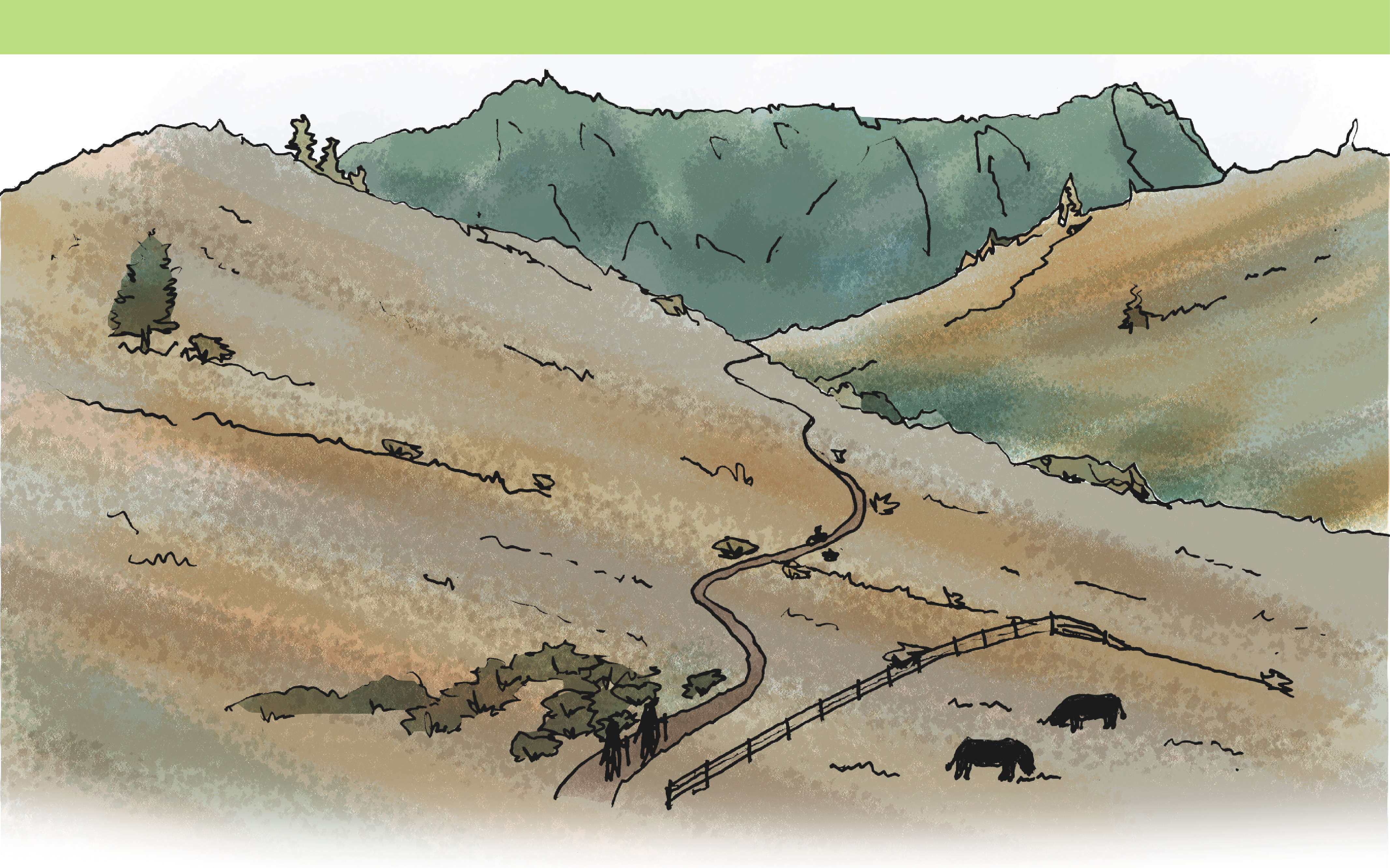
What it is
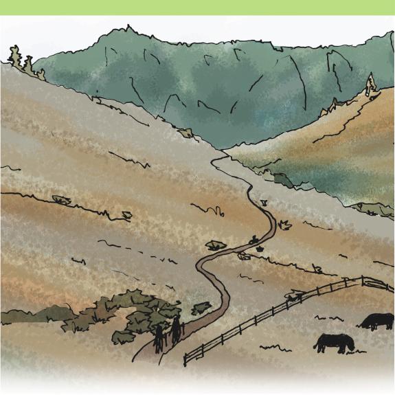
The Open Space system consists of lands maintained for specific purposes including, but not limited to, preservation and restoration of natural habitat and features, agricultural stewardship, floodplain protection, education, cultural resource protection and passive recreation. These purposes are further defined by the City of Boulder Charter or county open space tax-enabling ballot language. Open Space lands are stewarded by the city, county, other public entities or non-profits either through direct ownership, conservation easements on private land or other contractual obligations like management or annexation agreements. Open Space properties are not typically intensively developed and serve to limit urban sprawl into the rural areas of the Boulder Valley. Privately owned sites may contain development but still contribute to the community’s open space values by the terms of existing agreements.
Why it matters
The Open Space system forms the foundation for the community’s ecological health and climate resilience by maintaining plant and animal biodiversity, sequestering carbon, protecting water resources and managing wildfire risk. These lands provide a backbone for local agriculture and associated activities and support the Boulder Valley’s philosophy of compact urban development surrounded by rural and natural lands. Open Space creates a highly valued connection to nature and rural land, provides passive recreational opportunities, helps to ensure agricultural viability and contributes to the mental and physical well-being of the residents, workers and visitors of the Boulder Valley.
What you can expect
Uses
Primary:
| Category | Uses |
|---|---|
| Other | Agriculture; Open Lands; Passive Recreation |
For definitions of the use terms, visit our land use glossary.
Urban Design and Management
- Open Space areas are characterized by a deliberate absence of typical urban development as the landscape itself is the defining feature shaped by natural landforms, vegetation and ecological processes.
- Visitor infrastructure such as trails, trailheads, shelters, recreation facilities and picnic areas is used intentionally to provide a safe and welcoming experience for visitors and allow for enjoyment and stewardship of Open Space areas. These facilities provide access to and highlight Boulder’s scenic, natural and cultural landscapes while enjoying responsible recreation.
- Structures such as agricultural buildings, operational structures, historic landmarks and irrigation infrastructure support working landscapes and sustainable, productive agriculture that support local farmers and ranchers in the Boulder Valley.
Mobility
- Mobility in Open Space areas provides defined and strategic access for habitat management, recreation, agricultural purposes and regional connections.
- Access, where allowed, is primarily through trailheads, formal access points or farm entrances that connect to designated walking, bicycling or agricultural paths.
- If available, off-street parking may be managed. Curbside space may be provided for transit, shuttles, or managed parking to ensure access without compromising scenic, natural and cultural values.
Neighborhoods Class
Neighborhoods are primarily urban residential areas and are a building block of the City of Boulder’s character and housing choice.
Hubs Class
Hubs are mixed-use urban centers that vary in scale and activity, organized around nodes or corridors. They anchor surrounding areas, bringing together housing, commerce, services and mobility choices.
Special Purposes Class
Special purpose areas represent significant community assets and unique opportunities that support Boulder's governance and economy, addressing specialized needs across the broader community.
Rural Lands Class
The Rural class includes diverse land uses and development patterns reflecting the history of the Boulder Valley, comprised of privately owned lands within unincorporated Boulder County.