

As the Boulder Valley experiences more high heat days and more extremes in both precipitation and drought, steps are being taken to mitigate the impacts and build resilience in the city. The Boulder Valley’s open space system provides extensive and significant ecosystem services outside the city, but it is critical to infuse nature into urban environments as well.
Physical infrastructure including roads, parking lots, buildings, sidewalks, and alleyways are usually made up of dark and impermeable surfaces contributing to urban heat island effects. Built elements frequently concentrate both rainwater and pollutants in ways that can increase impacts. Nature-based solutions like trees, bioswales, and rain gardens can be designed in proximity to these built features in ways that can mitigate these effects.
Natural infrastructure is a network of natural areas, designed ecosystems and built infrastructure that provides essential services, particularly in urban environments, like stormwater management, natural cooling, and resilience to extreme weather events, while also supporting biodiversity and community well-being. By creating and maintaining natural infrastructure, we can cool the city, keep our creeks clean, protect wildlife and integrate community access.
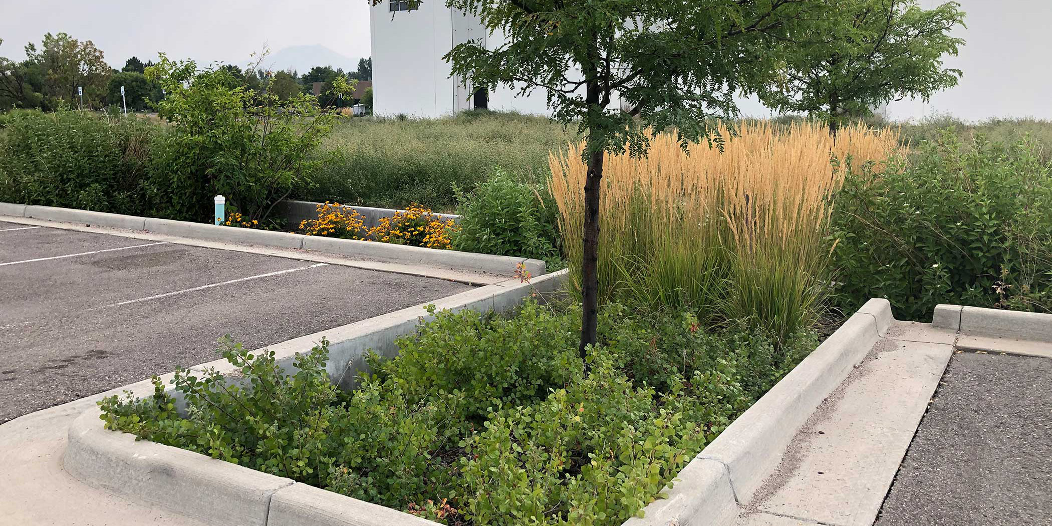
A bioretention feature in the parking area at Avery Brewing.
Natural Infrastructure
The community’s natural infrastructure is an interconnected network of living system elements that includes:
Waterways
Creeks, streams, and ponds are integral components of the local watershed. They offer places for the community to cool off, play and support thriving wildlife. Stream restoration projects may enhance flood mitigation, public safety, and biodiversity in these corridors.
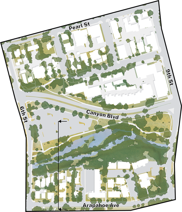
Plan view of Boulder Creek and the surrounding areas between 6th and 9th Street.
Wetlands
Areas where water collects at or near the ground surface near waterways or isolated areas that act like natural sponges during wet periods by storing and slowing water, filtering runoff, and offering critical habitat areas for wildlife.
Greenways
Greenways are areas adjacent to existing waterways, including Boulder Creek and tributary streams, that help manage and mitigate flooding, support multifunctional landscapes and ecosystem services, and protect cultural resources. Greenways may also offer recreation and active transportation amenities. These areas form an interconnected system across public and private lands.
Biodiversity Habitats
Areas that include native and adapted grasses and wildflowers to attract pollinating insects and offer food for animals.
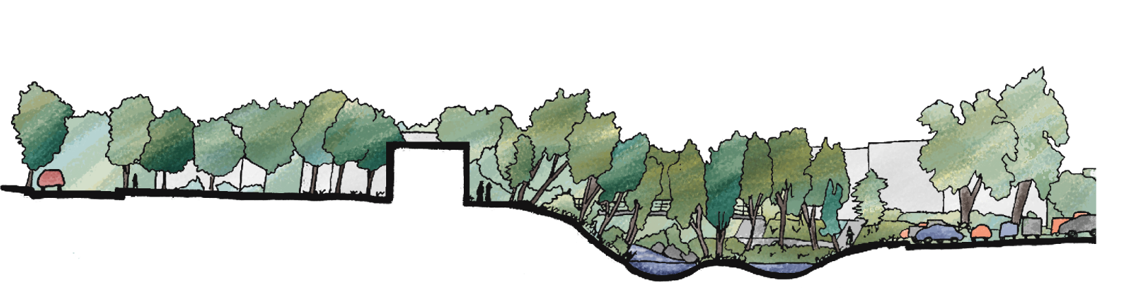
Section view of Boulder Creek and the surrounding areas between 6th and 9th Street.
Urban Tree Canopy
A connected canopy of tree vegetation that provides shade to cool the urban environment, increases rainwater infiltration, captures particulate matter, offers wildlife habitat and provides opportunities for community members to relax and play.
Rain Garden, Bioswale, or Bioretention
Shallow basins or channels that collect, slow, and filter runoff from roofs, streets, parking lots, and other hard surfaces using moisture-tolerant plants and absorbent soils. They temporarily hold stormwater, capture pollutants, and allow water to soak into the ground or drain slowly to the stormwater system.
Moving Forward
Relevant policies in the comprehensive plan provide a framework to develop projects, methods, and programs to increase and enhance natural infrastructure in the city. The plan’s Future Land Use map designates areas of the Boulder Valley as Greenways, Parks, and Open Space that serve as the backbone of the community’s connection to nature and resilience. Natural infrastructure will continue to be enhanced in the city to complement these areas and provide benefits at a smaller scale in the urban environment.